![](/images/other/stat-length.png)
![Randonnée A pied Ehrenberg - Extratour Rotes Moor - Photo](https://media.geolcdn.com/t/1900/400/0cdd8b87-9f6a-41b7-9dfb-41d03d8c4ae1.jpeg&format=pjpeg&maxdim=2)
Extratour Rotes Moor
SityTrail - itinéraires balisés pédestres
Tous les sentiers balisés d’Europe GUIDE+
![Longueur](/images/other/stat-length.png)
Longueur
18 km
![Altitude max](https://static1.geolcdn.com/siteimages/upload/files/1508320355ic_sort_altitude_max_24dp.png)
Altitude max
924 m
![Dénivelé positif](https://static1.geolcdn.com/siteimages/upload/files/1508320355ic_sort_den_pos_24dp.png)
Dénivelé positif
468 m
![Km-Effort](/images/other/stat-length.png)
Km-Effort
24 km
![Altitude min](https://static1.geolcdn.com/siteimages/upload/files/1508320355ic_sort_altitude_min_24dp.png)
Altitude min
688 m
![Dénivelé négatif](https://static1.geolcdn.com/siteimages/upload/files/1508320355ic_sort_den_neg_24dp.png)
Dénivelé négatif
470 m
![Boucle](https://static1.geolcdn.com/siteimages/upload/files/16400158638029165_repeat_loop_refresh_sync_direction_icon.png)
Boucle
Oui
Balise
Date de création :
2022-02-11 18:10:50.921
Dernière modification :
2022-02-11 18:10:50.921
![A pied](https://static1.geolcdn.com/sitytour/trail-icons/100.png)
5h31
Difficulté : Moyen
![Scannez ce code QR pour ouvrir la randonnée dans l'application SityTrail](https://capi.geolives.com/qq0zvz2zws4bq2lad0pu/sitytour/trails/3099117/qr.png?size=200)
Application GPS de randonnée GRATUITE
À propos
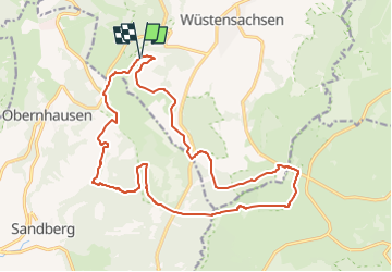
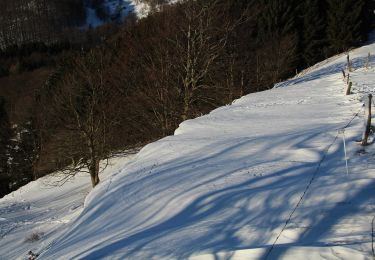
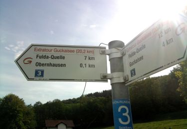
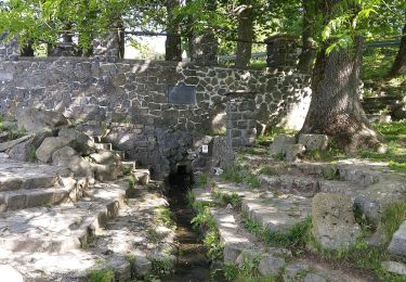
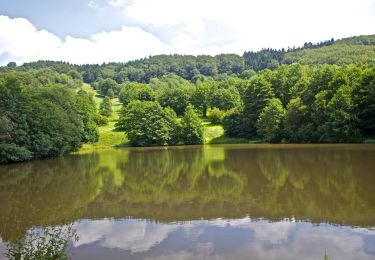
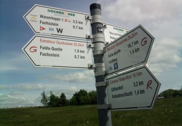
Randonnée A pied de 18 km à découvrir à Hesse, Landkreis Fulda, Ehrenberg. Cette randonnée est proposée par SityTrail - itinéraires balisés pédestres.
Description
Randonnée créée par Rhönclub.
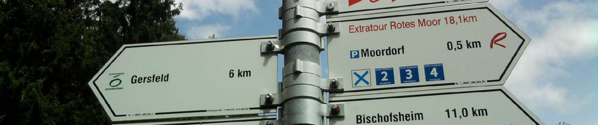
Site web: http://rhoenklub.de/wanderungen/19-extratour-rotes-moor
Localisation
Pays :
Allemagne
Région :
Hesse
Département/Province :
Landkreis Fulda
Commune :
Ehrenberg
Localité :
Wüstensachsen
Départ:(Dec)
Départ:(UTM)
569094 ; 5593727 (32U) N.
Commentaires
Randonnées à proximité
![Randonnée A pied Ehrenberg - Zubringer Wüstensachsen - Photo](https://media.geolcdn.com/t/375/260/01b4bef0-11d8-4d1d-bc2a-3d5c2459220c.jpeg&format=jpg&maxdim=2)
![A pied A pied](https://static1.geolcdn.com/sitytour/trail-icons/100.png)
Zubringer Wüstensachsen
A pied
Facile
Ehrenberg,
Hesse,
Landkreis Fulda,
Allemagne
![](/images/other/stat-length.png)
4,6 km | 7,9 km-effort
1h 47min
![](https://static1.geolcdn.com/siteimages/upload/files/16400158638029165_repeat_loop_refresh_sync_direction_icon.png)
Non
![Randonnée A pied Gersfeld - Rhön-Rundweg 3 Gersfeld - Photo](https://media.geolcdn.com/t/375/260/89cc5337-13ef-4a24-a2c4-3580cba71dc8.jpeg&format=jpg&maxdim=2)
![A pied A pied](https://static1.geolcdn.com/sitytour/trail-icons/100.png)
Rhön-Rundweg 3 Gersfeld
A pied
Facile
Gersfeld,
Hesse,
Landkreis Fulda,
Allemagne
![](/images/other/stat-length.png)
6,2 km | 8,6 km-effort
1h 57min
![](https://static1.geolcdn.com/siteimages/upload/files/16400158638029165_repeat_loop_refresh_sync_direction_icon.png)
Oui
![Randonnée A pied Gersfeld - Rhön-Rundweg 4 Gersfeld - Photo](https://media.geolcdn.com/t/375/260/89cc5337-13ef-4a24-a2c4-3580cba71dc8.jpeg&format=jpg&maxdim=2)
![A pied A pied](https://static1.geolcdn.com/sitytour/trail-icons/100.png)
Rhön-Rundweg 4 Gersfeld
A pied
Facile
Gersfeld,
Hesse,
Landkreis Fulda,
Allemagne
![](/images/other/stat-length.png)
6,4 km | 9,2 km-effort
2h 5min
![](https://static1.geolcdn.com/siteimages/upload/files/16400158638029165_repeat_loop_refresh_sync_direction_icon.png)
Non
![Randonnée A pied Gersfeld - Rhön-Rundweg 4 Wasserkuppe - Photo](https://media.geolcdn.com/t/375/260/3ebc1f0b-88dd-4cfe-aab8-8a19ff3e07f7.jpeg&format=jpg&maxdim=2)
![A pied A pied](https://static1.geolcdn.com/sitytour/trail-icons/100.png)
Rhön-Rundweg 4 Wasserkuppe
A pied
Facile
Gersfeld,
Hesse,
Landkreis Fulda,
Allemagne
![](/images/other/stat-length.png)
7,7 km | 10,2 km-effort
2h 18min
![](https://static1.geolcdn.com/siteimages/upload/files/16400158638029165_repeat_loop_refresh_sync_direction_icon.png)
Oui
![Randonnée A pied Gersfeld - Rhön-Rundweg 3 Spielberg - Photo](https://media.geolcdn.com/t/375/260/947d798c-23d7-4cd4-8adf-464f7d011f68.jpeg&format=jpg&maxdim=2)
![A pied A pied](https://static1.geolcdn.com/sitytour/trail-icons/100.png)
Rhön-Rundweg 3 Spielberg
A pied
Facile
Gersfeld,
Hesse,
Landkreis Fulda,
Allemagne
![](/images/other/stat-length.png)
5,1 km | 7,2 km-effort
1h 38min
![](https://static1.geolcdn.com/siteimages/upload/files/16400158638029165_repeat_loop_refresh_sync_direction_icon.png)
Non
![Randonnée A pied Gersfeld - Rhön-Rundweg 1 Spielberg - Photo](https://media.geolcdn.com/t/375/260/947d798c-23d7-4cd4-8adf-464f7d011f68.jpeg&format=jpg&maxdim=2)
![A pied A pied](https://static1.geolcdn.com/sitytour/trail-icons/100.png)
Rhön-Rundweg 1 Spielberg
A pied
Facile
Gersfeld,
Hesse,
Landkreis Fulda,
Allemagne
![](/images/other/stat-length.png)
4,1 km | 6,4 km-effort
1h 27min
![](https://static1.geolcdn.com/siteimages/upload/files/16400158638029165_repeat_loop_refresh_sync_direction_icon.png)
Oui
![Randonnée A pied Gersfeld - Rhön-Rundweg 1 Gersfeld - Photo](https://media.geolcdn.com/t/375/260/34228992-3cd5-492e-9b7a-53edf294da8c.jpeg&format=jpg&maxdim=2)
![A pied A pied](https://static1.geolcdn.com/sitytour/trail-icons/100.png)
Rhön-Rundweg 1 Gersfeld
A pied
Facile
Gersfeld,
Hesse,
Landkreis Fulda,
Allemagne
![](/images/other/stat-length.png)
9,1 km | 12,3 km-effort
2h 47min
![](https://static1.geolcdn.com/siteimages/upload/files/16400158638029165_repeat_loop_refresh_sync_direction_icon.png)
Non
![Randonnée A pied Poppenhausen - Guckaisee - Rhön-Rundweg 18 - Photo](https://media.geolcdn.com/t/375/260/dd37c3bf-d30d-493c-bfb6-604791e4efae.jpeg&format=jpg&maxdim=2)
![A pied A pied](https://static1.geolcdn.com/sitytour/trail-icons/100.png)
Guckaisee - Rhön-Rundweg 18
A pied
Facile
Poppenhausen,
Hesse,
Landkreis Fulda,
Allemagne
![](/images/other/stat-length.png)
4,2 km | 6,7 km-effort
1h 31min
![](https://static1.geolcdn.com/siteimages/upload/files/16400158638029165_repeat_loop_refresh_sync_direction_icon.png)
Oui
![Randonnée A pied Gersfeld - Extratour Guckaisee - Photo](https://media.geolcdn.com/t/375/260/c8727d26-644d-4342-86fc-c86a2c534386.jpeg&format=jpg&maxdim=2)
![A pied A pied](https://static1.geolcdn.com/sitytour/trail-icons/100.png)
Extratour Guckaisee
A pied
Moyen
Gersfeld,
Hesse,
Landkreis Fulda,
Allemagne
![](/images/other/stat-length.png)
16,9 km | 24 km-effort
5h 28min
![](https://static1.geolcdn.com/siteimages/upload/files/16400158638029165_repeat_loop_refresh_sync_direction_icon.png)
Non