![](/images/other/stat-length.png)
![Randonnée A pied Weingarten - Spazierweg Weingartener Bächle - Photo](https://media.geolcdn.com/t/1900/400/ext.pjpeg?maxdim=2&url=https%3A%2F%2Fmedia.geolcdn.com%2Ff%2F664cdcaf-caeb-4a29-b604-70cf6a457115.jpeg)
Spazierweg Weingartener Bächle
SityTrail - itinéraires balisés pédestres
Tous les sentiers balisés d’Europe PRO
![Longueur](/images/other/stat-length.png)
Longueur
3,3 km
![Altitude max](https://static1.geolcdn.com/siteimages/upload/files/1508320355ic_sort_altitude_max_24dp.png)
Altitude max
613 m
![Dénivelé positif](https://static1.geolcdn.com/siteimages/upload/files/1508320355ic_sort_den_pos_24dp.png)
Dénivelé positif
85 m
![Km-Effort](/images/other/stat-length.png)
Km-Effort
4,4 km
![Altitude min](https://static1.geolcdn.com/siteimages/upload/files/1508320355ic_sort_altitude_min_24dp.png)
Altitude min
546 m
![Dénivelé négatif](https://static1.geolcdn.com/siteimages/upload/files/1508320355ic_sort_den_neg_24dp.png)
Dénivelé négatif
75 m
![Boucle](https://static1.geolcdn.com/siteimages/upload/files/16400158638029165_repeat_loop_refresh_sync_direction_icon.png)
Boucle
Non
Balise
Date de création :
2022-02-11 18:05:13.08
Dernière modification :
2022-02-11 18:05:13.08
![A pied](https://static1.geolcdn.com/sitytour/trail-icons/100.png)
59m
Difficulté : Facile
![Scannez ce code QR pour ouvrir la randonnée dans l'application SityTrail](https://capi.geolives.com/qq0zvz2zws4bq2lad0pu/sitytour/trails/3098998/qr.png?size=200)
Application GPS de randonnée GRATUITE
À propos
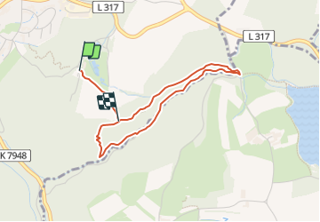
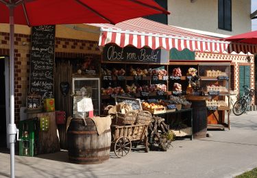
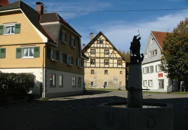
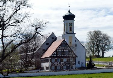
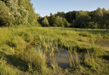
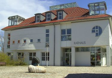
Randonnée A pied de 3,3 km à découvrir à Bade-Wurtemberg, Landkreis Ravensburg, Weingarten. Cette randonnée est proposée par SityTrail - itinéraires balisés pédestres.
Description
Site web: https://www.weingarten-online.de/,Lde/Startseite/Tourismus/Wandern.html
Localisation
Pays :
Allemagne
Région :
Bade-Wurtemberg
Département/Province :
Landkreis Ravensburg
Commune :
Weingarten
Localité :
Unknown
Départ:(Dec)
Départ:(UTM)
549303 ; 5294758 (32T) N.
Commentaires
Randonnées à proximité
![Randonnée A pied Friedrichshafen - Planetenweg Kluftern - Photo](https://media.geolcdn.com/t/375/260/ext.jpg?maxdim=2&url=https%3A%2F%2Fmedia.geolcdn.com%2Ff%2F46733009-a77d-469a-8bf1-fb80e19f2d17.jpeg)
![A pied A pied](https://static1.geolcdn.com/sitytour/trail-icons/100.png)
Planetenweg Kluftern
A pied
Facile
Friedrichshafen,
Bade-Wurtemberg,
Bodenseekreis,
Allemagne
![](/images/other/stat-length.png)
5,5 km | 6,5 km-effort
1h 28min
![](https://static1.geolcdn.com/siteimages/upload/files/16400158638029165_repeat_loop_refresh_sync_direction_icon.png)
Oui
![Randonnée A pied Markdorf - Wanderwege Markdorf: Froschweg - Photo](https://media.geolcdn.com/t/375/260/ext.jpg?maxdim=2&url=https%3A%2F%2Fmedia.geolcdn.com%2Ff%2F925776c0-f370-41fd-bf89-cf33cc203a47.jpeg)
![A pied A pied](https://static1.geolcdn.com/sitytour/trail-icons/100.png)
Wanderwege Markdorf: Froschweg
A pied
Facile
Markdorf,
Bade-Wurtemberg,
Bodenseekreis,
Allemagne
![](/images/other/stat-length.png)
4,9 km | 6 km-effort
1h 22min
![](https://static1.geolcdn.com/siteimages/upload/files/16400158638029165_repeat_loop_refresh_sync_direction_icon.png)
Non
![Randonnée A pied Friedrichshafen - Teuringer Bächlepfad - Photo](https://media.geolcdn.com/t/375/260/ext.jpg?maxdim=2&url=https%3A%2F%2Fmedia.geolcdn.com%2Ff%2F658a6b00-cada-4a62-b9f7-1373ac7f923a.jpeg)
![A pied A pied](https://static1.geolcdn.com/sitytour/trail-icons/100.png)
Teuringer Bächlepfad
A pied
Facile
Friedrichshafen,
Bade-Wurtemberg,
Bodenseekreis,
Allemagne
![](/images/other/stat-length.png)
12,9 km | 15,1 km-effort
3h 26min
![](https://static1.geolcdn.com/siteimages/upload/files/16400158638029165_repeat_loop_refresh_sync_direction_icon.png)
Oui
![Randonnée A pied Argenbühl - Wanderung Panoramahöhenweg durch Wald und Flur (Argenbühl: 8) - Photo](https://media.geolcdn.com/t/375/260/ext.jpg?maxdim=2&url=https%3A%2F%2Fmedia.geolcdn.com%2Ff%2F6de3db41-f370-497f-aafd-47914aa226bb.jpeg)
![A pied A pied](https://static1.geolcdn.com/sitytour/trail-icons/100.png)
Wanderung Panoramahöhenweg durch Wald und Flur (Argenbühl: 8)
A pied
Facile
Argenbühl,
Bade-Wurtemberg,
Landkreis Ravensburg,
Allemagne
![](/images/other/stat-length.png)
8,7 km | 10,9 km-effort
2h 28min
![](https://static1.geolcdn.com/siteimages/upload/files/16400158638029165_repeat_loop_refresh_sync_direction_icon.png)
Oui
![Randonnée A pied Kißlegg - Kißlegg: W 11 - Photo](https://media.geolcdn.com/t/375/260/ext.jpg?maxdim=2&url=https%3A%2F%2Fmedia.geolcdn.com%2Ff%2F70309e82-a8f7-419a-a41c-b2b83c9e6f98.jpeg)
![A pied A pied](https://static1.geolcdn.com/sitytour/trail-icons/100.png)
Kißlegg: W 11
A pied
Facile
Kißlegg,
Bade-Wurtemberg,
Landkreis Ravensburg,
Allemagne
![](/images/other/stat-length.png)
14,2 km | 17 km-effort
3h 52min
![](https://static1.geolcdn.com/siteimages/upload/files/16400158638029165_repeat_loop_refresh_sync_direction_icon.png)
Oui
![Randonnée A pied Tettnang - Glaubensweg Tannau - Photo](https://media.geolcdn.com/t/375/260/ext.jpg?maxdim=2&url=https%3A%2F%2Fmedia.geolcdn.com%2Ff%2F276d546a-6480-47a5-9bd6-f4b319c8d7ad.jpeg)
![A pied A pied](https://static1.geolcdn.com/sitytour/trail-icons/100.png)
Glaubensweg Tannau
A pied
Facile
Tettnang,
Bade-Wurtemberg,
Bodenseekreis,
Allemagne
![](/images/other/stat-length.png)
10,6 km | 13 km-effort
2h 57min
![](https://static1.geolcdn.com/siteimages/upload/files/16400158638029165_repeat_loop_refresh_sync_direction_icon.png)
Non
![Randonnée A pied Friedrichshafen - Ortsrundweg Kluftern - Südrunde - Photo](https://media.geolcdn.com/t/375/260/ext.jpg?maxdim=2&url=https%3A%2F%2Fmedia.geolcdn.com%2Ff%2F24eac72b-5d33-4d11-abeb-8e8d2d4a2164.jpeg)
![A pied A pied](https://static1.geolcdn.com/sitytour/trail-icons/100.png)
Ortsrundweg Kluftern - Südrunde
A pied
Facile
Friedrichshafen,
Bade-Wurtemberg,
Bodenseekreis,
Allemagne
![](/images/other/stat-length.png)
7,1 km | 8,6 km-effort
1h 57min
![](https://static1.geolcdn.com/siteimages/upload/files/16400158638029165_repeat_loop_refresh_sync_direction_icon.png)
Oui
![Randonnée A pied Grünkraut - Rundwanderweg 1 Ortsrunde Gemeinde Grünkraut - Photo](https://media.geolcdn.com/t/375/260/ext.jpg?maxdim=2&url=https%3A%2F%2Fmedia.geolcdn.com%2Ff%2F199c5d3a-ed67-4f83-8095-4c30c8deb8f5.jpeg)
![A pied A pied](https://static1.geolcdn.com/sitytour/trail-icons/100.png)
Rundwanderweg 1 Ortsrunde Gemeinde Grünkraut
A pied
Facile
Grünkraut,
Bade-Wurtemberg,
Landkreis Ravensburg,
Allemagne
![](/images/other/stat-length.png)
4,7 km | 5,3 km-effort
1h 12min
![](https://static1.geolcdn.com/siteimages/upload/files/16400158638029165_repeat_loop_refresh_sync_direction_icon.png)
Oui
![Randonnée A pied Waldburg - Wanderweg 8 der Gemeinde Waldburg - Photo](https://media.geolcdn.com/t/375/260/ext.jpg?maxdim=2&url=https%3A%2F%2Fmedia.geolcdn.com%2Ff%2Fe37998ad-ec32-4427-b60c-78135f7e802a.jpeg)
![A pied A pied](https://static1.geolcdn.com/sitytour/trail-icons/100.png)
Wanderweg 8 der Gemeinde Waldburg
A pied
Facile
Waldburg,
Bade-Wurtemberg,
Landkreis Ravensburg,
Allemagne
![](/images/other/stat-length.png)
5,4 km | 7,2 km-effort
1h 38min
![](https://static1.geolcdn.com/siteimages/upload/files/16400158638029165_repeat_loop_refresh_sync_direction_icon.png)
Oui