Randonnée A pied Werther - Weg für Genießer - Werther-Halle - Photo

Tous les sentiers balisés d’Europe GUIDE+

© OpenStreetMap contributors
Longueur
Longueur
11,2 km
Altitude max
Altitude max
265 m
Dénivelé positif
Dénivelé positif
259 m
Km-Effort
Km-Effort  
14,7 km
Altitude min
Altitude min
118 m
Dénivelé négatif
Dénivelé négatif
274 m
Boucle
Boucle
Non
Balise
Balise
Date de création :
2022-02-11 18:00:42.219
Dernière modification :
2022-02-11 18:00:42.219

(0 Avis)

A pied
A pied
3h21
Difficulté : Facile

Scannez ce code QR pour ouvrir la randonnée dans l'application SityTrail

Application GPS de randonnée GRATUITE

Logo SityTrail SityTrail

IGN / Instituts géographiques

Télécharger SityTrail sur l'App Store Télécharger SityTrail sur Google Play

Logo SityTrail SityTrail World

Le monde est à vous

Télécharger SityTrail sur l'App Store Télécharger SityTrail sur Google Play Télécharger SityTrail sur Huawei AppGallery

À propos

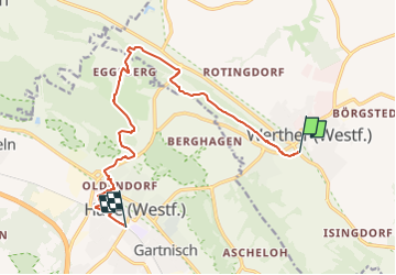
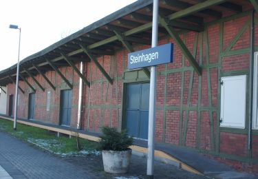
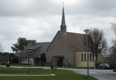
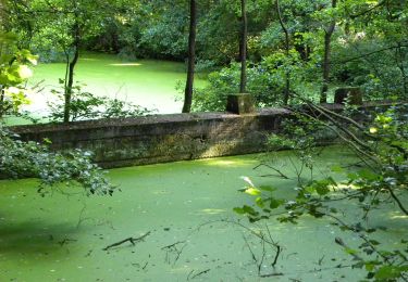
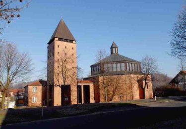
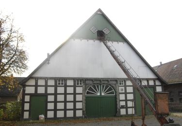
Randonnée A pied de 11,2 km à découvrir à Rhénanie-du-Nord-Westphalie, Kreis Gütersloh, Werther. Cette randonnée est proposée par SityTrail - itinéraires balisés pédestres.

Description

Randonnée créée par Arbeitsgemeinschaft „Weg für Genießer“.

Symbole: Weißes 'G' auf rotem Grund

Profil altimétrique

Photos

Localisation

Pays :
Allemagne
Région :
Rhénanie-du-Nord-Westphalie
Département/Province :
Kreis Gütersloh
Commune :
Werther
Localité :
Unknown
Départ:(UTM)
459764 ; 5769130 (32U) N.

Randonnées à proximité

Randonnée A pied Inconnu - Bergmannsweg - Photo
A pied
GUIDE+

A pied

Facile
Inconnu, Rhénanie-du-Nord-Westphalie, Bielefeld, Allemagne
5 km | 7,2 km-effort
1h 38min
Oui
Randonnée A pied Halle (Westf.) - Weg für Genießer - Halle-Borgholzhausen - Photo
A pied
GUIDE+

A pied

Facile
Halle (Westf.), Rhénanie-du-Nord-Westphalie, Kreis Gütersloh, Allemagne
13,2 km | 18 km-effort
4h 5min
Non
Randonnée A pied Halle (Westf.) - Weg für Genießer - Halle-Steinhagen - Photo
A pied
GUIDE+

A pied

Moyen
Halle (Westf.), Rhénanie-du-Nord-Westphalie, Kreis Gütersloh, Allemagne
17,3 km | 22 km-effort
5h 3min
Non
Randonnée A pied Werther - Häger 2 - Photo
A pied
GUIDE+

A pied

Facile
Werther, Rhénanie-du-Nord-Westphalie, Kreis Gütersloh, Allemagne
6,4 km | 7,6 km-effort
1h 43min
Non
Randonnée A pied Inconnu - A3 - Jöllenbeck - Photo
A pied
GUIDE+

A pied

Facile
Inconnu, Rhénanie-du-Nord-Westphalie, Bielefeld, Allemagne
9,6 km | 11,1 km-effort
2h 31min
Oui
Randonnée A pied  - Oberes Johannisbachtal - Photo
A pied
GUIDE+

A pied

Facile
, Rhénanie-du-Nord-Westphalie, Bielefeld, Allemagne
5,6 km | 7,6 km-effort
1h 43min
Non
Randonnée A pied  - Häger RH - Photo
A pied
GUIDE+

A pied

Facile
, Rhénanie-du-Nord-Westphalie, Bielefeld, Allemagne
13,9 km | 16,5 km-effort
3h 45min
Oui
Randonnée A pied Werther - Häger 4 - Photo
A pied
GUIDE+

A pied

Facile
Werther, Rhénanie-du-Nord-Westphalie, Kreis Gütersloh, Allemagne
7,5 km | 8,7 km-effort
1h 59min
Oui
Randonnée A pied Werther - Häger 3 - Photo
A pied
GUIDE+

A pied

Facile
Werther, Rhénanie-du-Nord-Westphalie, Kreis Gütersloh, Allemagne
8,2 km | 9,5 km-effort
2h 9min
Oui


Fermer
Mes abonnements