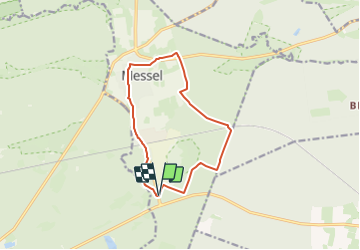
![](/images/other/stat-length.png)
![Randonnée A pied Messel - Rundwanderweg Messel 1: Urpferdchen-Weg - Photo](https://media.geolcdn.com/t/1900/400/e57d7775-2eb4-4af0-b68f-fd0b11805e9f.jpeg&format=pjpeg&maxdim=2)
Rundwanderweg Messel 1: Urpferdchen-Weg
SityTrail - itinéraires balisés pédestres
Tous les sentiers balisés d’Europe GUIDE+
![Longueur](/images/other/stat-length.png)
![Altitude max](https://static1.geolcdn.com/siteimages/upload/files/1508320355ic_sort_altitude_max_24dp.png)
![Dénivelé positif](https://static1.geolcdn.com/siteimages/upload/files/1508320355ic_sort_den_pos_24dp.png)
![Km-Effort](/images/other/stat-length.png)
![Altitude min](https://static1.geolcdn.com/siteimages/upload/files/1508320355ic_sort_altitude_min_24dp.png)
![Dénivelé négatif](https://static1.geolcdn.com/siteimages/upload/files/1508320355ic_sort_den_neg_24dp.png)
![Boucle](https://static1.geolcdn.com/siteimages/upload/files/16400158638029165_repeat_loop_refresh_sync_direction_icon.png)
![A pied](https://static1.geolcdn.com/sitytour/trail-icons/100.png)
2h48
Difficulté : Facile
![Scannez ce code QR pour ouvrir la randonnée dans l'application SityTrail](https://capi.geolives.com/qq0zvz2zws4bq2lad0pu/sitytour/trails/3098841/qr.png?size=200)
Application GPS de randonnée GRATUITE
À propos
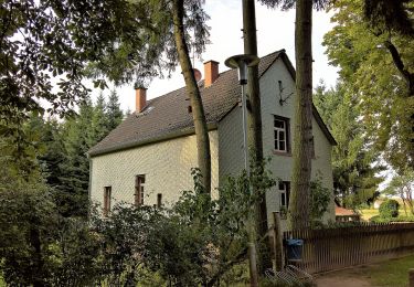
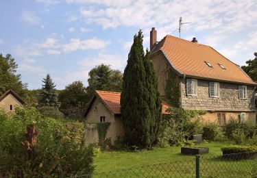
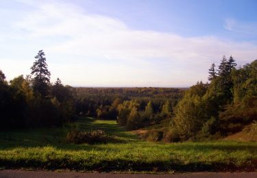
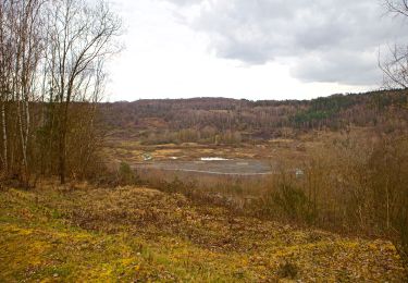
Randonnée A pied de 10,7 km à découvrir à Hesse, Landkreis Darmstadt-Dieburg, Messel. Cette randonnée est proposée par SityTrail - itinéraires balisés pédestres.
Description
Randonnée créée par Odenwaldklub.
Stand September 2016: Wegzeichen wird von weiß auf grün ummarkiert
Symbole: Grüne 1 in einem oben offenen Kreis, darüber grünes M
Localisation
Commentaires
Randonnées à proximité
![Randonnée A pied Inconnu - Rundwanderweg Darmstadt Steinbrücker Teich 3: Wildpark-Weg - Photo](https://media.geolcdn.com/t/375/260/1a8e8045-f536-4f30-af8a-f35942780baf.jpeg&format=jpg&maxdim=2)
![A pied A pied](https://static1.geolcdn.com/sitytour/trail-icons/100.png)
A pied
![](/images/other/stat-length.png)
![](https://static1.geolcdn.com/siteimages/upload/files/16400158638029165_repeat_loop_refresh_sync_direction_icon.png)
![Randonnée A pied Inconnu - Rundwanderweg Darmstadt Am Forschungszentrum 9: Dianaburg-Weg - Photo](https://media.geolcdn.com/t/375/260/e7522232-749b-4e49-ab54-12744d65b4a1.jpeg&format=jpg&maxdim=2)
![A pied A pied](https://static1.geolcdn.com/sitytour/trail-icons/100.png)
A pied
![](/images/other/stat-length.png)
![](https://static1.geolcdn.com/siteimages/upload/files/16400158638029165_repeat_loop_refresh_sync_direction_icon.png)
![Randonnée A pied Inconnu - Rundwanderweg Darmstadt Messeler Falltorhaus 7: Stockschlag-Weg - Photo](https://media.geolcdn.com/t/375/260/57582a93-750b-40d6-9c97-3461c6313c89.jpeg&format=jpg&maxdim=2)
![A pied A pied](https://static1.geolcdn.com/sitytour/trail-icons/100.png)
A pied
![](/images/other/stat-length.png)
![](https://static1.geolcdn.com/siteimages/upload/files/16400158638029165_repeat_loop_refresh_sync_direction_icon.png)
![Randonnée A pied Inconnu - Rundwanderweg Darmstadt Messeler Falltorhaus 8: Mörsbacher-Grund-Weg - Photo](https://media.geolcdn.com/t/375/260/76e82085-a09b-4483-a590-fabe2dd14212.jpeg&format=jpg&maxdim=2)
![A pied A pied](https://static1.geolcdn.com/sitytour/trail-icons/100.png)
A pied
![](/images/other/stat-length.png)
![](https://static1.geolcdn.com/siteimages/upload/files/16400158638029165_repeat_loop_refresh_sync_direction_icon.png)
![Randonnée A pied Inconnu - Rundwanderweg Darmstadt Jagdschl. Kranichstein 5: Dianaburg-Weg - Photo](https://media.geolcdn.com/t/375/260/fa24b1c5-f5f1-409a-a4a2-17576f6d5dfa.jpeg&format=jpg&maxdim=2)
![A pied A pied](https://static1.geolcdn.com/sitytour/trail-icons/100.png)
A pied
![](/images/other/stat-length.png)
![](https://static1.geolcdn.com/siteimages/upload/files/16400158638029165_repeat_loop_refresh_sync_direction_icon.png)
![Randonnée A pied Inconnu - Rundwanderweg Darmstadt Jagdschl. Kranichstein 6: Falkenhof-Weg - Photo](https://media.geolcdn.com/t/375/260/8e7ef7dc-a73a-4ee0-8455-50c6924322d1.jpeg&format=jpg&maxdim=2)
![A pied A pied](https://static1.geolcdn.com/sitytour/trail-icons/100.png)
A pied
![](/images/other/stat-length.png)
![](https://static1.geolcdn.com/siteimages/upload/files/16400158638029165_repeat_loop_refresh_sync_direction_icon.png)
![Randonnée A pied Messel - Rundwanderweg Messel 2: Ölschiefer-Weg - Photo](https://media.geolcdn.com/t/375/260/64bb340f-7928-4058-9ff5-a27772b2931d.jpeg&format=jpg&maxdim=2)
![A pied A pied](https://static1.geolcdn.com/sitytour/trail-icons/100.png)
A pied
![](/images/other/stat-length.png)
![](https://static1.geolcdn.com/siteimages/upload/files/16400158638029165_repeat_loop_refresh_sync_direction_icon.png)
![Randonnée A pied Messel - Rundwanderweg Messel 4: Mörsbacher Grund-Runde - Photo](https://media.geolcdn.com/t/375/260/57582a93-750b-40d6-9c97-3461c6313c89.jpeg&format=jpg&maxdim=2)
![A pied A pied](https://static1.geolcdn.com/sitytour/trail-icons/100.png)
A pied
![](/images/other/stat-length.png)
![](https://static1.geolcdn.com/siteimages/upload/files/16400158638029165_repeat_loop_refresh_sync_direction_icon.png)
![Randonnée A pied Messel - Rundwanderweg Messel 3: Kranichsteiner Weg - Photo](https://media.geolcdn.com/t/375/260/565dc47f-bf39-4d65-900b-9263ab70bd2d.jpeg&format=jpg&maxdim=2)
![A pied A pied](https://static1.geolcdn.com/sitytour/trail-icons/100.png)
A pied
![](/images/other/stat-length.png)
![](https://static1.geolcdn.com/siteimages/upload/files/16400158638029165_repeat_loop_refresh_sync_direction_icon.png)