Randonnée A pied Stolberg - Lehmjöres-Weg - Photo

Tous les sentiers balisés d’Europe PRO

© OpenStreetMap contributors
Longueur
Longueur
12,7 km
Altitude max
Altitude max
328 m
Dénivelé positif
Dénivelé positif
280 m
Km-Effort
Km-Effort  
16,5 km
Altitude min
Altitude min
219 m
Dénivelé négatif
Dénivelé négatif
289 m
Boucle
Boucle
Oui
Balise
Balise
Date de création :
2022-02-11 17:36:04.392
Dernière modification :
2022-02-11 17:36:04.392

(0 Avis)

A pied
A pied
3h44
Difficulté : Facile

Scannez ce code QR pour ouvrir la randonnée dans l'application SityTrail

Application GPS de randonnée GRATUITE

Logo SityTrail SityTrail

IGN / Instituts géographiques

Télécharger SityTrail sur l'App Store Télécharger SityTrail sur Google Play

Logo SityTrail SityTrail World

Le monde est à vous

Télécharger SityTrail sur l'App Store Télécharger SityTrail sur Google Play Télécharger SityTrail sur Huawei AppGallery

À propos

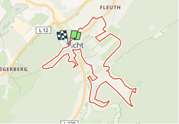
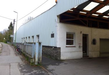
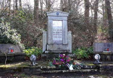
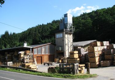
Randonnée A pied de 12,7 km à découvrir à Rhénanie-du-Nord-Westphalie, Région urbaine d'Aix-la-Chapelle, Stolberg. Cette randonnée est proposée par SityTrail - itinéraires balisés pédestres.

Description

Randonnée créée par IG Schönes Vicht.

Symbole: brauner Rahmen auf weißem Hintergrund, Lehmjöresfigur, mit umlaufender Beschriftung -Rund Um Vicht-


Site web: http://lehmjoeresweg.schoenes-vicht.de/

Photos

Localisation

Pays :
Allemagne
Région :
Rhénanie-du-Nord-Westphalie
Département/Province :
Région urbaine d'Aix-la-Chapelle
Commune :
Stolberg
Localité :
Unknown
Départ:(UTM)
306847 ; 5624877 (32U) N.

Randonnées à proximité

Randonnée A pied Stolberg - Schevenhütte Rundweg 3 - Photo
A pied
PRO

A pied

Facile
Stolberg, Rhénanie-du-Nord-Westphalie, Région urbaine d'Aix-la-Chapelle, Allemagne
6,9 km | 9 km-effort
2h 3min
Non
Randonnée A pied Stolberg - Stolberg Rundweg 1 - Photo
A pied
PRO

A pied

Facile
Stolberg, Rhénanie-du-Nord-Westphalie, Région urbaine d'Aix-la-Chapelle, Allemagne
9 km | 11,4 km-effort
2h 35min
Non
Randonnée A pied Stolberg - Langerwehe Rundwanderweg Nr. 41 - Photo
A pied
PRO

A pied

Facile
Stolberg, Rhénanie-du-Nord-Westphalie, Région urbaine d'Aix-la-Chapelle, Allemagne
12,2 km | 15,1 km-effort
3h 26min
Oui
Randonnée A pied Stolberg - Venwegen Rundweg A3 - Photo
A pied
PRO

A pied

Facile
Stolberg, Rhénanie-du-Nord-Westphalie, Région urbaine d'Aix-la-Chapelle, Allemagne
5,1 km | 6,5 km-effort
1h 28min
Non
Randonnée A pied Stolberg - Waldlehrpfad Zweifall - Photo
A pied
PRO

A pied

Facile
Stolberg, Rhénanie-du-Nord-Westphalie, Région urbaine d'Aix-la-Chapelle, Allemagne
4,2 km | 5,2 km-effort
1h 11min
Oui
Randonnée A pied Stolberg - Süssendell Rundweg A2 - Photo
A pied
PRO

A pied

Facile
Stolberg, Rhénanie-du-Nord-Westphalie, Région urbaine d'Aix-la-Chapelle, Allemagne
3,1 km | 3,7 km-effort
50min
Non
Randonnée Moteur Stolberg - a-duitsland-het-betere-werk - Photo
Moteur
gpstracks

Moteur

Très facile
Stolberg, Rhénanie-du-Nord-Westphalie, Région urbaine d'Aix-la-Chapelle, Allemagne
135 km | 200 km-effort
Inconnu
Oui
Randonnée Moteur Stolberg - a-duitsland-eifel-bochten-route - Photo
Moteur
gpstracks

Moteur

Très facile
Stolberg, Rhénanie-du-Nord-Westphalie, Région urbaine d'Aix-la-Chapelle, Allemagne
284 km | 467 km-effort
Inconnu
Non
Randonnée Marche Stolberg - boucle - Photo
Marche
Lychee

Marche

Facile
Stolberg, Rhénanie-du-Nord-Westphalie, Région urbaine d'Aix-la-Chapelle, Allemagne
4,8 km | 5,8 km-effort
7h 40min
Non


Fermer
Mes abonnements