

Teuringertal Bahnweg ("Wandern in Friedrichshafen")
SityTrail - itinéraires balisés pédestres
Tous les sentiers balisés d’Europe GUIDE+

Longueur
5 km

Altitude max
477 m

Dénivelé positif
93 m

Km-Effort
6,2 km

Altitude min
430 m

Dénivelé négatif
78 m
Boucle
Non
Balise
Date de création :
2022-02-11 17:25:45.339
Dernière modification :
2022-02-11 17:25:45.339
1h24
Difficulté : Facile

Application GPS de randonnée GRATUITE
À propos
Randonnée A pied de 5 km à découvrir à Bade-Wurtemberg, Bodenseekreis, Oberteuringen. Cette randonnée est proposée par SityTrail - itinéraires balisés pédestres.
Description
Symbole: gelbe Raute zusammen mit Text "Teuringertal Bahnweg"
Photos
"
data-pinterest-text="Pin it"
data-tweet-text="share on twitter"
data-facebook-share-url="https://www.sitytrail.com/fr/trails/3097911-oberteuringen--teuringertal-bahnweg-xxwandern-in-friedrichshafenxx/?photo=0#lg=1&slide=0"
data-twitter-share-url="https://www.sitytrail.com/fr/trails/3097911-oberteuringen--teuringertal-bahnweg-xxwandern-in-friedrichshafenxx/?photo=0#lg=1&slide=0"
data-googleplus-share-url="https://www.sitytrail.com/fr/trails/3097911-oberteuringen--teuringertal-bahnweg-xxwandern-in-friedrichshafenxx/?photo=0#lg=1&slide=0"
data-pinterest-share-url="https://www.sitytrail.com/fr/trails/3097911-oberteuringen--teuringertal-bahnweg-xxwandern-in-friedrichshafenxx/?photo=0#lg=1&slide=0">
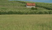 "
data-pinterest-text="Pin it"
data-tweet-text="share on twitter"
data-facebook-share-url="https://www.sitytrail.com/fr/trails/3097911-oberteuringen--teuringertal-bahnweg-xxwandern-in-friedrichshafenxx/?photo=1#lg=1&slide=1"
data-twitter-share-url="https://www.sitytrail.com/fr/trails/3097911-oberteuringen--teuringertal-bahnweg-xxwandern-in-friedrichshafenxx/?photo=1#lg=1&slide=1"
data-googleplus-share-url="https://www.sitytrail.com/fr/trails/3097911-oberteuringen--teuringertal-bahnweg-xxwandern-in-friedrichshafenxx/?photo=1#lg=1&slide=1"
data-pinterest-share-url="https://www.sitytrail.com/fr/trails/3097911-oberteuringen--teuringertal-bahnweg-xxwandern-in-friedrichshafenxx/?photo=1#lg=1&slide=1">
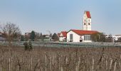

Localisation
Pays :
Allemagne
Région :
Bade-Wurtemberg
Département/Province :
Bodenseekreis
Commune :
Oberteuringen
Localité :
Unknown
Départ:(Dec)
Départ:(UTM)
534587 ; 5284616 (32T) N.
Commentaires
Randonnées à proximité
Planetenweg Kluftern


A pied
Facile
Friedrichshafen,
Bade-Wurtemberg,
Bodenseekreis,
Allemagne

5,5 km | 6,5 km-effort
1h 28min
Oui
Wanderwege Markdorf: Froschweg


A pied
Facile
Markdorf,
Bade-Wurtemberg,
Bodenseekreis,
Allemagne

4,9 km | 6 km-effort
1h 22min
Non
Teuringer Bächlepfad


A pied
Facile
Friedrichshafen,
Bade-Wurtemberg,
Bodenseekreis,
Allemagne

12,9 km | 15,1 km-effort
3h 26min
Oui
Ortsrundweg Kluftern - Südrunde


A pied
Facile
Friedrichshafen,
Bade-Wurtemberg,
Bodenseekreis,
Allemagne

7,1 km | 8,6 km-effort
1h 57min
Oui
Hirschlatter Runde


A pied
Facile
Friedrichshafen,
Bade-Wurtemberg,
Bodenseekreis,
Allemagne

3,3 km | 3,8 km-effort
51min
Non
Wanderwege Markdorf: Eulenweg


A pied
Facile
Markdorf,
Bade-Wurtemberg,
Bodenseekreis,
Allemagne

7,1 km | 10,3 km-effort
2h 20min
Oui

Wanderwege Markdorf: Wildschweinweg


A pied
Facile
Deggenhausertal,
Bade-Wurtemberg,
Bodenseekreis,
Allemagne

5,6 km | 7,5 km-effort
1h 41min
Oui

Ortsrundweg Kluftern - Nordrunde


A pied
Facile
Friedrichshafen,
Bade-Wurtemberg,
Bodenseekreis,
Allemagne

5,3 km | 6,2 km-effort
1h 24min
Oui

Rotachweg


A pied
Facile
Oberteuringen,
Bade-Wurtemberg,
Bodenseekreis,
Allemagne

5,3 km | 5,9 km-effort
1h 19min
Oui


 SityTrail


