![](/images/other/stat-length.png)
![Randonnée A pied Bad Berka - Hexenberg-Rundweg - Photo](https://media.geolcdn.com/t/1900/400/0e45825d-8363-42f1-8ba7-0b70861684b0.jpeg&format=pjpeg&maxdim=2)
Hexenberg-Rundweg
SityTrail - itinéraires balisés pédestres
Tous les sentiers balisés d’Europe GUIDE+
![Longueur](/images/other/stat-length.png)
Longueur
5 km
![Altitude max](https://static1.geolcdn.com/siteimages/upload/files/1508320355ic_sort_altitude_max_24dp.png)
Altitude max
435 m
![Dénivelé positif](https://static1.geolcdn.com/siteimages/upload/files/1508320355ic_sort_den_pos_24dp.png)
Dénivelé positif
182 m
![Km-Effort](/images/other/stat-length.png)
Km-Effort
7,3 km
![Altitude min](https://static1.geolcdn.com/siteimages/upload/files/1508320355ic_sort_altitude_min_24dp.png)
Altitude min
272 m
![Dénivelé négatif](https://static1.geolcdn.com/siteimages/upload/files/1508320355ic_sort_den_neg_24dp.png)
Dénivelé négatif
140 m
![Boucle](https://static1.geolcdn.com/siteimages/upload/files/16400158638029165_repeat_loop_refresh_sync_direction_icon.png)
Boucle
Non
Balise
Date de création :
2022-02-11 17:05:13.538
Dernière modification :
2022-02-11 17:05:13.538
![A pied](https://static1.geolcdn.com/sitytour/trail-icons/100.png)
1h39
Difficulté : Facile
![Scannez ce code QR pour ouvrir la randonnée dans l'application SityTrail](https://capi.geolives.com/qq0zvz2zws4bq2lad0pu/sitytour/trails/3097282/qr.png?size=200)
Application GPS de randonnée GRATUITE
À propos
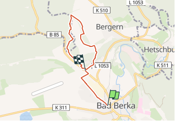
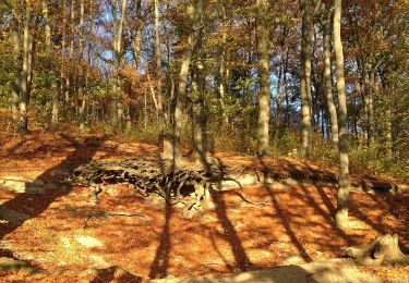
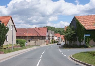
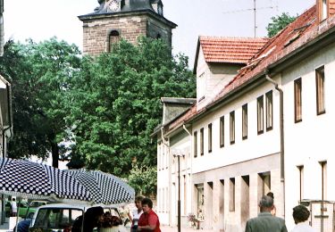
Randonnée A pied de 5 km à découvrir à Thuringe, Landkreis Weimarer Land, Bad Berka. Cette randonnée est proposée par SityTrail - itinéraires balisés pédestres.
Description
Symbole: schwarze 6 auf mittig senkrecht geteiltem, links blauen, rechts gelben Kreis
Localisation
Pays :
Allemagne
Région :
Thuringe
Département/Province :
Landkreis Weimarer Land
Commune :
Bad Berka
Localité :
Unknown
Départ:(Dec)
Départ:(UTM)
660320 ; 5641199 (32U) N.
Commentaires
Randonnées à proximité
![Randonnée A pied Bad Berka - Ludwig-Geist-Weg - Photo](https://media.geolcdn.com/t/375/260/0e45825d-8363-42f1-8ba7-0b70861684b0.jpeg&format=jpg&maxdim=2)
![A pied A pied](https://static1.geolcdn.com/sitytour/trail-icons/100.png)
Ludwig-Geist-Weg
A pied
Facile
Bad Berka,
Thuringe,
Landkreis Weimarer Land,
Allemagne
![](/images/other/stat-length.png)
5,1 km | 7,3 km-effort
1h 39min
![](https://static1.geolcdn.com/siteimages/upload/files/16400158638029165_repeat_loop_refresh_sync_direction_icon.png)
Oui
![Randonnée A pied Bad Berka - Heinrich-Schütz-Weg - Photo](https://media.geolcdn.com/t/375/260/0e45825d-8363-42f1-8ba7-0b70861684b0.jpeg&format=jpg&maxdim=2)
![A pied A pied](https://static1.geolcdn.com/sitytour/trail-icons/100.png)
Heinrich-Schütz-Weg
A pied
Facile
Bad Berka,
Thuringe,
Landkreis Weimarer Land,
Allemagne
![](/images/other/stat-length.png)
9 km | 11,1 km-effort
2h 31min
![](https://static1.geolcdn.com/siteimages/upload/files/16400158638029165_repeat_loop_refresh_sync_direction_icon.png)
Oui
![Randonnée A pied Bad Berka - Justizrat-Reinhard-Weg - Photo](https://media.geolcdn.com/t/375/260/0e45825d-8363-42f1-8ba7-0b70861684b0.jpeg&format=jpg&maxdim=2)
![A pied A pied](https://static1.geolcdn.com/sitytour/trail-icons/100.png)
Justizrat-Reinhard-Weg
A pied
Facile
Bad Berka,
Thuringe,
Landkreis Weimarer Land,
Allemagne
![](/images/other/stat-length.png)
5 km | 6,6 km-effort
1h 30min
![](https://static1.geolcdn.com/siteimages/upload/files/16400158638029165_repeat_loop_refresh_sync_direction_icon.png)
Oui
![Randonnée A pied - Legefeld - Blankenhain (Gelber Strich) - Photo](https://media.geolcdn.com/t/375/260/65ff9145-5c85-4418-980e-29c25a10b3c3.jpeg&format=jpg&maxdim=2)
![A pied A pied](https://static1.geolcdn.com/sitytour/trail-icons/100.png)
Legefeld - Blankenhain (Gelber Strich)
A pied
Facile
,
Thuringe,
Weimar,
Allemagne
![](/images/other/stat-length.png)
3,2 km | 4,2 km-effort
56min
![](https://static1.geolcdn.com/siteimages/upload/files/16400158638029165_repeat_loop_refresh_sync_direction_icon.png)
Non
![Randonnée A pied Bad Berka - Ludwig-Häfner-Weg - Photo](https://media.geolcdn.com/t/375/260/24bfff84-3606-4d68-98bc-baa67bebd698.jpeg&format=jpg&maxdim=2)
![A pied A pied](https://static1.geolcdn.com/sitytour/trail-icons/100.png)
Ludwig-Häfner-Weg
A pied
Facile
Bad Berka,
Thuringe,
Landkreis Weimarer Land,
Allemagne
![](/images/other/stat-length.png)
10,2 km | 14,6 km-effort
3h 18min
![](https://static1.geolcdn.com/siteimages/upload/files/16400158638029165_repeat_loop_refresh_sync_direction_icon.png)
Oui
![Randonnée A pied Bad Berka - Hebammenweg - Photo](https://media.geolcdn.com/t/375/260/d94298de-62c6-4e5c-a280-30a7a885a3b2.jpeg&format=jpg&maxdim=2)
![A pied A pied](https://static1.geolcdn.com/sitytour/trail-icons/100.png)
Hebammenweg
A pied
Facile
Bad Berka,
Thuringe,
Landkreis Weimarer Land,
Allemagne
![](/images/other/stat-length.png)
3,3 km | 4,5 km-effort
1h 1min
![](https://static1.geolcdn.com/siteimages/upload/files/16400158638029165_repeat_loop_refresh_sync_direction_icon.png)
Non
![Randonnée A pied Bad Berka - Förster-Brommer-Weg - Photo](https://media.geolcdn.com/t/375/260/24293f55-d528-4409-9b45-9e00d671532e.jpeg&format=jpg&maxdim=2)
![A pied A pied](https://static1.geolcdn.com/sitytour/trail-icons/100.png)
Förster-Brommer-Weg
A pied
Facile
Bad Berka,
Thuringe,
Landkreis Weimarer Land,
Allemagne
![](/images/other/stat-length.png)
6,2 km | 8,3 km-effort
1h 53min
![](https://static1.geolcdn.com/siteimages/upload/files/16400158638029165_repeat_loop_refresh_sync_direction_icon.png)
Non
![Randonnée A pied Bad Berka - Prof.-Tegtmeier-Weg - Photo](https://media.geolcdn.com/t/375/260/24293f55-d528-4409-9b45-9e00d671532e.jpeg&format=jpg&maxdim=2)
![A pied A pied](https://static1.geolcdn.com/sitytour/trail-icons/100.png)
Prof.-Tegtmeier-Weg
A pied
Facile
Bad Berka,
Thuringe,
Landkreis Weimarer Land,
Allemagne
![](/images/other/stat-length.png)
4,7 km | 5,9 km-effort
1h 20min
![](https://static1.geolcdn.com/siteimages/upload/files/16400158638029165_repeat_loop_refresh_sync_direction_icon.png)
Oui
![Randonnée A pied Bad Berka - Gebietswanderweg roter Balken - Photo](https://media.geolcdn.com/t/375/260/ext.jpg?maxdim=2&url=https%3A%2F%2Fstatic1.geolcdn.com%2Fsiteimages%2Fupload%2Ffiles%2F1545311037marcheuse_200dpi.jpg)
![A pied A pied](https://static1.geolcdn.com/sitytour/trail-icons/100.png)
Gebietswanderweg roter Balken
A pied
Facile
Bad Berka,
Thuringe,
Landkreis Weimarer Land,
Allemagne
![](/images/other/stat-length.png)
7,9 km | 10,3 km-effort
2h 20min
![](https://static1.geolcdn.com/siteimages/upload/files/16400158638029165_repeat_loop_refresh_sync_direction_icon.png)
Non