![](/images/other/stat-length.png)
![Randonnée A pied Neubeuern - Seilenau - Photo](https://media.geolcdn.com/t/1900/400/a1f643e0-e1c0-4031-9642-375bf2da164b.jpeg&format=pjpeg&maxdim=2)
Seilenau
SityTrail - itinéraires balisés pédestres
Tous les sentiers balisés d’Europe GUIDE+
![Longueur](/images/other/stat-length.png)
Longueur
9,2 km
![Altitude max](https://static1.geolcdn.com/siteimages/upload/files/1508320355ic_sort_altitude_max_24dp.png)
Altitude max
469 m
![Dénivelé positif](https://static1.geolcdn.com/siteimages/upload/files/1508320355ic_sort_den_pos_24dp.png)
Dénivelé positif
57 m
![Km-Effort](/images/other/stat-length.png)
Km-Effort
10 km
![Altitude min](https://static1.geolcdn.com/siteimages/upload/files/1508320355ic_sort_altitude_min_24dp.png)
Altitude min
452 m
![Dénivelé négatif](https://static1.geolcdn.com/siteimages/upload/files/1508320355ic_sort_den_neg_24dp.png)
Dénivelé négatif
53 m
![Boucle](https://static1.geolcdn.com/siteimages/upload/files/16400158638029165_repeat_loop_refresh_sync_direction_icon.png)
Boucle
Non
Balise
Date de création :
2022-02-11 16:48:28.669
Dernière modification :
2022-02-11 16:48:28.669
![A pied](https://static1.geolcdn.com/sitytour/trail-icons/100.png)
2h16
Difficulté : Facile
![Scannez ce code QR pour ouvrir la randonnée dans l'application SityTrail](https://capi.geolives.com/qq0zvz2zws4bq2lad0pu/sitytour/trails/3096890/qr.png?size=200)
Application GPS de randonnée GRATUITE
À propos
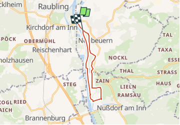
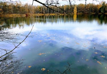
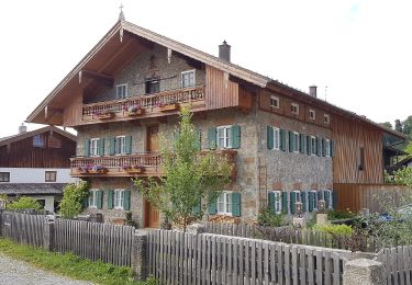
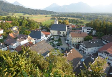
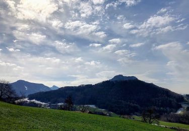
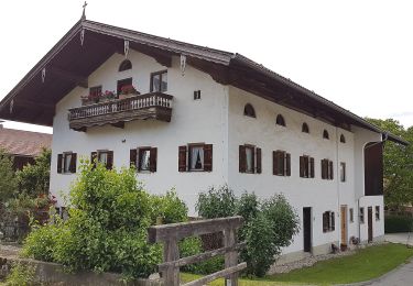
Randonnée A pied de 9,2 km à découvrir à Bavière, Landkreis Rosenheim, Neubeuern. Cette randonnée est proposée par SityTrail - itinéraires balisés pédestres.
Description
Symbole: Weiße Schilder mit einem schwarzen Wanderer mit Stöcken und der Aufschrift "Route 2"
Localisation
Pays :
Allemagne
Région :
Bavière
Département/Province :
Landkreis Rosenheim
Commune :
Neubeuern
Localité :
Unknown
Départ:(Dec)
Départ:(UTM)
284799 ; 5296000 (33T) N.
Commentaires
Randonnées à proximité
![Randonnée A pied Neubeuern - Wanderweg 23 - Neubeuern - Photo](https://media.geolcdn.com/t/375/260/0ebcb92c-e2d3-47ba-a539-bba332a56891.jpeg&format=jpg&maxdim=2)
![A pied A pied](https://static1.geolcdn.com/sitytour/trail-icons/100.png)
Wanderweg 23 - Neubeuern
A pied
Facile
Neubeuern,
Bavière,
Landkreis Rosenheim,
Allemagne
![](/images/other/stat-length.png)
5,1 km | 5,8 km-effort
1h 19min
![](https://static1.geolcdn.com/siteimages/upload/files/16400158638029165_repeat_loop_refresh_sync_direction_icon.png)
Non
![Randonnée A pied Neubeuern - Neubeurer See - Photo](https://media.geolcdn.com/t/375/260/a1f643e0-e1c0-4031-9642-375bf2da164b.jpeg&format=jpg&maxdim=2)
![A pied A pied](https://static1.geolcdn.com/sitytour/trail-icons/100.png)
Neubeurer See
A pied
Facile
Neubeuern,
Bavière,
Landkreis Rosenheim,
Allemagne
![](/images/other/stat-length.png)
5,4 km | 5,8 km-effort
1h 18min
![](https://static1.geolcdn.com/siteimages/upload/files/16400158638029165_repeat_loop_refresh_sync_direction_icon.png)
Non
![Randonnée A pied Neubeuern - Neuner See - Photo](https://media.geolcdn.com/t/375/260/f37aa111-a33a-4866-9021-8c7d646e1e92.jpeg&format=jpg&maxdim=2)
![A pied A pied](https://static1.geolcdn.com/sitytour/trail-icons/100.png)
Neuner See
A pied
Facile
Neubeuern,
Bavière,
Landkreis Rosenheim,
Allemagne
![](/images/other/stat-length.png)
5,6 km | 6,2 km-effort
1h 24min
![](https://static1.geolcdn.com/siteimages/upload/files/16400158638029165_repeat_loop_refresh_sync_direction_icon.png)
Non
![Randonnée A pied Nußdorf am Inn - SalzAlpenZugweg Nußdorf/Daffnerwald-Almen - Photo](https://media.geolcdn.com/t/375/260/5e1c3d1c-01bf-4b0c-b23e-ae95a6e5f146.jpeg&format=jpg&maxdim=2)
![A pied A pied](https://static1.geolcdn.com/sitytour/trail-icons/100.png)
SalzAlpenZugweg Nußdorf/Daffnerwald-Almen
A pied
Facile
Nußdorf am Inn,
Bavière,
Landkreis Rosenheim,
Allemagne
![](/images/other/stat-length.png)
4,8 km | 10,5 km-effort
2h 23min
![](https://static1.geolcdn.com/siteimages/upload/files/16400158638029165_repeat_loop_refresh_sync_direction_icon.png)
Non
![Randonnée A pied Neubeuern - Wanderweg 24 - Neubeuern - Photo](https://media.geolcdn.com/t/375/260/64cc1371-16a9-4084-903a-196958f5b679.jpeg&format=jpg&maxdim=2)
![A pied A pied](https://static1.geolcdn.com/sitytour/trail-icons/100.png)
Wanderweg 24 - Neubeuern
A pied
Facile
Neubeuern,
Bavière,
Landkreis Rosenheim,
Allemagne
![](/images/other/stat-length.png)
3,5 km | 4,5 km-effort
1h 1min
![](https://static1.geolcdn.com/siteimages/upload/files/16400158638029165_repeat_loop_refresh_sync_direction_icon.png)
Non
![Randonnée A pied Samerberg - Wanderweg 51 - Samerberg - Photo](https://media.geolcdn.com/t/375/260/8e570050-b69c-402d-8110-7056f739b2ca.jpeg&format=jpg&maxdim=2)
![A pied A pied](https://static1.geolcdn.com/sitytour/trail-icons/100.png)
Wanderweg 51 - Samerberg
A pied
Facile
Samerberg,
Bavière,
Landkreis Rosenheim,
Allemagne
![](/images/other/stat-length.png)
6,3 km | 8,8 km-effort
2h 0min
![](https://static1.geolcdn.com/siteimages/upload/files/16400158638029165_repeat_loop_refresh_sync_direction_icon.png)
Oui
![Randonnée A pied Samerberg - Wanderweg 57 - Samerberg - Photo](https://media.geolcdn.com/t/375/260/5d7da1db-e559-48bb-bc96-48c1d6a2af35.jpeg&format=jpg&maxdim=2)
![A pied A pied](https://static1.geolcdn.com/sitytour/trail-icons/100.png)
Wanderweg 57 - Samerberg
A pied
Facile
Samerberg,
Bavière,
Landkreis Rosenheim,
Allemagne
![](/images/other/stat-length.png)
6,5 km | 9,4 km-effort
2h 7min
![](https://static1.geolcdn.com/siteimages/upload/files/16400158638029165_repeat_loop_refresh_sync_direction_icon.png)
Non
![Randonnée A pied Samerberg - Wanderweg 54 - Samerberg - Photo](https://media.geolcdn.com/t/375/260/fc7575ce-b7e0-4759-bfc8-7d94e25cd2d0.jpeg&format=jpg&maxdim=2)
![A pied A pied](https://static1.geolcdn.com/sitytour/trail-icons/100.png)
Wanderweg 54 - Samerberg
A pied
Facile
Samerberg,
Bavière,
Landkreis Rosenheim,
Allemagne
![](/images/other/stat-length.png)
4,2 km | 5,7 km-effort
1h 18min
![](https://static1.geolcdn.com/siteimages/upload/files/16400158638029165_repeat_loop_refresh_sync_direction_icon.png)
Non
![Randonnée A pied Nußdorf am Inn - Nußdorf-Bichleralm-Heuberg - Photo](https://media.geolcdn.com/t/375/260/2bce1b0a-481b-4248-88bd-0c32ba41cee2.jpeg&format=jpg&maxdim=2)
![A pied A pied](https://static1.geolcdn.com/sitytour/trail-icons/100.png)
Nußdorf-Bichleralm-Heuberg
A pied
Facile
Nußdorf am Inn,
Bavière,
Landkreis Rosenheim,
Allemagne
![](/images/other/stat-length.png)
3,9 km | 12,1 km-effort
2h 44min
![](https://static1.geolcdn.com/siteimages/upload/files/16400158638029165_repeat_loop_refresh_sync_direction_icon.png)
Non