![](/images/other/stat-length.png)
![Randonnée A pied Waldalgesheim - Rhein-Nahe-Schleife - Photo](https://media.geolcdn.com/t/1900/400/a9699664-da82-452a-83b2-de6b25b0bfb9.jpeg&format=pjpeg&maxdim=2)
Rhein-Nahe-Schleife
SityTrail - itinéraires balisés pédestres
Tous les sentiers balisés d’Europe GUIDE+
![Longueur](/images/other/stat-length.png)
Longueur
20 km
![Altitude max](https://static1.geolcdn.com/siteimages/upload/files/1508320355ic_sort_altitude_max_24dp.png)
Altitude max
333 m
![Dénivelé positif](https://static1.geolcdn.com/siteimages/upload/files/1508320355ic_sort_den_pos_24dp.png)
Dénivelé positif
475 m
![Km-Effort](/images/other/stat-length.png)
Km-Effort
27 km
![Altitude min](https://static1.geolcdn.com/siteimages/upload/files/1508320355ic_sort_altitude_min_24dp.png)
Altitude min
134 m
![Dénivelé négatif](https://static1.geolcdn.com/siteimages/upload/files/1508320355ic_sort_den_neg_24dp.png)
Dénivelé négatif
475 m
![Boucle](https://static1.geolcdn.com/siteimages/upload/files/16400158638029165_repeat_loop_refresh_sync_direction_icon.png)
Boucle
Oui
Balise
Date de création :
2022-02-11 16:09:05.684
Dernière modification :
2022-02-11 16:09:05.684
![A pied](https://static1.geolcdn.com/sitytour/trail-icons/100.png)
6h01
Difficulté : Moyen
![Scannez ce code QR pour ouvrir la randonnée dans l'application SityTrail](https://capi.geolives.com/qq0zvz2zws4bq2lad0pu/sitytour/trails/3095828/qr.png?size=200)
Application GPS de randonnée GRATUITE
À propos
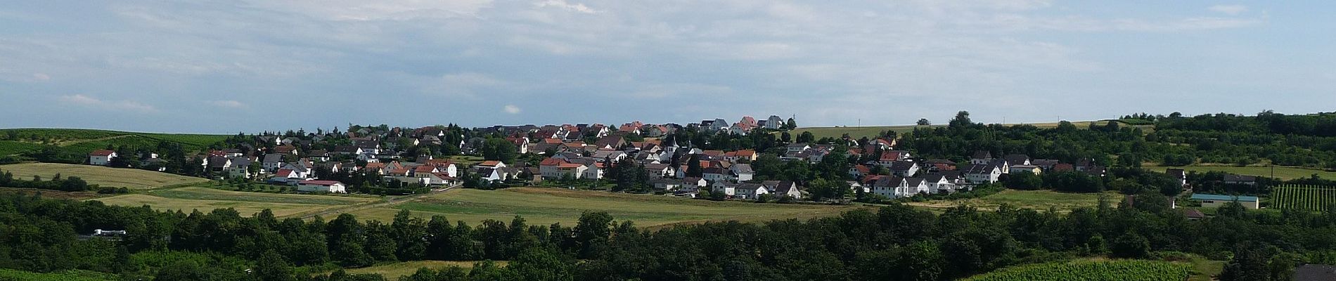
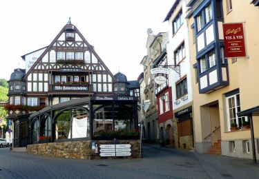
Randonnée A pied de 20 km à découvrir à Rhénanie-Palatinat, Landkreis Mainz-Bingen, Waldalgesheim. Cette randonnée est proposée par SityTrail - itinéraires balisés pédestres.
Description
Randonnée créée par Romantischer Rhein Tourismus GmbH.
Symbole: weiße Burgzinnen und stilisiertes R auf rotem Grund (Rheinburgenwegsymbol)
Localisation
Pays :
Allemagne
Région :
Rhénanie-Palatinat
Département/Province :
Landkreis Mainz-Bingen
Commune :
Waldalgesheim
Localité :
Unknown
Départ:(Dec)
Départ:(UTM)
416938 ; 5533501 (32U) N.
Commentaires
Randonnées à proximité
![Randonnée A pied Rüdesheim am Rhein - Rheingauer Klostersteig Zuweg Assmannshausen - Photo](https://media.geolcdn.com/t/375/260/0b549e65-574a-4424-acfe-276db4f7f1c5.jpeg&format=jpg&maxdim=2)
![A pied A pied](https://static1.geolcdn.com/sitytour/trail-icons/100.png)
Rheingauer Klostersteig Zuweg Assmannshausen
A pied
Facile
Rüdesheim am Rhein,
Hesse,
Rheingau-Taunus-Kreis,
Allemagne
![](/images/other/stat-length.png)
3,1 km | 4,6 km-effort
1h 3min
![](https://static1.geolcdn.com/siteimages/upload/files/16400158638029165_repeat_loop_refresh_sync_direction_icon.png)
Non
![Randonnée A pied Windesheim - VitalTour Wald, Wein & Horizonte - Photo](https://media.geolcdn.com/t/375/260/ef06a4f4-b98b-48ce-b3a2-a35eac2a946a.jpeg&format=jpg&maxdim=2)
![A pied A pied](https://static1.geolcdn.com/sitytour/trail-icons/100.png)
VitalTour Wald, Wein & Horizonte
A pied
Facile
Windesheim,
Rhénanie-Palatinat,
Landkreis Bad Kreuznach,
Allemagne
![](/images/other/stat-length.png)
9,8 km | 13,6 km-effort
3h 5min
![](https://static1.geolcdn.com/siteimages/upload/files/16400158638029165_repeat_loop_refresh_sync_direction_icon.png)
Non
![Randonnée A pied Rüdesheim am Rhein - Wanderweg gelber Balken - Photo](https://media.geolcdn.com/t/375/260/1631cdc5-00bc-479f-8da0-8df5784865c6.jpeg&format=jpg&maxdim=2)
![A pied A pied](https://static1.geolcdn.com/sitytour/trail-icons/100.png)
Wanderweg gelber Balken
A pied
Facile
Rüdesheim am Rhein,
Hesse,
Rheingau-Taunus-Kreis,
Allemagne
![](/images/other/stat-length.png)
6,2 km | 8 km-effort
1h 49min
![](https://static1.geolcdn.com/siteimages/upload/files/16400158638029165_repeat_loop_refresh_sync_direction_icon.png)
Non
![Randonnée A pied Weiler bei Bingen - Baumgeister-Tour - Photo](https://media.geolcdn.com/t/375/260/860edcd6-aac1-44a5-b437-19decf78aa73.jpeg&format=jpg&maxdim=2)
![A pied A pied](https://static1.geolcdn.com/sitytour/trail-icons/100.png)
Baumgeister-Tour
A pied
Moyen
Weiler bei Bingen,
Rhénanie-Palatinat,
Landkreis Mainz-Bingen,
Allemagne
![](/images/other/stat-length.png)
15,5 km | 22 km-effort
5h 4min
![](https://static1.geolcdn.com/siteimages/upload/files/16400158638029165_repeat_loop_refresh_sync_direction_icon.png)
Oui
![Randonnée A pied Stromberg - Rundweg Neupfalz - Photo](https://media.geolcdn.com/t/375/260/6101d4b1-0651-4423-b910-31e226d4ad1e.jpeg&format=jpg&maxdim=2)
![A pied A pied](https://static1.geolcdn.com/sitytour/trail-icons/100.png)
Rundweg Neupfalz
A pied
Facile
Stromberg,
Rhénanie-Palatinat,
Landkreis Bad Kreuznach,
Allemagne
![](/images/other/stat-length.png)
8,4 km | 10,6 km-effort
2h 24min
![](https://static1.geolcdn.com/siteimages/upload/files/16400158638029165_repeat_loop_refresh_sync_direction_icon.png)
Oui
![Randonnée A pied Stromberg - Schöner Berg Weg - Photo](https://media.geolcdn.com/t/375/260/5b2d75d9-714f-401e-a615-9194f4ecc279.jpeg&format=jpg&maxdim=2)
![A pied A pied](https://static1.geolcdn.com/sitytour/trail-icons/100.png)
Schöner Berg Weg
A pied
Facile
Stromberg,
Rhénanie-Palatinat,
Landkreis Bad Kreuznach,
Allemagne
![](/images/other/stat-length.png)
7 km | 9,6 km-effort
2h 10min
![](https://static1.geolcdn.com/siteimages/upload/files/16400158638029165_repeat_loop_refresh_sync_direction_icon.png)
Oui
![Randonnée A pied Stromberg - Rundweg Panoramabad - Photo](https://media.geolcdn.com/t/375/260/0e77221d-50c7-41b7-9848-0f524d9c033d.jpeg&format=jpg&maxdim=2)
![A pied A pied](https://static1.geolcdn.com/sitytour/trail-icons/100.png)
Rundweg Panoramabad
A pied
Facile
Stromberg,
Rhénanie-Palatinat,
Landkreis Bad Kreuznach,
Allemagne
![](/images/other/stat-length.png)
4,8 km | 6,4 km-effort
1h 26min
![](https://static1.geolcdn.com/siteimages/upload/files/16400158638029165_repeat_loop_refresh_sync_direction_icon.png)
Oui
![Randonnée A pied Rüdesheim am Rhein - Rheinsteig [Rüdesheim - Johannisberg] - Photo](https://media.geolcdn.com/t/375/260/ext.jpg?maxdim=2&url=https%3A%2F%2Fstatic1.geolcdn.com%2Fsiteimages%2Fupload%2Ffiles%2F1545311037marcheuse_200dpi.jpg)
![A pied A pied](https://static1.geolcdn.com/sitytour/trail-icons/100.png)
Rheinsteig [Rüdesheim - Johannisberg]
A pied
Facile
Rüdesheim am Rhein,
Hesse,
Rheingau-Taunus-Kreis,
Allemagne
![](/images/other/stat-length.png)
14,8 km | 20 km-effort
4h 32min
![](https://static1.geolcdn.com/siteimages/upload/files/16400158638029165_repeat_loop_refresh_sync_direction_icon.png)
Non
![Randonnée A pied Stromberg - Kleine Runde - Photo](https://media.geolcdn.com/t/375/260/ext.jpg?maxdim=2&url=https%3A%2F%2Fstatic1.geolcdn.com%2Fsiteimages%2Fupload%2Ffiles%2F1545311037marcheuse_200dpi.jpg)
![A pied A pied](https://static1.geolcdn.com/sitytour/trail-icons/100.png)
Kleine Runde
A pied
Facile
Stromberg,
Rhénanie-Palatinat,
Landkreis Bad Kreuznach,
Allemagne
![](/images/other/stat-length.png)
3,3 km | 4,4 km-effort
59min
![](https://static1.geolcdn.com/siteimages/upload/files/16400158638029165_repeat_loop_refresh_sync_direction_icon.png)
Oui