![](/images/other/stat-length.png)
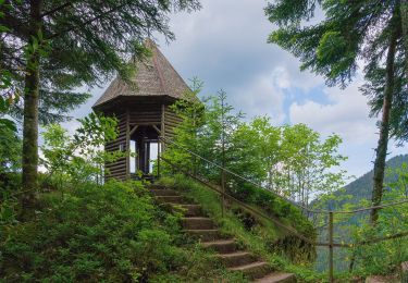
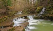
![Randonnée A pied Epfendorf - Schlichemklammweg - Photo](https://media.geolcdn.com/t/1900/400/d3eb2c08-afe1-466a-be05-282762d0b7eb.jpeg&format=pjpeg&maxdim=2)
Schlichemklammweg
SityTrail - itinéraires balisés pédestres
Tous les sentiers balisés d’Europe GUIDE+
![Longueur](/images/other/stat-length.png)
Longueur
4,4 km
![Altitude max](https://static1.geolcdn.com/siteimages/upload/files/1508320355ic_sort_altitude_max_24dp.png)
Altitude max
547 m
![Dénivelé positif](https://static1.geolcdn.com/siteimages/upload/files/1508320355ic_sort_den_pos_24dp.png)
Dénivelé positif
109 m
![Km-Effort](/images/other/stat-length.png)
Km-Effort
5,7 km
![Altitude min](https://static1.geolcdn.com/siteimages/upload/files/1508320355ic_sort_altitude_min_24dp.png)
Altitude min
483 m
![Dénivelé négatif](https://static1.geolcdn.com/siteimages/upload/files/1508320355ic_sort_den_neg_24dp.png)
Dénivelé négatif
59 m
![Boucle](https://static1.geolcdn.com/siteimages/upload/files/16400158638029165_repeat_loop_refresh_sync_direction_icon.png)
Boucle
Non
Balise
Date de création :
2022-02-11 15:52:02.855
Dernière modification :
2022-02-11 15:52:02.855
![A pied](https://static1.geolcdn.com/sitytour/trail-icons/100.png)
1h17
Difficulté : Facile
![Scannez ce code QR pour ouvrir la randonnée dans l'application SityTrail](https://capi.geolives.com/qq0zvz2zws4bq2lad0pu/sitytour/trails/3095375/qr.png?size=200)
Application GPS de randonnée GRATUITE
À propos
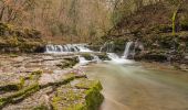
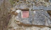
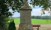
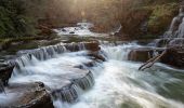
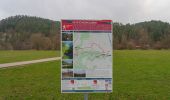
Randonnée A pied de 4,4 km à découvrir à Bade-Wurtemberg, Landkreis Rottweil, Epfendorf. Cette randonnée est proposée par SityTrail - itinéraires balisés pédestres.
Description
Randonnée créée par Schwäbischer Albverein.
Symbole: Roter Punkt auf weißem Grund
Localisation
Pays :
Allemagne
Région :
Bade-Wurtemberg
Département/Province :
Landkreis Rottweil
Commune :
Epfendorf
Localité :
Unknown
Départ:(Dec)
Départ:(UTM)
470086 ; 5343903 (32U) N.
Commentaires
Randonnées à proximité
![Randonnée A pied Haigerloch - Bad Imnau - Trillfingen - Photo](https://media.geolcdn.com/t/375/260/bc6cb41e-25a3-4cb8-a695-26124ee1800e.jpeg&format=jpg&maxdim=2)
![A pied A pied](https://static1.geolcdn.com/sitytour/trail-icons/100.png)
Bad Imnau - Trillfingen
A pied
Facile
Haigerloch,
Bade-Wurtemberg,
Zollernalbkreis,
Allemagne
![](/images/other/stat-length.png)
4,6 km | 7 km-effort
1h 36min
![](https://static1.geolcdn.com/siteimages/upload/files/16400158638029165_repeat_loop_refresh_sync_direction_icon.png)
Non
![Randonnée A pied Bad Rippoldsau-Schapbach - Bad Rippoldsau - Burgbachhöhe (Mittelweg) - Photo](https://media.geolcdn.com/t/375/260/35019236-3d2a-4e92-a8c8-def75f614134.jpeg&format=jpg&maxdim=2)
![A pied A pied](https://static1.geolcdn.com/sitytour/trail-icons/100.png)
Bad Rippoldsau - Burgbachhöhe (Mittelweg)
A pied
Facile
Bad Rippoldsau-Schapbach,
Bade-Wurtemberg,
Landkreis Freudenstadt,
Allemagne
![](/images/other/stat-length.png)
5,4 km | 9,5 km-effort
2h 10min
![](https://static1.geolcdn.com/siteimages/upload/files/16400158638029165_repeat_loop_refresh_sync_direction_icon.png)
Non
![Randonnée A pied Empfingen - Äußerer Querweg - Horb am Neckar - Weg-4 - Weiherhof - Dettensee - Photo](https://media.geolcdn.com/t/375/260/96ae4664-162b-423a-8fd8-48aaf1318989.jpeg&format=jpg&maxdim=2)
![A pied A pied](https://static1.geolcdn.com/sitytour/trail-icons/100.png)
Äußerer Querweg - Horb am Neckar - Weg-4 - Weiherhof - Dettensee
A pied
Facile
Empfingen,
Bade-Wurtemberg,
Landkreis Freudenstadt,
Allemagne
![](/images/other/stat-length.png)
6,1 km | 8 km-effort
1h 49min
![](https://static1.geolcdn.com/siteimages/upload/files/16400158638029165_repeat_loop_refresh_sync_direction_icon.png)
Non
![Randonnée A pied Sulz am Neckar - Äußerer Alternativweg - Dettingen - Weg-2 - Isenburg - Fischingen - Photo](https://media.geolcdn.com/t/375/260/d0e011fd-5507-49bb-ab14-800229085ec1.jpeg&format=jpg&maxdim=2)
![A pied A pied](https://static1.geolcdn.com/sitytour/trail-icons/100.png)
Äußerer Alternativweg - Dettingen - Weg-2 - Isenburg - Fischingen
A pied
Facile
Sulz am Neckar,
Bade-Wurtemberg,
Landkreis Rottweil,
Allemagne
![](/images/other/stat-length.png)
6,9 km | 9,5 km-effort
2h 9min
![](https://static1.geolcdn.com/siteimages/upload/files/16400158638029165_repeat_loop_refresh_sync_direction_icon.png)
Non
![Randonnée A pied St. Georgen im Schwarzwald - St. Georgener Heimatpfad - Photo](https://media.geolcdn.com/t/375/260/1b7aec99-88b2-4e13-8bb7-7fbb219f402a.jpeg&format=jpg&maxdim=2)
![A pied A pied](https://static1.geolcdn.com/sitytour/trail-icons/100.png)
St. Georgener Heimatpfad
A pied
Moyen
St. Georgen im Schwarzwald,
Bade-Wurtemberg,
Schwarzwald-Baar-Kreis,
Allemagne
![](/images/other/stat-length.png)
16 km | 22 km-effort
4h 57min
![](https://static1.geolcdn.com/siteimages/upload/files/16400158638029165_repeat_loop_refresh_sync_direction_icon.png)
Oui
![Randonnée A pied Deißlingen - SAV rote Gabel Wildenstein - Maienbühl Dauchingen Schwenningen - Photo](https://media.geolcdn.com/t/375/260/96a7e94e-8b14-474e-8394-691321662ee8.jpeg&format=jpg&maxdim=2)
![A pied A pied](https://static1.geolcdn.com/sitytour/trail-icons/100.png)
SAV rote Gabel Wildenstein - Maienbühl Dauchingen Schwenningen
A pied
Facile
Deißlingen,
Bade-Wurtemberg,
Landkreis Rottweil,
Allemagne
![](/images/other/stat-length.png)
4 km | 5,2 km-effort
1h 10min
![](https://static1.geolcdn.com/siteimages/upload/files/16400158638029165_repeat_loop_refresh_sync_direction_icon.png)
Non
![Randonnée A pied Starzach - Wachendorf-Bieringen-Oberndorf - Photo](https://media.geolcdn.com/t/375/260/c64343ac-d213-45ca-9cef-6cde8dca29a9.jpeg&format=jpg&maxdim=2)
![A pied A pied](https://static1.geolcdn.com/sitytour/trail-icons/100.png)
Wachendorf-Bieringen-Oberndorf
A pied
Facile
Starzach,
Bade-Wurtemberg,
Landkreis Tübingen,
Allemagne
![](/images/other/stat-length.png)
5,1 km | 6,9 km-effort
1h 33min
![](https://static1.geolcdn.com/siteimages/upload/files/16400158638029165_repeat_loop_refresh_sync_direction_icon.png)
Non
![Randonnée A pied Starzach - Burgmühle-Frommenhausen-Rottenburg - Photo](https://media.geolcdn.com/t/375/260/4d3d54c3-3d2f-4979-bbcf-8781e6d2f840.jpeg&format=jpg&maxdim=2)
![A pied A pied](https://static1.geolcdn.com/sitytour/trail-icons/100.png)
Burgmühle-Frommenhausen-Rottenburg
A pied
Facile
Starzach,
Bade-Wurtemberg,
Landkreis Tübingen,
Allemagne
![](/images/other/stat-length.png)
9,4 km | 13,2 km-effort
2h 59min
![](https://static1.geolcdn.com/siteimages/upload/files/16400158638029165_repeat_loop_refresh_sync_direction_icon.png)
Non
![Randonnée A pied Zimmern ob Rottweil - Horgen-Ruinie Wildenstein - Photo](https://media.geolcdn.com/t/375/260/7f29cd9e-ee65-49ff-95dd-0a933230cfdd.jpeg&format=jpg&maxdim=2)
![A pied A pied](https://static1.geolcdn.com/sitytour/trail-icons/100.png)
Horgen-Ruinie Wildenstein
A pied
Facile
Zimmern ob Rottweil,
Bade-Wurtemberg,
Landkreis Rottweil,
Allemagne
![](/images/other/stat-length.png)
3 km | 4 km-effort
53min
![](https://static1.geolcdn.com/siteimages/upload/files/16400158638029165_repeat_loop_refresh_sync_direction_icon.png)
Non