![](/images/other/stat-length.png)
![Randonnée A pied Grassau - Zum Moorrundweg - Photo](https://media.geolcdn.com/t/1900/400/60b88188-01f0-4419-a5de-16e9925a7169.jpeg&format=pjpeg&maxdim=2)
Zum Moorrundweg
SityTrail - itinéraires balisés pédestres
Tous les sentiers balisés d’Europe GUIDE+
![Longueur](/images/other/stat-length.png)
![Altitude max](https://static1.geolcdn.com/siteimages/upload/files/1508320355ic_sort_altitude_max_24dp.png)
![Dénivelé positif](https://static1.geolcdn.com/siteimages/upload/files/1508320355ic_sort_den_pos_24dp.png)
![Km-Effort](/images/other/stat-length.png)
![Altitude min](https://static1.geolcdn.com/siteimages/upload/files/1508320355ic_sort_altitude_min_24dp.png)
![Dénivelé négatif](https://static1.geolcdn.com/siteimages/upload/files/1508320355ic_sort_den_neg_24dp.png)
![Boucle](https://static1.geolcdn.com/siteimages/upload/files/16400158638029165_repeat_loop_refresh_sync_direction_icon.png)
![A pied](https://static1.geolcdn.com/sitytour/trail-icons/100.png)
1h01
Difficulté : Facile
![Scannez ce code QR pour ouvrir la randonnée dans l'application SityTrail](https://capi.geolives.com/qq0zvz2zws4bq2lad0pu/sitytour/trails/3094022/qr.png?size=200)
Application GPS de randonnée GRATUITE
À propos
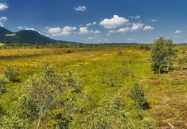
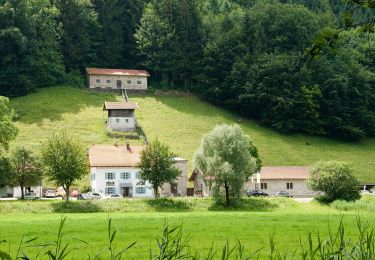
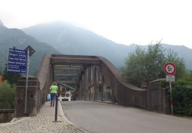
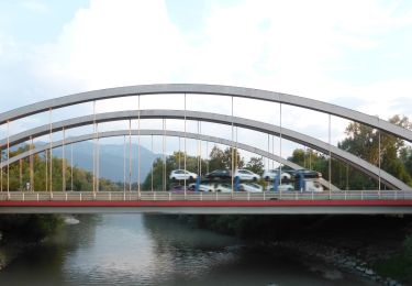
Randonnée A pied de 4,2 km à découvrir à Bavière, Landkreis Traunstein, Grassau. Cette randonnée est proposée par SityTrail - itinéraires balisés pédestres.
Description
Randonnée créée par Markt Grassau.
Zubringer Moorrundweg
Symbole: Gelbes Viereck mit Zahl. Neuere Beschilderung mit gelben Blechschildern und schwarzer Schrift
Localisation
Commentaires
Randonnées à proximité
![Randonnée A pied Marquartstein - SalzAlpenTour - Marquartstein - Photo](https://media.geolcdn.com/t/375/260/6a08c7a4-18e6-432b-8d18-6c58893e510c.jpeg&format=jpg&maxdim=2)
![A pied A pied](https://static1.geolcdn.com/sitytour/trail-icons/100.png)
A pied
![](/images/other/stat-length.png)
![](https://static1.geolcdn.com/siteimages/upload/files/16400158638029165_repeat_loop_refresh_sync_direction_icon.png)
![Randonnée A pied Grassau - Wanderweg 4 - Grassau - Photo](https://media.geolcdn.com/t/375/260/d24c11c6-c82e-4efd-b811-b1ed9001aaff.jpeg&format=jpg&maxdim=2)
![A pied A pied](https://static1.geolcdn.com/sitytour/trail-icons/100.png)
A pied
![](/images/other/stat-length.png)
![](https://static1.geolcdn.com/siteimages/upload/files/16400158638029165_repeat_loop_refresh_sync_direction_icon.png)
![Randonnée A pied Grassau - Wanderweg 23 - Grassau - Photo](https://media.geolcdn.com/t/375/260/939b449c-8bfe-4713-8ba8-45392e182414.jpeg&format=jpg&maxdim=2)
![A pied A pied](https://static1.geolcdn.com/sitytour/trail-icons/100.png)
A pied
![](/images/other/stat-length.png)
![](https://static1.geolcdn.com/siteimages/upload/files/16400158638029165_repeat_loop_refresh_sync_direction_icon.png)
![Randonnée A pied Staudach-Egerndach - Wanderweg 1 - Grassau - Photo](https://media.geolcdn.com/t/375/260/601be0dc-08da-414f-ba1d-ce5a53e79f8c.jpeg&format=jpg&maxdim=2)
![A pied A pied](https://static1.geolcdn.com/sitytour/trail-icons/100.png)
A pied
![](/images/other/stat-length.png)
![](https://static1.geolcdn.com/siteimages/upload/files/16400158638029165_repeat_loop_refresh_sync_direction_icon.png)
![Randonnée A pied Grassau - SalzAlpenTour - Über die Grassauer Almen - Photo](https://media.geolcdn.com/t/375/260/5cc8f884-fa03-4b69-aeeb-fdd283aca3e7.jpeg&format=jpg&maxdim=2)
![A pied A pied](https://static1.geolcdn.com/sitytour/trail-icons/100.png)
A pied
![](/images/other/stat-length.png)
![](https://static1.geolcdn.com/siteimages/upload/files/16400158638029165_repeat_loop_refresh_sync_direction_icon.png)
![Randonnée A pied Grassau - eon - Trail - Photo](https://media.geolcdn.com/t/375/260/601be0dc-08da-414f-ba1d-ce5a53e79f8c.jpeg&format=jpg&maxdim=2)
![A pied A pied](https://static1.geolcdn.com/sitytour/trail-icons/100.png)
A pied
![](/images/other/stat-length.png)
![](https://static1.geolcdn.com/siteimages/upload/files/16400158638029165_repeat_loop_refresh_sync_direction_icon.png)
![Randonnée A pied Grassau - Haas - Trail - Photo](https://media.geolcdn.com/t/375/260/457a24b3-c1bf-43db-afd7-f27dcbdf84a9.jpeg&format=jpg&maxdim=2)
![A pied A pied](https://static1.geolcdn.com/sitytour/trail-icons/100.png)
A pied
![](/images/other/stat-length.png)
![](https://static1.geolcdn.com/siteimages/upload/files/16400158638029165_repeat_loop_refresh_sync_direction_icon.png)
![Randonnée A pied Marquartstein - Wanderweg 12 - Staudach - Photo](https://media.geolcdn.com/t/375/260/457a24b3-c1bf-43db-afd7-f27dcbdf84a9.jpeg&format=jpg&maxdim=2)
![A pied A pied](https://static1.geolcdn.com/sitytour/trail-icons/100.png)
A pied
![](/images/other/stat-length.png)
![](https://static1.geolcdn.com/siteimages/upload/files/16400158638029165_repeat_loop_refresh_sync_direction_icon.png)
![Randonnée A pied Übersee - eon - Trail - Photo](https://media.geolcdn.com/t/375/260/70708853-27ea-456e-8329-837fef18fa69.jpeg&format=jpg&maxdim=2)
![A pied A pied](https://static1.geolcdn.com/sitytour/trail-icons/100.png)
A pied
![](/images/other/stat-length.png)
![](https://static1.geolcdn.com/siteimages/upload/files/16400158638029165_repeat_loop_refresh_sync_direction_icon.png)