![](/images/other/stat-length.png)
![Randonnée A pied Hemmingen - Hemminger Landwirtschaftspfad - Photo](https://media.geolcdn.com/t/1900/400/ext.pjpeg?maxdim=2&url=https%3A%2F%2Fstatic1.geolcdn.com%2Fsiteimages%2Fupload%2Ffiles%2F1545311037marcheuse_200dpi.jpg)
Hemminger Landwirtschaftspfad
SityTrail - itinéraires balisés pédestres
Tous les sentiers balisés d’Europe GUIDE+
![Longueur](/images/other/stat-length.png)
Longueur
25 km
![Altitude max](https://static1.geolcdn.com/siteimages/upload/files/1508320355ic_sort_altitude_max_24dp.png)
Altitude max
88 m
![Dénivelé positif](https://static1.geolcdn.com/siteimages/upload/files/1508320355ic_sort_den_pos_24dp.png)
Dénivelé positif
158 m
![Km-Effort](/images/other/stat-length.png)
Km-Effort
27 km
![Altitude min](https://static1.geolcdn.com/siteimages/upload/files/1508320355ic_sort_altitude_min_24dp.png)
Altitude min
51 m
![Dénivelé négatif](https://static1.geolcdn.com/siteimages/upload/files/1508320355ic_sort_den_neg_24dp.png)
Dénivelé négatif
150 m
![Boucle](https://static1.geolcdn.com/siteimages/upload/files/16400158638029165_repeat_loop_refresh_sync_direction_icon.png)
Boucle
Non
Balise
Date de création :
2022-02-11 15:01:52.283
Dernière modification :
2022-02-11 15:01:52.283
![A pied](https://static1.geolcdn.com/sitytour/trail-icons/100.png)
6h13
Difficulté : Moyen
![Scannez ce code QR pour ouvrir la randonnée dans l'application SityTrail](https://capi.geolives.com/qq0zvz2zws4bq2lad0pu/sitytour/trails/3093809/qr.png?size=200)
Application GPS de randonnée GRATUITE
À propos
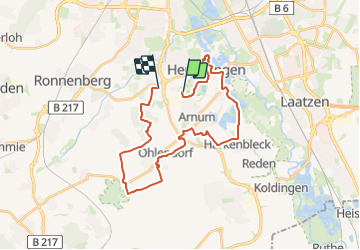
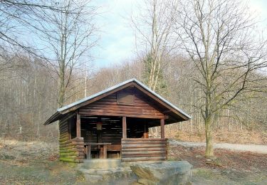
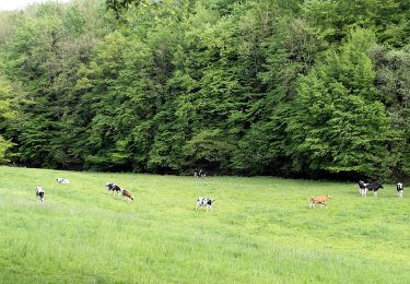
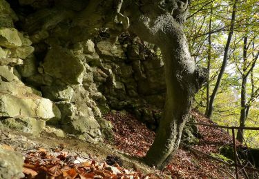
Randonnée A pied de 25 km à découvrir à Basse-Saxe, Hanovre (région), Hemmingen. Cette randonnée est proposée par SityTrail - itinéraires balisés pédestres.
Description
Randonnée créée par Stadt Hemmingen.
Site web: https://www.stadthemmingen.de/medien/bilder/landwirtschaftspfad_uebersicht.jpg
Localisation
Pays :
Allemagne
Région :
Basse-Saxe
Département/Province :
Hanovre (région)
Commune :
Hemmingen
Localité :
Arnum
Départ:(Dec)
Départ:(UTM)
549738 ; 5795974 (32U) N.
Commentaires
Randonnées à proximité
![Randonnée A pied Wennigsen (Deister) - Hüttenwanderung im Deister - Photo](https://media.geolcdn.com/t/375/260/ec521f1a-1a16-4235-93b1-b4563b19449f.jpeg&format=jpg&maxdim=2)
![A pied A pied](https://static1.geolcdn.com/sitytour/trail-icons/100.png)
Hüttenwanderung im Deister
A pied
Facile
Wennigsen (Deister),
Basse-Saxe,
Hanovre (région),
Allemagne
![](/images/other/stat-length.png)
11,7 km | 15,8 km-effort
3h 35min
![](https://static1.geolcdn.com/siteimages/upload/files/16400158638029165_repeat_loop_refresh_sync_direction_icon.png)
Non
![Randonnée A pied Auetal - Nienstedter-Pass zum Steinkrug - Photo](https://media.geolcdn.com/t/375/260/2de91305-bfa1-4f95-b566-b3afdb0d9250.jpeg&format=jpg&maxdim=2)
![A pied A pied](https://static1.geolcdn.com/sitytour/trail-icons/100.png)
Nienstedter-Pass zum Steinkrug
A pied
Facile
Auetal,
Basse-Saxe,
Schaumbourg (arrondissement),
Allemagne
![](/images/other/stat-length.png)
14,1 km | 17,7 km-effort
4h 0min
![](https://static1.geolcdn.com/siteimages/upload/files/16400158638029165_repeat_loop_refresh_sync_direction_icon.png)
Non
![Randonnée A pied Wennigsen (Deister) - Wennigser Mark - Annaturm, Rundweg - Photo](https://media.geolcdn.com/t/375/260/ec521f1a-1a16-4235-93b1-b4563b19449f.jpeg&format=jpg&maxdim=2)
![A pied A pied](https://static1.geolcdn.com/sitytour/trail-icons/100.png)
Wennigser Mark - Annaturm, Rundweg
A pied
Facile
Wennigsen (Deister),
Basse-Saxe,
Hanovre (région),
Allemagne
![](/images/other/stat-length.png)
10,3 km | 14,3 km-effort
3h 15min
![](https://static1.geolcdn.com/siteimages/upload/files/16400158638029165_repeat_loop_refresh_sync_direction_icon.png)
Non
![Randonnée A pied Auetal - Eltenweg - Photo](https://media.geolcdn.com/t/375/260/be01d703-58e4-4e67-8a3d-ec978d4220b0.jpeg&format=jpg&maxdim=2)
![A pied A pied](https://static1.geolcdn.com/sitytour/trail-icons/100.png)
Eltenweg
A pied
Facile
Auetal,
Basse-Saxe,
Schaumbourg (arrondissement),
Allemagne
![](/images/other/stat-length.png)
6,6 km | 8,7 km-effort
1h 59min
![](https://static1.geolcdn.com/siteimages/upload/files/16400158638029165_repeat_loop_refresh_sync_direction_icon.png)
Oui
![Randonnée A pied Auetal - Bergmannsweg - Photo](https://media.geolcdn.com/t/375/260/a5bc9133-0128-4268-81e1-56e0b2407aae.jpeg&format=jpg&maxdim=2)
![A pied A pied](https://static1.geolcdn.com/sitytour/trail-icons/100.png)
Bergmannsweg
A pied
Moyen
Auetal,
Basse-Saxe,
Schaumbourg (arrondissement),
Allemagne
![](/images/other/stat-length.png)
22 km | 29 km-effort
6h 35min
![](https://static1.geolcdn.com/siteimages/upload/files/16400158638029165_repeat_loop_refresh_sync_direction_icon.png)
Non
![Randonnée A pied Auetal - L2 Rundwanderweg Lauenau Nr. 2 - Photo](https://media.geolcdn.com/t/375/260/60a9f5b3-3f94-4402-b535-e6975533e577.jpeg&format=jpg&maxdim=2)
![A pied A pied](https://static1.geolcdn.com/sitytour/trail-icons/100.png)
L2 Rundwanderweg Lauenau Nr. 2
A pied
Facile
Auetal,
Basse-Saxe,
Schaumbourg (arrondissement),
Allemagne
![](/images/other/stat-length.png)
6,5 km | 8,8 km-effort
2h 0min
![](https://static1.geolcdn.com/siteimages/upload/files/16400158638029165_repeat_loop_refresh_sync_direction_icon.png)
Oui
![Randonnée A pied Auetal - NI 1 - Photo](https://media.geolcdn.com/t/375/260/85e7196b-892f-43d1-9b16-9fe1e01a26b7.jpeg&format=jpg&maxdim=2)
![A pied A pied](https://static1.geolcdn.com/sitytour/trail-icons/100.png)
NI 1
A pied
Facile
Auetal,
Basse-Saxe,
Schaumbourg (arrondissement),
Allemagne
![](/images/other/stat-length.png)
9,1 km | 11,7 km-effort
2h 39min
![](https://static1.geolcdn.com/siteimages/upload/files/16400158638029165_repeat_loop_refresh_sync_direction_icon.png)
Oui
![Randonnée A pied Auetal - W3 Rundwanderweg Wennigsen 3 - Photo](https://media.geolcdn.com/t/375/260/7681e020-e2b9-477e-84a2-f9fd7435f679.jpeg&format=jpg&maxdim=2)
![A pied A pied](https://static1.geolcdn.com/sitytour/trail-icons/100.png)
W3 Rundwanderweg Wennigsen 3
A pied
Facile
Auetal,
Basse-Saxe,
Schaumbourg (arrondissement),
Allemagne
![](/images/other/stat-length.png)
7,9 km | 11,2 km-effort
2h 32min
![](https://static1.geolcdn.com/siteimages/upload/files/16400158638029165_repeat_loop_refresh_sync_direction_icon.png)
Oui
![Randonnée A pied Auetal - W4 Rundwanderweg Wennigsen 4 - Photo](https://media.geolcdn.com/t/375/260/d3961ee0-929e-4f6a-a7e5-670a77a85d58.jpeg&format=jpg&maxdim=2)
![A pied A pied](https://static1.geolcdn.com/sitytour/trail-icons/100.png)
W4 Rundwanderweg Wennigsen 4
A pied
Facile
Auetal,
Basse-Saxe,
Schaumbourg (arrondissement),
Allemagne
![](/images/other/stat-length.png)
4,3 km | 5,6 km-effort
1h 16min
![](https://static1.geolcdn.com/siteimages/upload/files/16400158638029165_repeat_loop_refresh_sync_direction_icon.png)
Oui