![](/images/other/stat-length.png)
![Randonnée A pied Velden - Rundweg Velden – Gelbring - Photo](https://media.geolcdn.com/t/1900/400/ext.pjpeg?maxdim=2&url=https%3A%2F%2Fmedia.geolcdn.com%2Ff%2F394272d4-9d5b-4f63-bd39-377ceeb6a7e3.jpeg)
Rundweg Velden – Gelbring
SityTrail - itinéraires balisés pédestres
Tous les sentiers balisés d’Europe PRO
![Longueur](/images/other/stat-length.png)
Longueur
3,6 km
![Altitude max](https://static1.geolcdn.com/siteimages/upload/files/1508320355ic_sort_altitude_max_24dp.png)
Altitude max
432 m
![Dénivelé positif](https://static1.geolcdn.com/siteimages/upload/files/1508320355ic_sort_den_pos_24dp.png)
Dénivelé positif
62 m
![Km-Effort](/images/other/stat-length.png)
Km-Effort
4,4 km
![Altitude min](https://static1.geolcdn.com/siteimages/upload/files/1508320355ic_sort_altitude_min_24dp.png)
Altitude min
378 m
![Dénivelé négatif](https://static1.geolcdn.com/siteimages/upload/files/1508320355ic_sort_den_neg_24dp.png)
Dénivelé négatif
57 m
![Boucle](https://static1.geolcdn.com/siteimages/upload/files/16400158638029165_repeat_loop_refresh_sync_direction_icon.png)
Boucle
Oui
Balise
Date de création :
2022-02-11 14:52:22.121
Dernière modification :
2022-02-11 14:52:22.121
![A pied](https://static1.geolcdn.com/sitytour/trail-icons/100.png)
1h00
Difficulté : Facile
![Scannez ce code QR pour ouvrir la randonnée dans l'application SityTrail](https://capi.geolives.com/qq0zvz2zws4bq2lad0pu/sitytour/trails/3093486/qr.png?size=200)
Application GPS de randonnée GRATUITE
À propos
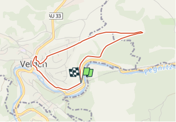
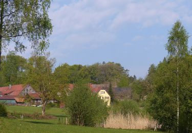
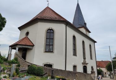
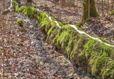
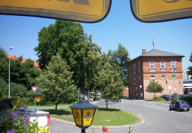
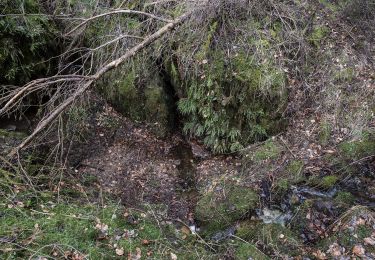
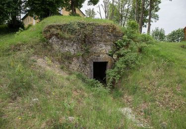
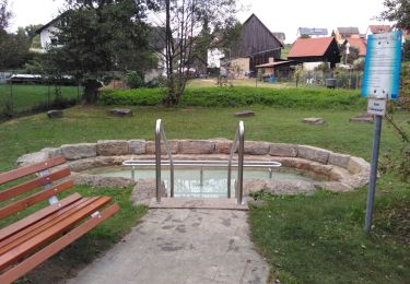
Randonnée A pied de 3,6 km à découvrir à Bavière, Nuremberg-Campagne, Velden. Cette randonnée est proposée par SityTrail - itinéraires balisés pédestres.
Description
Randonnée créée par Gemeinde Velden.
geprüft (März 2015, by cycling_zno)
Symbole: Gelber Ring auf weißem Grund
Localisation
Pays :
Allemagne
Région :
Bavière
Département/Province :
Nuremberg-Campagne
Commune :
Velden
Localité :
Unknown
Départ:(Dec)
Départ:(UTM)
681997 ; 5498464 (32U) N.
Commentaires
Randonnées à proximité
![Randonnée A pied Velden - Scheunenweg - Photo](https://media.geolcdn.com/t/375/260/ext.jpg?maxdim=2&url=https%3A%2F%2Fmedia.geolcdn.com%2Ff%2F394272d4-9d5b-4f63-bd39-377ceeb6a7e3.jpeg)
![A pied A pied](https://static1.geolcdn.com/sitytour/trail-icons/100.png)
Scheunenweg
A pied
Facile
Velden,
Bavière,
Nuremberg-Campagne,
Allemagne
![](/images/other/stat-length.png)
4,4 km | 5,9 km-effort
1h 20min
![](https://static1.geolcdn.com/siteimages/upload/files/16400158638029165_repeat_loop_refresh_sync_direction_icon.png)
Oui
![Randonnée A pied Hartenstein - Rundweg Hartenstein – Teufelshof - Photo](https://media.geolcdn.com/t/375/260/ext.jpg?maxdim=2&url=https%3A%2F%2Fmedia.geolcdn.com%2Ff%2Fef62a62d-ca86-4117-8fc8-44f1b2449b3f.jpeg)
![A pied A pied](https://static1.geolcdn.com/sitytour/trail-icons/100.png)
Rundweg Hartenstein – Teufelshof
A pied
Facile
Hartenstein,
Bavière,
Nuremberg-Campagne,
Allemagne
![](/images/other/stat-length.png)
3,3 km | 4,6 km-effort
1h 3min
![](https://static1.geolcdn.com/siteimages/upload/files/16400158638029165_repeat_loop_refresh_sync_direction_icon.png)
Non
![Randonnée A pied Velden - Landkreislauf Nürnberger Land 2013 Etappe 2 - Photo](https://media.geolcdn.com/t/375/260/ext.jpg?maxdim=2&url=https%3A%2F%2Fmedia.geolcdn.com%2Ff%2Fa7fc1d39-662a-4c1b-8693-17188111951e.jpeg)
![A pied A pied](https://static1.geolcdn.com/sitytour/trail-icons/100.png)
Landkreislauf Nürnberger Land 2013 Etappe 2
A pied
Facile
Velden,
Bavière,
Nuremberg-Campagne,
Allemagne
![](/images/other/stat-length.png)
6 km | 7,9 km-effort
1h 47min
![](https://static1.geolcdn.com/siteimages/upload/files/16400158638029165_repeat_loop_refresh_sync_direction_icon.png)
Non
![Randonnée A pied Plech - Löwen-Runde - Photo](https://media.geolcdn.com/t/375/260/ext.jpg?maxdim=2&url=https%3A%2F%2Fmedia.geolcdn.com%2Ff%2F3ffe4bd6-65d3-447b-8a83-b8151d0aa446.jpeg)
![A pied A pied](https://static1.geolcdn.com/sitytour/trail-icons/100.png)
Löwen-Runde
A pied
Facile
Plech,
Bavière,
Landkreis Bayreuth,
Allemagne
![](/images/other/stat-length.png)
6,3 km | 8,2 km-effort
1h 52min
![](https://static1.geolcdn.com/siteimages/upload/files/16400158638029165_repeat_loop_refresh_sync_direction_icon.png)
Non
![Randonnée A pied Vorra - Rundweg Vorra – Artelshofen - Photo](https://media.geolcdn.com/t/375/260/ext.jpg?maxdim=2&url=https%3A%2F%2Fmedia.geolcdn.com%2Ff%2Ffeb44a10-a919-49df-8047-3179a740a1b2.jpeg)
![A pied A pied](https://static1.geolcdn.com/sitytour/trail-icons/100.png)
Rundweg Vorra – Artelshofen
A pied
Facile
Vorra,
Bavière,
Nuremberg-Campagne,
Allemagne
![](/images/other/stat-length.png)
11,4 km | 17,1 km-effort
3h 52min
![](https://static1.geolcdn.com/siteimages/upload/files/16400158638029165_repeat_loop_refresh_sync_direction_icon.png)
Oui
![Randonnée A pied Hartenstein - Neuhaus-Rundwanderweg No.6 - Photo](https://media.geolcdn.com/t/375/260/ext.jpg?maxdim=2&url=https%3A%2F%2Fmedia.geolcdn.com%2Ff%2F2542aa88-407f-4834-a0cc-5e6d79028a79.jpeg)
![A pied A pied](https://static1.geolcdn.com/sitytour/trail-icons/100.png)
Neuhaus-Rundwanderweg No.6
A pied
Facile
Hartenstein,
Bavière,
Nuremberg-Campagne,
Allemagne
![](/images/other/stat-length.png)
10 km | 13,3 km-effort
3h 1min
![](https://static1.geolcdn.com/siteimages/upload/files/16400158638029165_repeat_loop_refresh_sync_direction_icon.png)
Non
![Randonnée A pied Königstein - Neuhaus-Rundwanderweg No.10 - Photo](https://media.geolcdn.com/t/375/260/ext.jpg?maxdim=2&url=https%3A%2F%2Fmedia.geolcdn.com%2Ff%2F08a0dd65-8d3c-49c0-8c53-c52e628914c1.jpeg)
![A pied A pied](https://static1.geolcdn.com/sitytour/trail-icons/100.png)
Neuhaus-Rundwanderweg No.10
A pied
Facile
Königstein,
Bavière,
Landkreis Amberg-Sulzbach,
Allemagne
![](/images/other/stat-length.png)
8,8 km | 12 km-effort
2h 43min
![](https://static1.geolcdn.com/siteimages/upload/files/16400158638029165_repeat_loop_refresh_sync_direction_icon.png)
Non
![Randonnée A pied Auerbach in der Oberpfalz - Neuhaus-Rundwanderweg No.9 - Photo](https://media.geolcdn.com/t/375/260/ext.jpg?maxdim=2&url=https%3A%2F%2Fmedia.geolcdn.com%2Ff%2F24c23395-ed5f-4337-98c6-2a7318d03c93.jpeg)
![A pied A pied](https://static1.geolcdn.com/sitytour/trail-icons/100.png)
Neuhaus-Rundwanderweg No.9
A pied
Facile
Auerbach in der Oberpfalz,
Bavière,
Landkreis Amberg-Sulzbach,
Allemagne
![](/images/other/stat-length.png)
7,7 km | 9,5 km-effort
2h 9min
![](https://static1.geolcdn.com/siteimages/upload/files/16400158638029165_repeat_loop_refresh_sync_direction_icon.png)
Non
![Randonnée A pied Neuhaus a.d.Pegnitz - Neuhaus-Rundwanderweg No.5 - Photo](https://media.geolcdn.com/t/375/260/ext.jpg?maxdim=2&url=https%3A%2F%2Fmedia.geolcdn.com%2Ff%2F4461e8ef-3244-4aba-ae74-83c40aa01bd6.jpeg)
![A pied A pied](https://static1.geolcdn.com/sitytour/trail-icons/100.png)
Neuhaus-Rundwanderweg No.5
A pied
Facile
Neuhaus a.d.Pegnitz,
Bavière,
Nuremberg-Campagne,
Allemagne
![](/images/other/stat-length.png)
10,1 km | 12,6 km-effort
2h 52min
![](https://static1.geolcdn.com/siteimages/upload/files/16400158638029165_repeat_loop_refresh_sync_direction_icon.png)
Oui