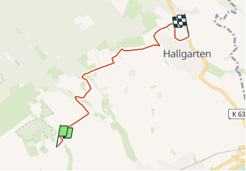
![](/images/other/stat-length.png)
![Randonnée A pied Oestrich-Winkel - Quer-Flötenweg - Photo](https://media.geolcdn.com/t/1900/400/f0ed43c9-212e-4979-9325-1ab2244a8844.jpeg&format=pjpeg&maxdim=2)
Quer-Flötenweg
SityTrail - itinéraires balisés pédestres
Tous les sentiers balisés d’Europe GUIDE+
![Longueur](/images/other/stat-length.png)
![Altitude max](https://static1.geolcdn.com/siteimages/upload/files/1508320355ic_sort_altitude_max_24dp.png)
![Dénivelé positif](https://static1.geolcdn.com/siteimages/upload/files/1508320355ic_sort_den_pos_24dp.png)
![Km-Effort](/images/other/stat-length.png)
![Altitude min](https://static1.geolcdn.com/siteimages/upload/files/1508320355ic_sort_altitude_min_24dp.png)
![Dénivelé négatif](https://static1.geolcdn.com/siteimages/upload/files/1508320355ic_sort_den_neg_24dp.png)
![Boucle](https://static1.geolcdn.com/siteimages/upload/files/16400158638029165_repeat_loop_refresh_sync_direction_icon.png)
![A pied](https://static1.geolcdn.com/sitytour/trail-icons/100.png)
1h27
Difficulté : Facile
![Scannez ce code QR pour ouvrir la randonnée dans l'application SityTrail](https://capi.geolives.com/qq0zvz2zws4bq2lad0pu/sitytour/trails/3093336/qr.png?size=200)
Application GPS de randonnée GRATUITE
À propos
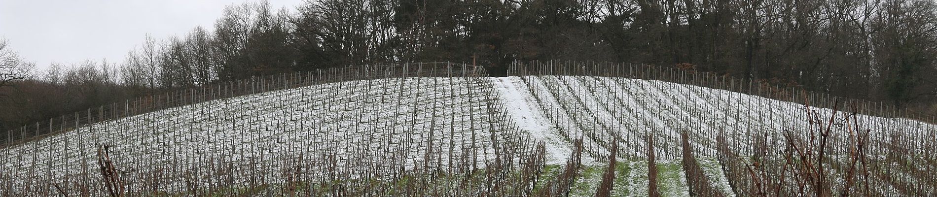
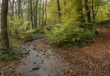
Randonnée A pied de 4,9 km à découvrir à Hesse, Rheingau-Taunus-Kreis, Oestrich-Winkel. Cette randonnée est proposée par SityTrail - itinéraires balisés pédestres.
Description
Randonnée créée par Verkehrsamt Oestrich-Winkel.
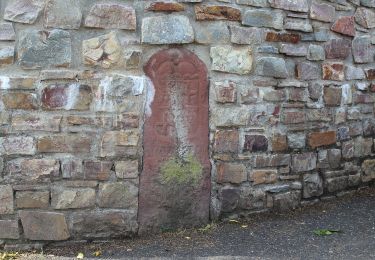
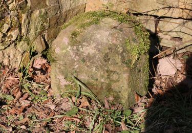
Symbole: Wandernde Weinflasche (Weinflöte) mit Bündel auf rundem, orangem Schild, umschrieben mit "QUER FLÖTENWEG"
Localisation
Commentaires
Randonnées à proximité
![Randonnée A pied Geisenheim - Himmelssteig Stephanshausen - Photo](https://media.geolcdn.com/t/375/260/9223db67-e7da-4277-bf63-0b96616ead54.jpeg&format=jpg&maxdim=2)
![A pied A pied](https://static1.geolcdn.com/sitytour/trail-icons/100.png)
A pied
![](/images/other/stat-length.png)
![](https://static1.geolcdn.com/siteimages/upload/files/16400158638029165_repeat_loop_refresh_sync_direction_icon.png)
![Randonnée A pied Geisenheim - Geisenheimer Rundweg O - Photo](https://media.geolcdn.com/t/375/260/23caf65e-d1b0-432b-8cb1-95d45052c5b3.jpeg&format=jpg&maxdim=2)
![A pied A pied](https://static1.geolcdn.com/sitytour/trail-icons/100.png)
A pied
![](/images/other/stat-length.png)
![](https://static1.geolcdn.com/siteimages/upload/files/16400158638029165_repeat_loop_refresh_sync_direction_icon.png)
![Randonnée A pied Geisenheim - Geisenheimer Rundweg M - Photo](https://media.geolcdn.com/t/375/260/0aad0740-e5ea-4eab-b9e4-1dc6f9e6e635.jpeg&format=jpg&maxdim=2)
![A pied A pied](https://static1.geolcdn.com/sitytour/trail-icons/100.png)
A pied
![](/images/other/stat-length.png)
![](https://static1.geolcdn.com/siteimages/upload/files/16400158638029165_repeat_loop_refresh_sync_direction_icon.png)
![Randonnée A pied Geisenheim - Geisenheimer Rundweg I - Photo](https://media.geolcdn.com/t/375/260/a7b95e33-3a2b-44fc-8c9b-988116704fbb.jpeg&format=jpg&maxdim=2)
![A pied A pied](https://static1.geolcdn.com/sitytour/trail-icons/100.png)
A pied
![](/images/other/stat-length.png)
![](https://static1.geolcdn.com/siteimages/upload/files/16400158638029165_repeat_loop_refresh_sync_direction_icon.png)
![Randonnée A pied Geisenheim - Geisenheimer Rundweg J - Photo](https://media.geolcdn.com/t/375/260/e4502c24-35a9-4c74-a651-9299cfecf071.jpeg&format=jpg&maxdim=2)
![A pied A pied](https://static1.geolcdn.com/sitytour/trail-icons/100.png)
A pied
![](/images/other/stat-length.png)
![](https://static1.geolcdn.com/siteimages/upload/files/16400158638029165_repeat_loop_refresh_sync_direction_icon.png)
![Randonnée A pied Geisenheim - Geisenheimer Rundweg D - Photo](https://media.geolcdn.com/t/375/260/9223db67-e7da-4277-bf63-0b96616ead54.jpeg&format=jpg&maxdim=2)
![A pied A pied](https://static1.geolcdn.com/sitytour/trail-icons/100.png)
A pied
![](/images/other/stat-length.png)
![](https://static1.geolcdn.com/siteimages/upload/files/16400158638029165_repeat_loop_refresh_sync_direction_icon.png)
![Randonnée A pied Geisenheim - Geisenheimer Rundweg F - Photo](https://media.geolcdn.com/t/375/260/c4e2e677-d8d1-4f54-8616-f5083e0a1cdf.jpeg&format=jpg&maxdim=2)
![A pied A pied](https://static1.geolcdn.com/sitytour/trail-icons/100.png)
A pied
![](/images/other/stat-length.png)
![](https://static1.geolcdn.com/siteimages/upload/files/16400158638029165_repeat_loop_refresh_sync_direction_icon.png)
![Randonnée A pied Oestrich-Winkel - Mühlenwanderweg im Elsterbachtal - Photo](https://media.geolcdn.com/t/375/260/e4502c24-35a9-4c74-a651-9299cfecf071.jpeg&format=jpg&maxdim=2)
![A pied A pied](https://static1.geolcdn.com/sitytour/trail-icons/100.png)
A pied
![](/images/other/stat-length.png)
![](https://static1.geolcdn.com/siteimages/upload/files/16400158638029165_repeat_loop_refresh_sync_direction_icon.png)
![Randonnée A pied Geisenheim - Geisenheimer Rundweg L - Photo](https://media.geolcdn.com/t/375/260/f6a6296f-73fa-467e-a544-97556f064c77.jpeg&format=jpg&maxdim=2)
![A pied A pied](https://static1.geolcdn.com/sitytour/trail-icons/100.png)
A pied
![](/images/other/stat-length.png)
![](https://static1.geolcdn.com/siteimages/upload/files/16400158638029165_repeat_loop_refresh_sync_direction_icon.png)