


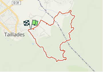

16,7 km | 27 km-effort


Utilisateur


Application GPS de randonnée GRATUITE
 SityTrail
IGN / Instituts géographiques
SityTrail World
Le monde est à vous
Randonnée Marche de 5,3 km à découvrir à Provence-Alpes-Côte d'Azur, Vaucluse, Taillades. Cette randonnée est proposée par denel.
Rando assez facile avec quand même un passage d'échelle qui peut poser problème avec un animal
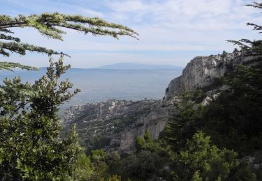
On passe par la Gorge de Badarel et retour par le sommet de Castelas et la vire en dessous du Rocher de Baude

Marche

Vélo

Vélo
Marche

Marche

Marche

Marche

Marche
Marche