![](/images/other/stat-length.png)
![Randonnée A pied Hohenberg an der Eger - Hohenberg 3 - Photo](https://media.geolcdn.com/t/1900/400/175e67bc-1377-44a3-95b9-ce0dcc591fa1.jpeg&format=pjpeg&maxdim=2)
Hohenberg 3
SityTrail - itinéraires balisés pédestres
Tous les sentiers balisés d’Europe GUIDE+
![Longueur](/images/other/stat-length.png)
Longueur
10,9 km
![Altitude max](https://static1.geolcdn.com/siteimages/upload/files/1508320355ic_sort_altitude_max_24dp.png)
Altitude max
622 m
![Dénivelé positif](https://static1.geolcdn.com/siteimages/upload/files/1508320355ic_sort_den_pos_24dp.png)
Dénivelé positif
228 m
![Km-Effort](/images/other/stat-length.png)
Km-Effort
13,9 km
![Altitude min](https://static1.geolcdn.com/siteimages/upload/files/1508320355ic_sort_altitude_min_24dp.png)
Altitude min
508 m
![Dénivelé négatif](https://static1.geolcdn.com/siteimages/upload/files/1508320355ic_sort_den_neg_24dp.png)
Dénivelé négatif
230 m
![Boucle](https://static1.geolcdn.com/siteimages/upload/files/16400158638029165_repeat_loop_refresh_sync_direction_icon.png)
Boucle
Non
Balise
Date de création :
2022-02-11 14:26:55.705
Dernière modification :
2022-02-11 14:26:55.705
![A pied](https://static1.geolcdn.com/sitytour/trail-icons/100.png)
3h09
Difficulté : Facile
![Scannez ce code QR pour ouvrir la randonnée dans l'application SityTrail](https://capi.geolives.com/qq0zvz2zws4bq2lad0pu/sitytour/trails/3092640/qr.png?size=200)
Application GPS de randonnée GRATUITE
À propos
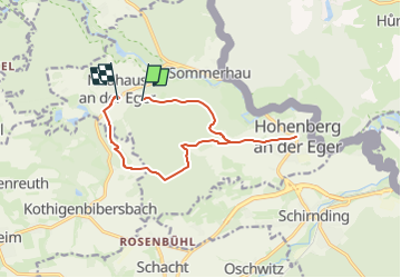
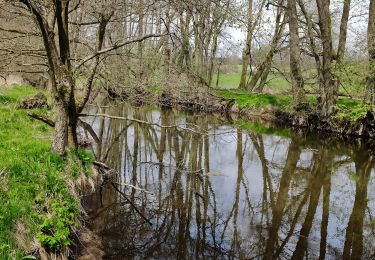
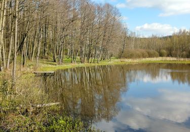
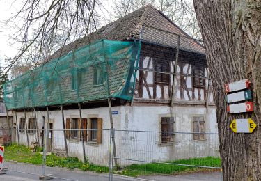
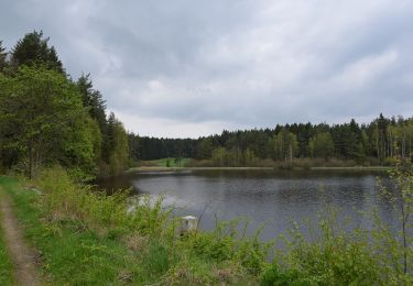
Randonnée A pied de 10,9 km à découvrir à Bavière, Landkreis Wunsiedel im Fichtelgebirge, Hohenberg an der Eger. Cette randonnée est proposée par SityTrail - itinéraires balisés pédestres.
Description
Symbole: weiße 3 auf grünem Grund
Localisation
Pays :
Allemagne
Région :
Bavière
Département/Province :
Landkreis Wunsiedel im Fichtelgebirge
Commune :
Hohenberg an der Eger
Localité :
Unknown
Départ:(Dec)
Départ:(UTM)
298018 ; 5554022 (33U) N.
Commentaires
Randonnées à proximité
![Randonnée A pied Thiersheim - Mühlenweg - Photo](https://media.geolcdn.com/t/375/260/01720f9c-a96f-46fd-a209-317713a1cbaa.jpeg&format=jpg&maxdim=2)
![A pied A pied](https://static1.geolcdn.com/sitytour/trail-icons/100.png)
Mühlenweg
A pied
Facile
Thiersheim,
Bavière,
Landkreis Wunsiedel im Fichtelgebirge,
Allemagne
![](/images/other/stat-length.png)
6,9 km | 7,9 km-effort
1h 48min
![](https://static1.geolcdn.com/siteimages/upload/files/16400158638029165_repeat_loop_refresh_sync_direction_icon.png)
Non
![Randonnée A pied Hohenberg an der Eger - Wanderweg 2 Hohenberg a.d. Eger - Photo](https://media.geolcdn.com/t/375/260/f63c0798-986c-4da6-8859-647a7ebe631c.jpeg&format=jpg&maxdim=2)
![A pied A pied](https://static1.geolcdn.com/sitytour/trail-icons/100.png)
Wanderweg 2 Hohenberg a.d. Eger
A pied
Facile
Hohenberg an der Eger,
Bavière,
Landkreis Wunsiedel im Fichtelgebirge,
Allemagne
![](/images/other/stat-length.png)
4 km | 5 km-effort
1h 7min
![](https://static1.geolcdn.com/siteimages/upload/files/16400158638029165_repeat_loop_refresh_sync_direction_icon.png)
Non
![Randonnée A pied Hohenberg an der Eger - Wanderweg 1 Hohenberg a.d. Eger - Photo](https://media.geolcdn.com/t/375/260/dc15ae97-3c51-40b0-b17d-17e5cbcabf43.jpeg&format=jpg&maxdim=2)
![A pied A pied](https://static1.geolcdn.com/sitytour/trail-icons/100.png)
Wanderweg 1 Hohenberg a.d. Eger
A pied
Facile
Hohenberg an der Eger,
Bavière,
Landkreis Wunsiedel im Fichtelgebirge,
Allemagne
![](/images/other/stat-length.png)
6,1 km | 8,1 km-effort
1h 49min
![](https://static1.geolcdn.com/siteimages/upload/files/16400158638029165_repeat_loop_refresh_sync_direction_icon.png)
Oui
![Randonnée A pied Schirnding - Wanderweg 3 Schirnding - Photo](https://media.geolcdn.com/t/375/260/9b6340b8-9512-4c71-9429-f76d5976acbd.jpeg&format=jpg&maxdim=2)
![A pied A pied](https://static1.geolcdn.com/sitytour/trail-icons/100.png)
Wanderweg 3 Schirnding
A pied
Facile
Schirnding,
Bavière,
Landkreis Wunsiedel im Fichtelgebirge,
Allemagne
![](/images/other/stat-length.png)
3,3 km | 4,1 km-effort
55min
![](https://static1.geolcdn.com/siteimages/upload/files/16400158638029165_repeat_loop_refresh_sync_direction_icon.png)
Oui
![Randonnée A pied Schirnding - Wanderweg 4 Hohenberg a.d. Eger - Photo](https://media.geolcdn.com/t/375/260/175e67bc-1377-44a3-95b9-ce0dcc591fa1.jpeg&format=jpg&maxdim=2)
![A pied A pied](https://static1.geolcdn.com/sitytour/trail-icons/100.png)
Wanderweg 4 Hohenberg a.d. Eger
A pied
Facile
Schirnding,
Bavière,
Landkreis Wunsiedel im Fichtelgebirge,
Allemagne
![](/images/other/stat-length.png)
6,9 km | 8,5 km-effort
1h 55min
![](https://static1.geolcdn.com/siteimages/upload/files/16400158638029165_repeat_loop_refresh_sync_direction_icon.png)
Oui
![Randonnée A pied Thiersheim - Wanderweg 4 Thiersheim - Photo](https://media.geolcdn.com/t/375/260/2965c40e-d840-49a2-8722-f73dd83526d7.jpeg&format=jpg&maxdim=2)
![A pied A pied](https://static1.geolcdn.com/sitytour/trail-icons/100.png)
Wanderweg 4 Thiersheim
A pied
Facile
Thiersheim,
Bavière,
Landkreis Wunsiedel im Fichtelgebirge,
Allemagne
![](/images/other/stat-length.png)
5,6 km | 6,8 km-effort
1h 33min
![](https://static1.geolcdn.com/siteimages/upload/files/16400158638029165_repeat_loop_refresh_sync_direction_icon.png)
Non
![Randonnée A pied Selb - 3 [Selb] - Photo](https://media.geolcdn.com/t/375/260/a65d9baa-5712-430b-ad9a-ce39442ae678.jpeg&format=jpg&maxdim=2)
![A pied A pied](https://static1.geolcdn.com/sitytour/trail-icons/100.png)
3 [Selb]
A pied
Facile
Selb,
Bavière,
Landkreis Wunsiedel im Fichtelgebirge,
Allemagne
![](/images/other/stat-length.png)
6,4 km | 8,2 km-effort
1h 51min
![](https://static1.geolcdn.com/siteimages/upload/files/16400158638029165_repeat_loop_refresh_sync_direction_icon.png)
Oui
![Randonnée A pied Thiersheim - blau weiß diagonal Arzberg-Hohe Warte - Photo](https://media.geolcdn.com/t/375/260/ext.jpg?maxdim=2&url=https%3A%2F%2Fstatic1.geolcdn.com%2Fsiteimages%2Fupload%2Ffiles%2F1545311037marcheuse_200dpi.jpg)
![A pied A pied](https://static1.geolcdn.com/sitytour/trail-icons/100.png)
blau weiß diagonal Arzberg-Hohe Warte
A pied
Facile
Thiersheim,
Bavière,
Landkreis Wunsiedel im Fichtelgebirge,
Allemagne
![](/images/other/stat-length.png)
5,4 km | 6,1 km-effort
1h 23min
![](https://static1.geolcdn.com/siteimages/upload/files/16400158638029165_repeat_loop_refresh_sync_direction_icon.png)
Non
![Randonnée A pied Hohenberg an der Eger - Museumsweg: Blauer Punkt auf weißem Grund - Photo](https://media.geolcdn.com/t/375/260/ext.jpg?maxdim=2&url=https%3A%2F%2Fstatic1.geolcdn.com%2Fsiteimages%2Fupload%2Ffiles%2F1545311037marcheuse_200dpi.jpg)
![A pied A pied](https://static1.geolcdn.com/sitytour/trail-icons/100.png)
Museumsweg: Blauer Punkt auf weißem Grund
A pied
Facile
Hohenberg an der Eger,
Bavière,
Landkreis Wunsiedel im Fichtelgebirge,
Allemagne
![](/images/other/stat-length.png)
8,3 km | 10,2 km-effort
2h 19min
![](https://static1.geolcdn.com/siteimages/upload/files/16400158638029165_repeat_loop_refresh_sync_direction_icon.png)
Non