![](/images/other/stat-length.png)
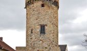
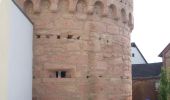
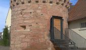
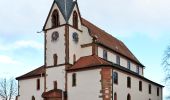
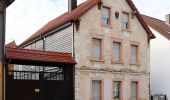
![Randonnée A pied Großostheim - Kulturweg Bachgau 5 - Photo](https://media.geolcdn.com/t/1900/400/59f6e3b2-c0a8-4d91-89c0-edcf7bb243c8.jpeg&format=pjpeg&maxdim=2)
Kulturweg Bachgau 5
SityTrail - itinéraires balisés pédestres
Tous les sentiers balisés d’Europe GUIDE+
![Longueur](/images/other/stat-length.png)
![Altitude max](https://static1.geolcdn.com/siteimages/upload/files/1508320355ic_sort_altitude_max_24dp.png)
![Dénivelé positif](https://static1.geolcdn.com/siteimages/upload/files/1508320355ic_sort_den_pos_24dp.png)
![Km-Effort](/images/other/stat-length.png)
![Altitude min](https://static1.geolcdn.com/siteimages/upload/files/1508320355ic_sort_altitude_min_24dp.png)
![Dénivelé négatif](https://static1.geolcdn.com/siteimages/upload/files/1508320355ic_sort_den_neg_24dp.png)
![Boucle](https://static1.geolcdn.com/siteimages/upload/files/16400158638029165_repeat_loop_refresh_sync_direction_icon.png)
![A pied](https://static1.geolcdn.com/sitytour/trail-icons/100.png)
1h46
Difficulté : Facile
![Scannez ce code QR pour ouvrir la randonnée dans l'application SityTrail](https://capi.geolives.com/qq0zvz2zws4bq2lad0pu/sitytour/trails/3092610/qr.png?size=200)
Application GPS de randonnée GRATUITE
À propos
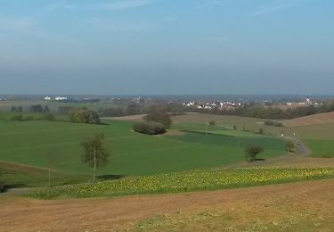
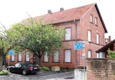
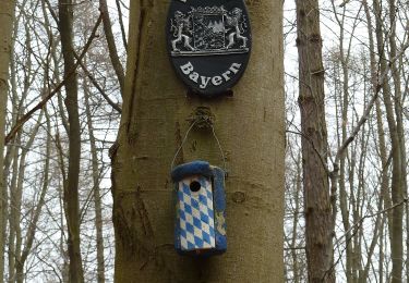
Randonnée A pied de 6,1 km à découvrir à Bavière, Landkreis Aschaffenburg, Großostheim. Cette randonnée est proposée par SityTrail - itinéraires balisés pédestres.
Description
Randonnée créée par Archäologisches Spessartprojekt.
Symbole: Gelbes EU-Schiffchen auf blauem Grund
Site web: https://www.spessartprojekt.de/?page_id=20177
Localisation
Commentaires
Randonnées à proximité
![Randonnée A pied Schaafheim - Kulturweg Bachgau 3 - Photo](https://media.geolcdn.com/t/375/260/f233c923-e1e6-4241-ba78-ebdc612e6b70.jpeg&format=jpg&maxdim=2)
![A pied A pied](https://static1.geolcdn.com/sitytour/trail-icons/100.png)
A pied
![](/images/other/stat-length.png)
![](https://static1.geolcdn.com/siteimages/upload/files/16400158638029165_repeat_loop_refresh_sync_direction_icon.png)
![Randonnée A pied Großostheim - Rundwanderweg Pflaumheim 1 : Wartturm-Weg - Photo](https://media.geolcdn.com/t/375/260/f233c923-e1e6-4241-ba78-ebdc612e6b70.jpeg&format=jpg&maxdim=2)
![A pied A pied](https://static1.geolcdn.com/sitytour/trail-icons/100.png)
A pied
![](/images/other/stat-length.png)
![](https://static1.geolcdn.com/siteimages/upload/files/16400158638029165_repeat_loop_refresh_sync_direction_icon.png)
![Randonnée A pied Großostheim - Rundwanderweg Großostheim Sausteige 3: Mutter-Gottes-Buchen-Weg - Photo](https://media.geolcdn.com/t/375/260/45ef1f12-c2d8-4f82-95a5-1b04369815c2.jpeg&format=jpg&maxdim=2)
![A pied A pied](https://static1.geolcdn.com/sitytour/trail-icons/100.png)
A pied
![](/images/other/stat-length.png)
![](https://static1.geolcdn.com/siteimages/upload/files/16400158638029165_repeat_loop_refresh_sync_direction_icon.png)
![Randonnée A pied Großostheim - Rundwanderweg Großostheim Sausteige 5: Tannengraben-Weg - Photo](https://media.geolcdn.com/t/375/260/45ef1f12-c2d8-4f82-95a5-1b04369815c2.jpeg&format=jpg&maxdim=2)
![A pied A pied](https://static1.geolcdn.com/sitytour/trail-icons/100.png)
A pied
![](/images/other/stat-length.png)
![](https://static1.geolcdn.com/siteimages/upload/files/16400158638029165_repeat_loop_refresh_sync_direction_icon.png)
![Randonnée A pied Großostheim - Rundwanderweg Großostheim Sausteige 4: Ameisenloch-Weg - Photo](https://media.geolcdn.com/t/375/260/45ef1f12-c2d8-4f82-95a5-1b04369815c2.jpeg&format=jpg&maxdim=2)
![A pied A pied](https://static1.geolcdn.com/sitytour/trail-icons/100.png)
A pied
![](/images/other/stat-length.png)
![](https://static1.geolcdn.com/siteimages/upload/files/16400158638029165_repeat_loop_refresh_sync_direction_icon.png)
![Randonnée A pied - Roter Hase, Rundwanderweg Obernauer Wald - Photo](https://media.geolcdn.com/t/375/260/6ab7fb0e-b04a-4632-85e9-d1789f7c9675.jpeg&format=jpg&maxdim=2)
![A pied A pied](https://static1.geolcdn.com/sitytour/trail-icons/100.png)
A pied
![](/images/other/stat-length.png)
![](https://static1.geolcdn.com/siteimages/upload/files/16400158638029165_repeat_loop_refresh_sync_direction_icon.png)
![Randonnée A pied Großostheim - Rundwanderweg Großostheim Hesselburg 3: Farngrund-Weg - Photo](https://media.geolcdn.com/t/375/260/45ef1f12-c2d8-4f82-95a5-1b04369815c2.jpeg&format=jpg&maxdim=2)
![A pied A pied](https://static1.geolcdn.com/sitytour/trail-icons/100.png)
A pied
![](/images/other/stat-length.png)
![](https://static1.geolcdn.com/siteimages/upload/files/16400158638029165_repeat_loop_refresh_sync_direction_icon.png)
![Randonnée A pied Großostheim - Rundwanderweg Großostheim Hesselburg 2: Wendelinus-Weg - Photo](https://media.geolcdn.com/t/375/260/45ef1f12-c2d8-4f82-95a5-1b04369815c2.jpeg&format=jpg&maxdim=2)
![A pied A pied](https://static1.geolcdn.com/sitytour/trail-icons/100.png)
A pied
![](/images/other/stat-length.png)
![](https://static1.geolcdn.com/siteimages/upload/files/16400158638029165_repeat_loop_refresh_sync_direction_icon.png)
![Randonnée A pied Schaafheim - Rundwanderweg Schaafheim Sterbach 3: Kesselrain-Weg - Photo](https://media.geolcdn.com/t/375/260/e79a66e7-2922-4b78-bcda-02cff237216a.jpeg&format=jpg&maxdim=2)
![A pied A pied](https://static1.geolcdn.com/sitytour/trail-icons/100.png)
A pied
![](/images/other/stat-length.png)
![](https://static1.geolcdn.com/siteimages/upload/files/16400158638029165_repeat_loop_refresh_sync_direction_icon.png)