![](/images/other/stat-length.png)
![Randonnée A pied Calden - Habichtswaldsteig - Extratour Zierenberg - Photo](https://media.geolcdn.com/t/1900/400/1e53a8f8-7fbe-40ff-9af0-8d85ddce8fd1.jpeg&format=pjpeg&maxdim=2)
Habichtswaldsteig - Extratour Zierenberg
SityTrail - itinéraires balisés pédestres
Tous les sentiers balisés d’Europe GUIDE+
![Longueur](/images/other/stat-length.png)
Longueur
17,3 km
![Altitude max](https://static1.geolcdn.com/siteimages/upload/files/1508320355ic_sort_altitude_max_24dp.png)
Altitude max
572 m
![Dénivelé positif](https://static1.geolcdn.com/siteimages/upload/files/1508320355ic_sort_den_pos_24dp.png)
Dénivelé positif
515 m
![Km-Effort](/images/other/stat-length.png)
Km-Effort
24 km
![Altitude min](https://static1.geolcdn.com/siteimages/upload/files/1508320355ic_sort_altitude_min_24dp.png)
Altitude min
300 m
![Dénivelé négatif](https://static1.geolcdn.com/siteimages/upload/files/1508320355ic_sort_den_neg_24dp.png)
Dénivelé négatif
502 m
![Boucle](https://static1.geolcdn.com/siteimages/upload/files/16400158638029165_repeat_loop_refresh_sync_direction_icon.png)
Boucle
Oui
Balise
Date de création :
2022-02-11 14:15:05.766
Dernière modification :
2022-02-11 14:15:05.766
![A pied](https://static1.geolcdn.com/sitytour/trail-icons/100.png)
5h29
Difficulté : Moyen
![Scannez ce code QR pour ouvrir la randonnée dans l'application SityTrail](https://capi.geolives.com/qq0zvz2zws4bq2lad0pu/sitytour/trails/3092293/qr.png?size=200)
Application GPS de randonnée GRATUITE
À propos
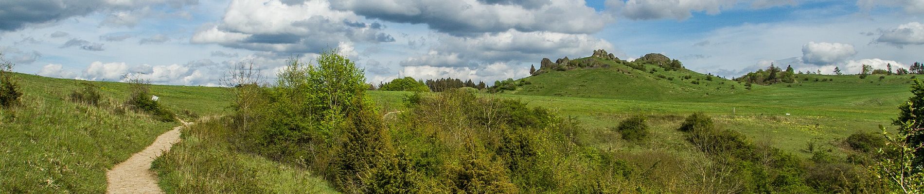
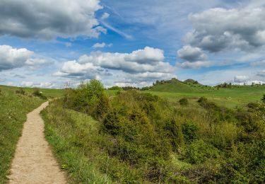
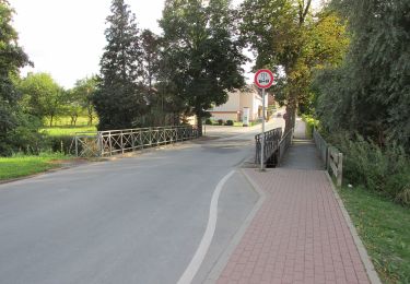
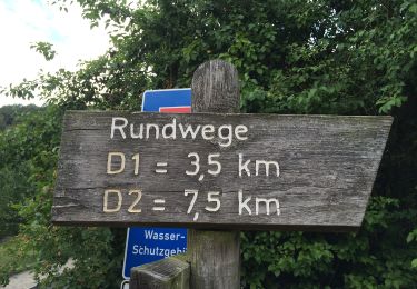
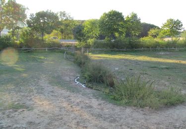
Randonnée A pied de 17,3 km à découvrir à Hesse, Landkreis Kassel, Calden. Cette randonnée est proposée par SityTrail - itinéraires balisés pédestres.
Description
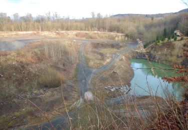
Entlang des 85 km langen Habichtswaldsteigs und seinen einzelnen Etappen entdecken Sie märchenhafte Landschaften und einzigartige Natur.
Localisation
Pays :
Allemagne
Région :
Hesse
Département/Province :
Landkreis Kassel
Commune :
Calden
Localité :
Fürstenwald
Départ:(Dec)
Départ:(UTM)
523100 ; 5691442 (32U) N.
Commentaires
Randonnées à proximité
![Randonnée A pied Zierenberg - Alpenpfad - Photo](https://media.geolcdn.com/t/375/260/1e53a8f8-7fbe-40ff-9af0-8d85ddce8fd1.jpeg&format=jpg&maxdim=2)
![A pied A pied](https://static1.geolcdn.com/sitytour/trail-icons/100.png)
Alpenpfad
A pied
Facile
Zierenberg,
Hesse,
Landkreis Kassel,
Allemagne
![](/images/other/stat-length.png)
5 km | 6 km-effort
1h 21min
![](https://static1.geolcdn.com/siteimages/upload/files/16400158638029165_repeat_loop_refresh_sync_direction_icon.png)
Oui
![Randonnée A pied Ahnatal - Eco-Pfad Ahne - Photo](https://media.geolcdn.com/t/375/260/623a6635-ea17-4c96-97a1-9aad5077f554.jpeg&format=jpg&maxdim=2)
![A pied A pied](https://static1.geolcdn.com/sitytour/trail-icons/100.png)
Eco-Pfad Ahne
A pied
Facile
Ahnatal,
Hesse,
Landkreis Kassel,
Allemagne
![](/images/other/stat-length.png)
7,6 km | 8,2 km-effort
1h 51min
![](https://static1.geolcdn.com/siteimages/upload/files/16400158638029165_repeat_loop_refresh_sync_direction_icon.png)
Non
![Randonnée A pied Calden - Kulturwege Calden: Eselspfad Meimbressen - Zierenberg G2 - Photo](https://media.geolcdn.com/t/375/260/d88ba308-0059-4287-a4c8-279c10afdc2f.jpeg&format=jpg&maxdim=2)
![A pied A pied](https://static1.geolcdn.com/sitytour/trail-icons/100.png)
Kulturwege Calden: Eselspfad Meimbressen - Zierenberg G2
A pied
Facile
Calden,
Hesse,
Landkreis Kassel,
Allemagne
![](/images/other/stat-length.png)
4,4 km | 5,9 km-effort
1h 20min
![](https://static1.geolcdn.com/siteimages/upload/files/16400158638029165_repeat_loop_refresh_sync_direction_icon.png)
Non
![Randonnée A pied Zierenberg - Zierenberg, Z1 - Photo](https://media.geolcdn.com/t/375/260/6d3d2497-cbf3-465a-8d76-bed199a62d09.jpeg&format=jpg&maxdim=2)
![A pied A pied](https://static1.geolcdn.com/sitytour/trail-icons/100.png)
Zierenberg, Z1
A pied
Facile
Zierenberg,
Hesse,
Landkreis Kassel,
Allemagne
![](/images/other/stat-length.png)
7,8 km | 9,7 km-effort
2h 12min
![](https://static1.geolcdn.com/siteimages/upload/files/16400158638029165_repeat_loop_refresh_sync_direction_icon.png)
Oui
![Randonnée A pied Habichtswald - Dörnberg D2 - Photo](https://media.geolcdn.com/t/375/260/c373377c-1b06-4573-a933-34e2b77b3b05.jpeg&format=jpg&maxdim=2)
![A pied A pied](https://static1.geolcdn.com/sitytour/trail-icons/100.png)
Dörnberg D2
A pied
Facile
Habichtswald,
Hesse,
Landkreis Kassel,
Allemagne
![](/images/other/stat-length.png)
6,9 km | 9,3 km-effort
2h 7min
![](https://static1.geolcdn.com/siteimages/upload/files/16400158638029165_repeat_loop_refresh_sync_direction_icon.png)
Oui
![Randonnée A pied Habichtswald - Ehlen, E2 - Photo](https://media.geolcdn.com/t/375/260/6252982e-271f-4373-b90c-262e4ec23f76.jpeg&format=jpg&maxdim=2)
![A pied A pied](https://static1.geolcdn.com/sitytour/trail-icons/100.png)
Ehlen, E2
A pied
Facile
Habichtswald,
Hesse,
Landkreis Kassel,
Allemagne
![](/images/other/stat-length.png)
4,6 km | 5,8 km-effort
1h 18min
![](https://static1.geolcdn.com/siteimages/upload/files/16400158638029165_repeat_loop_refresh_sync_direction_icon.png)
Oui
![Randonnée A pied Habichtswald - Eco-Pfad Habichtswald - Photo](https://media.geolcdn.com/t/375/260/8ebd1e52-5f96-4823-a519-be94a4d8e575.jpeg&format=jpg&maxdim=2)
![A pied A pied](https://static1.geolcdn.com/sitytour/trail-icons/100.png)
Eco-Pfad Habichtswald
A pied
Moyen
Habichtswald,
Hesse,
Landkreis Kassel,
Allemagne
![](/images/other/stat-length.png)
15,8 km | 21 km-effort
4h 39min
![](https://static1.geolcdn.com/siteimages/upload/files/16400158638029165_repeat_loop_refresh_sync_direction_icon.png)
Oui
![Randonnée A pied Habichtswald - Dörnberg D1 - Photo](https://media.geolcdn.com/t/375/260/c373377c-1b06-4573-a933-34e2b77b3b05.jpeg&format=jpg&maxdim=2)
![A pied A pied](https://static1.geolcdn.com/sitytour/trail-icons/100.png)
Dörnberg D1
A pied
Facile
Habichtswald,
Hesse,
Landkreis Kassel,
Allemagne
![](/images/other/stat-length.png)
3,4 km | 4,9 km-effort
1h 6min
![](https://static1.geolcdn.com/siteimages/upload/files/16400158638029165_repeat_loop_refresh_sync_direction_icon.png)
Oui
![Randonnée A pied Habichtswald - Dörnberg D4 - Photo](https://media.geolcdn.com/t/375/260/c373377c-1b06-4573-a933-34e2b77b3b05.jpeg&format=jpg&maxdim=2)
![A pied A pied](https://static1.geolcdn.com/sitytour/trail-icons/100.png)
Dörnberg D4
A pied
Facile
Habichtswald,
Hesse,
Landkreis Kassel,
Allemagne
![](/images/other/stat-length.png)
9,3 km | 13,1 km-effort
2h 58min
![](https://static1.geolcdn.com/siteimages/upload/files/16400158638029165_repeat_loop_refresh_sync_direction_icon.png)
Oui