


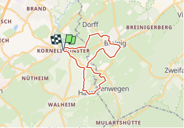

15,5 km | 19,8 km-effort
![Randonnée A pied Aix-la-Chapelle - [1] Kornelimünster - Breinig - Hahn - Photo](https://media.geolcdn.com/t/1900/400/a06b960d-38ba-42d5-bfd5-7c754ca4689b.jpeg&format=pjpeg&maxdim=2)

Tous les sentiers balisés d’Europe GUIDE+


Application GPS de randonnée GRATUITE
 SityTrail
IGN / Instituts géographiques
SityTrail World
Le monde est à vous
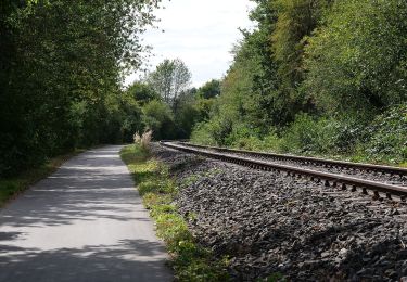
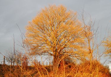
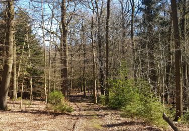
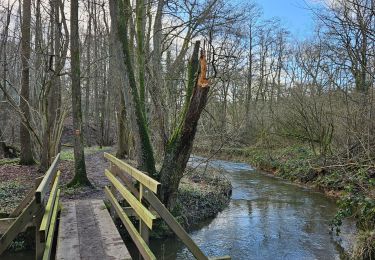
Randonnée A pied de 12 km à découvrir à Rhénanie-du-Nord-Westphalie, Région urbaine d'Aix-la-Chapelle, Aix-la-Chapelle. Cette randonnée est proposée par SityTrail - itinéraires balisés pédestres.
![Randonnée A pied Aix-la-Chapelle - [1] Kornelimünster - Breinig - Hahn - Photo 1](https://media.geolcdn.com/t/2048/auto/90747bc5-df86-44bf-9277-6afda4edd6d6.jpeg&format=jpg&maxdim=0 "Randonnée A pied Aix-la-Chapelle - [1] Kornelimünster - Breinig - Hahn - Photo 1")
![Randonnée A pied Aix-la-Chapelle - [1] Kornelimünster - Breinig - Hahn - Photo 2](https://media.geolcdn.com/t/2048/auto/571ec007-f6a9-4194-9fa8-fd6374b8ad98.jpeg&format=jpg&maxdim=0 "Randonnée A pied Aix-la-Chapelle - [1] Kornelimünster - Breinig - Hahn - Photo 2")
![Randonnée A pied Aix-la-Chapelle - [1] Kornelimünster - Breinig - Hahn - Photo 3](https://media.geolcdn.com/t/2048/auto/5f26a450-52b6-478f-81cb-524b1dae8599.jpeg&format=jpg&maxdim=0 "Randonnée A pied Aix-la-Chapelle - [1] Kornelimünster - Breinig - Hahn - Photo 3")
![Randonnée A pied Aix-la-Chapelle - [1] Kornelimünster - Breinig - Hahn - Photo 4](https://media.geolcdn.com/t/2048/auto/4516bbd2-7ee5-453d-9477-6bd6f2ac83e8.jpeg&format=jpg&maxdim=0 "Randonnée A pied Aix-la-Chapelle - [1] Kornelimünster - Breinig - Hahn - Photo 4")
![Randonnée A pied Aix-la-Chapelle - [1] Kornelimünster - Breinig - Hahn - Photo 5](https://media.geolcdn.com/t/2048/auto/ff7cf63a-a5f3-4f8c-929e-62790455e41d.jpeg&format=jpg&maxdim=0 "Randonnée A pied Aix-la-Chapelle - [1] Kornelimünster - Breinig - Hahn - Photo 5")
![Randonnée A pied Aix-la-Chapelle - [1] Kornelimünster - Breinig - Hahn - Photo 6](https://media.geolcdn.com/t/2048/auto/43606d99-90dd-4f08-8845-7f3b66ad3723.jpeg&format=jpg&maxdim=0 "Randonnée A pied Aix-la-Chapelle - [1] Kornelimünster - Breinig - Hahn - Photo 6")
![Randonnée A pied Aix-la-Chapelle - [1] Kornelimünster - Breinig - Hahn - Photo 7](https://media.geolcdn.com/t/2048/auto/a0c444b7-8a43-439e-aa87-dcf3864a2e9b.jpeg&format=jpg&maxdim=0 "Randonnée A pied Aix-la-Chapelle - [1] Kornelimünster - Breinig - Hahn - Photo 7")
![Randonnée A pied Aix-la-Chapelle - [1] Kornelimünster - Breinig - Hahn - Photo 8](https://media.geolcdn.com/t/2048/auto/04372005-29fe-453b-8960-704e8db8521c.jpeg&format=jpg&maxdim=0 "Randonnée A pied Aix-la-Chapelle - [1] Kornelimünster - Breinig - Hahn - Photo 8")
![Randonnée A pied Aix-la-Chapelle - [1] Kornelimünster - Breinig - Hahn - Photo 9](https://media.geolcdn.com/t/2048/auto/a06b960d-38ba-42d5-bfd5-7c754ca4689b.jpeg&format=jpg&maxdim=0 "Randonnée A pied Aix-la-Chapelle - [1] Kornelimünster - Breinig - Hahn - Photo 9")
![Randonnée A pied Aix-la-Chapelle - [1] Kornelimünster - Breinig - Hahn - Photo 10](https://media.geolcdn.com/t/2048/auto/f6e7a1c8-a205-48c6-b1a1-73057e4a2636.jpeg&format=jpg&maxdim=0 "Randonnée A pied Aix-la-Chapelle - [1] Kornelimünster - Breinig - Hahn - Photo 10")
Marche

Marche
A pied
A pied
A pied
A pied
Marche
Marche
A pied
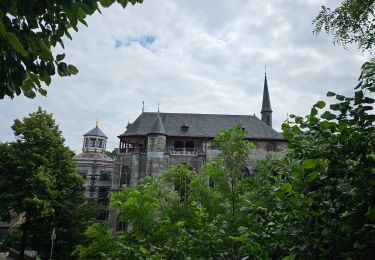
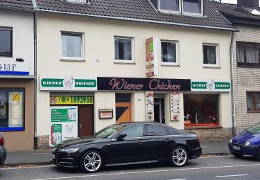
Kornelimünster vaut le détour de la decouverte ... Un peu trop d'asphalte à Breinig. Faite avec Luna 🐕 Une belle pause au Café Cornelius