

Rundwanderweg Nr. 4 "Reschbachtal"
SityTrail - itinéraires balisés pédestres
Tous les sentiers balisés d’Europe GUIDE+

Longueur
4,5 km

Altitude max
721 m

Dénivelé positif
189 m

Km-Effort
6,6 km

Altitude min
577 m

Dénivelé négatif
77 m
Boucle
Non
Balise
Date de création :
2022-02-11 14:07:54.587
Dernière modification :
2022-02-11 14:07:54.587
1h29
Difficulté : Facile

Application GPS de randonnée GRATUITE
À propos
Randonnée A pied de 4,5 km à découvrir à Bavière, Landkreis Freyung-Grafenau, Hohenau. Cette randonnée est proposée par SityTrail - itinéraires balisés pédestres.
Description
Randonnée créée par Bayerischer Waldverein.
Symbole: weiße 4 auf rotem Kreis
Photos
"
data-pinterest-text="Pin it"
data-tweet-text="share on twitter"
data-facebook-share-url="https://www.sitytrail.com/fr/trails/3092024-hohenau--rundwanderweg-nrx-4-xreschbachtalx/?photo=0#lg=1&slide=0"
data-twitter-share-url="https://www.sitytrail.com/fr/trails/3092024-hohenau--rundwanderweg-nrx-4-xreschbachtalx/?photo=0#lg=1&slide=0"
data-googleplus-share-url="https://www.sitytrail.com/fr/trails/3092024-hohenau--rundwanderweg-nrx-4-xreschbachtalx/?photo=0#lg=1&slide=0"
data-pinterest-share-url="https://www.sitytrail.com/fr/trails/3092024-hohenau--rundwanderweg-nrx-4-xreschbachtalx/?photo=0#lg=1&slide=0">
 "
data-pinterest-text="Pin it"
data-tweet-text="share on twitter"
data-facebook-share-url="https://www.sitytrail.com/fr/trails/3092024-hohenau--rundwanderweg-nrx-4-xreschbachtalx/?photo=1#lg=1&slide=1"
data-twitter-share-url="https://www.sitytrail.com/fr/trails/3092024-hohenau--rundwanderweg-nrx-4-xreschbachtalx/?photo=1#lg=1&slide=1"
data-googleplus-share-url="https://www.sitytrail.com/fr/trails/3092024-hohenau--rundwanderweg-nrx-4-xreschbachtalx/?photo=1#lg=1&slide=1"
data-pinterest-share-url="https://www.sitytrail.com/fr/trails/3092024-hohenau--rundwanderweg-nrx-4-xreschbachtalx/?photo=1#lg=1&slide=1">
 "
data-pinterest-text="Pin it"
data-tweet-text="share on twitter"
data-facebook-share-url="https://www.sitytrail.com/fr/trails/3092024-hohenau--rundwanderweg-nrx-4-xreschbachtalx/?photo=2#lg=1&slide=2"
data-twitter-share-url="https://www.sitytrail.com/fr/trails/3092024-hohenau--rundwanderweg-nrx-4-xreschbachtalx/?photo=2#lg=1&slide=2"
data-googleplus-share-url="https://www.sitytrail.com/fr/trails/3092024-hohenau--rundwanderweg-nrx-4-xreschbachtalx/?photo=2#lg=1&slide=2"
data-pinterest-share-url="https://www.sitytrail.com/fr/trails/3092024-hohenau--rundwanderweg-nrx-4-xreschbachtalx/?photo=2#lg=1&slide=2">
 "
data-pinterest-text="Pin it"
data-tweet-text="share on twitter"
data-facebook-share-url="https://www.sitytrail.com/fr/trails/3092024-hohenau--rundwanderweg-nrx-4-xreschbachtalx/?photo=3#lg=1&slide=3"
data-twitter-share-url="https://www.sitytrail.com/fr/trails/3092024-hohenau--rundwanderweg-nrx-4-xreschbachtalx/?photo=3#lg=1&slide=3"
data-googleplus-share-url="https://www.sitytrail.com/fr/trails/3092024-hohenau--rundwanderweg-nrx-4-xreschbachtalx/?photo=3#lg=1&slide=3"
data-pinterest-share-url="https://www.sitytrail.com/fr/trails/3092024-hohenau--rundwanderweg-nrx-4-xreschbachtalx/?photo=3#lg=1&slide=3">
 "
data-pinterest-text="Pin it"
data-tweet-text="share on twitter"
data-facebook-share-url="https://www.sitytrail.com/fr/trails/3092024-hohenau--rundwanderweg-nrx-4-xreschbachtalx/?photo=1#lg=1&slide=1"
data-twitter-share-url="https://www.sitytrail.com/fr/trails/3092024-hohenau--rundwanderweg-nrx-4-xreschbachtalx/?photo=1#lg=1&slide=1"
data-googleplus-share-url="https://www.sitytrail.com/fr/trails/3092024-hohenau--rundwanderweg-nrx-4-xreschbachtalx/?photo=1#lg=1&slide=1"
data-pinterest-share-url="https://www.sitytrail.com/fr/trails/3092024-hohenau--rundwanderweg-nrx-4-xreschbachtalx/?photo=1#lg=1&slide=1">
 "
data-pinterest-text="Pin it"
data-tweet-text="share on twitter"
data-facebook-share-url="https://www.sitytrail.com/fr/trails/3092024-hohenau--rundwanderweg-nrx-4-xreschbachtalx/?photo=2#lg=1&slide=2"
data-twitter-share-url="https://www.sitytrail.com/fr/trails/3092024-hohenau--rundwanderweg-nrx-4-xreschbachtalx/?photo=2#lg=1&slide=2"
data-googleplus-share-url="https://www.sitytrail.com/fr/trails/3092024-hohenau--rundwanderweg-nrx-4-xreschbachtalx/?photo=2#lg=1&slide=2"
data-pinterest-share-url="https://www.sitytrail.com/fr/trails/3092024-hohenau--rundwanderweg-nrx-4-xreschbachtalx/?photo=2#lg=1&slide=2">
 "
data-pinterest-text="Pin it"
data-tweet-text="share on twitter"
data-facebook-share-url="https://www.sitytrail.com/fr/trails/3092024-hohenau--rundwanderweg-nrx-4-xreschbachtalx/?photo=3#lg=1&slide=3"
data-twitter-share-url="https://www.sitytrail.com/fr/trails/3092024-hohenau--rundwanderweg-nrx-4-xreschbachtalx/?photo=3#lg=1&slide=3"
data-googleplus-share-url="https://www.sitytrail.com/fr/trails/3092024-hohenau--rundwanderweg-nrx-4-xreschbachtalx/?photo=3#lg=1&slide=3"
data-pinterest-share-url="https://www.sitytrail.com/fr/trails/3092024-hohenau--rundwanderweg-nrx-4-xreschbachtalx/?photo=3#lg=1&slide=3">

Localisation
Pays :
Allemagne
Région :
Bavière
Département/Province :
Landkreis Freyung-Grafenau
Commune :
Hohenau
Localité :
Unknown
Départ:(Dec)
Départ:(UTM)
391231 ; 5408518 (33U) N.
Commentaires
Randonnées à proximité
Silberdistel


A pied
Moyen
Freyung,
Bavière,
Landkreis Freyung-Grafenau,
Allemagne

21 km | 30 km-effort
6h 46min
Non
Rundwanderweg Geyersberg - Mertersberg - Baderstein


A pied
Facile
Freyung,
Bavière,
Landkreis Freyung-Grafenau,
Allemagne

4,8 km | 6,7 km-effort
1h 31min
Oui
Rundwanderweg Nr. 11 "Ochsenberg - Leitenholz"


A pied
Facile
Freyung,
Bavière,
Landkreis Freyung-Grafenau,
Allemagne

12,4 km | 16,6 km-effort
3h 46min
Oui

Rundwnderwef Nr. 9 Freyunger Dörfertour - Ost


A pied
Facile
Freyung,
Bavière,
Landkreis Freyung-Grafenau,
Allemagne

11,1 km | 14,7 km-effort
3h 20min
Oui

Rundwanderweg Nr. 8 "Perlesöd - Leitenholz (kutz)"


A pied
Facile
Freyung,
Bavière,
Landkreis Freyung-Grafenau,
Allemagne

3,6 km | 4,6 km-effort
1h 2min
Non

Rundwanderweg Nr. 7 "Ochsenberg - Am heißen Stein"


A pied
Facile
Freyung,
Bavière,
Landkreis Freyung-Grafenau,
Allemagne

3,2 km | 4,2 km-effort
56min
Non
Rundwanderweg Nr. 6 "Geyersberg-Runde"


A pied
Facile
Freyung,
Bavière,
Landkreis Freyung-Grafenau,
Allemagne

8,8 km | 12,8 km-effort
2h 54min
Oui
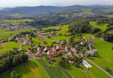
Verlängerungsmöglichkeit "Buchberger Leite"


A pied
Facile
Ringelai,
Bavière,
Landkreis Freyung-Grafenau,
Allemagne

5,5 km | 7,9 km-effort
1h 48min
Non
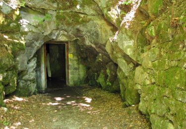
Rundwanderweg Nr. 3 "Buchberger Leite"


A pied
Facile
Freyung,
Bavière,
Landkreis Freyung-Grafenau,
Allemagne

4,6 km | 5,5 km-effort
1h 15min
Non


 SityTrail


