


15,5 km | 19,8 km-effort
![Randonnée A pied Aix-la-Chapelle - [5] Itertalweg: Kornelimünster - Sief - Photo](https://media.geolcdn.com/t/1900/400/a06b960d-38ba-42d5-bfd5-7c754ca4689b.jpeg&format=pjpeg&maxdim=2)

Tous les sentiers balisés d’Europe GUIDE+


Application GPS de randonnée GRATUITE
 SityTrail
IGN / Instituts géographiques
SityTrail World
Le monde est à vous
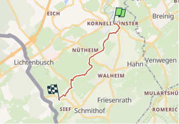
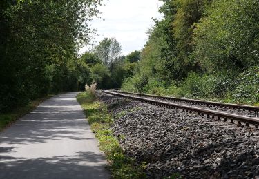
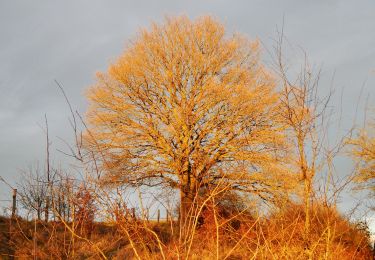
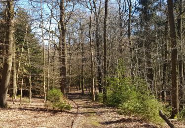
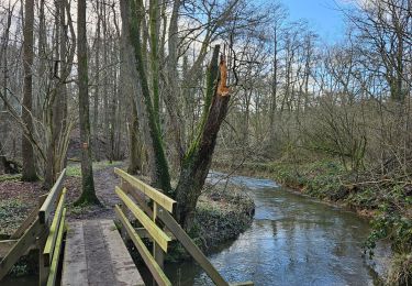
Randonnée A pied de 6,2 km à découvrir à Rhénanie-du-Nord-Westphalie, Région urbaine d'Aix-la-Chapelle, Aix-la-Chapelle. Cette randonnée est proposée par SityTrail - itinéraires balisés pédestres.
![Randonnée A pied Aix-la-Chapelle - [5] Itertalweg: Kornelimünster - Sief - Photo 1](https://media.geolcdn.com/t/2048/auto/0696819b-10e5-4a80-a6d5-c788d9c3eaff.jpeg&format=jpg&maxdim=0 "Randonnée A pied Aix-la-Chapelle - [5] Itertalweg: Kornelimünster - Sief - Photo 1")
![Randonnée A pied Aix-la-Chapelle - [5] Itertalweg: Kornelimünster - Sief - Photo 2](https://media.geolcdn.com/t/2048/auto/c87cc611-7e1e-428e-8e92-fa0e9e2711c6.jpeg&format=jpg&maxdim=0 "Randonnée A pied Aix-la-Chapelle - [5] Itertalweg: Kornelimünster - Sief - Photo 2")
![Randonnée A pied Aix-la-Chapelle - [5] Itertalweg: Kornelimünster - Sief - Photo 3](https://media.geolcdn.com/t/2048/auto/4f6fe56a-abd0-454e-a764-61f42a0a99ca.jpeg&format=jpg&maxdim=0 "Randonnée A pied Aix-la-Chapelle - [5] Itertalweg: Kornelimünster - Sief - Photo 3")
![Randonnée A pied Aix-la-Chapelle - [5] Itertalweg: Kornelimünster - Sief - Photo 4](https://media.geolcdn.com/t/2048/auto/00c12234-87db-49d6-a3b3-b3ae1021a154.jpeg&format=jpg&maxdim=0 "Randonnée A pied Aix-la-Chapelle - [5] Itertalweg: Kornelimünster - Sief - Photo 4")
![Randonnée A pied Aix-la-Chapelle - [5] Itertalweg: Kornelimünster - Sief - Photo 5](https://media.geolcdn.com/t/2048/auto/b028d00a-50f2-4022-bdaf-d5e13e6d5541.jpeg&format=jpg&maxdim=0 "Randonnée A pied Aix-la-Chapelle - [5] Itertalweg: Kornelimünster - Sief - Photo 5")
![Randonnée A pied Aix-la-Chapelle - [5] Itertalweg: Kornelimünster - Sief - Photo 6](https://media.geolcdn.com/t/2048/auto/cdc0f95d-21b9-45f8-9060-e6b19a81b2a4.jpeg&format=jpg&maxdim=0 "Randonnée A pied Aix-la-Chapelle - [5] Itertalweg: Kornelimünster - Sief - Photo 6")
![Randonnée A pied Aix-la-Chapelle - [5] Itertalweg: Kornelimünster - Sief - Photo 7](https://media.geolcdn.com/t/2048/auto/e0d859e8-f760-4aa5-89bf-e6d8517a8177.jpeg&format=jpg&maxdim=0 "Randonnée A pied Aix-la-Chapelle - [5] Itertalweg: Kornelimünster - Sief - Photo 7")
![Randonnée A pied Aix-la-Chapelle - [5] Itertalweg: Kornelimünster - Sief - Photo 8](https://media.geolcdn.com/t/2048/auto/c6dc3e34-6d30-43c0-aa0c-0d1538b7b4fb.jpeg&format=jpg&maxdim=0 "Randonnée A pied Aix-la-Chapelle - [5] Itertalweg: Kornelimünster - Sief - Photo 8")
![Randonnée A pied Aix-la-Chapelle - [5] Itertalweg: Kornelimünster - Sief - Photo 9](https://media.geolcdn.com/t/2048/auto/a06b960d-38ba-42d5-bfd5-7c754ca4689b.jpeg&format=jpg&maxdim=0 "Randonnée A pied Aix-la-Chapelle - [5] Itertalweg: Kornelimünster - Sief - Photo 9")
![Randonnée A pied Aix-la-Chapelle - [5] Itertalweg: Kornelimünster - Sief - Photo 10](https://media.geolcdn.com/t/2048/auto/a186b906-0813-4d8f-a05b-ea5611e4bbf9.jpeg&format=jpg&maxdim=0 "Randonnée A pied Aix-la-Chapelle - [5] Itertalweg: Kornelimünster - Sief - Photo 10")
Marche

Marche
A pied
A pied
A pied
A pied
Marche
Marche
A pied