![](/images/other/stat-length.png)
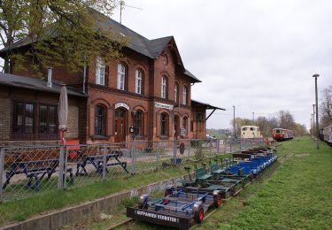
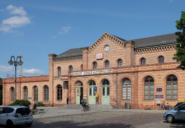
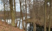
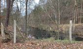
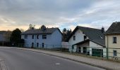
![Randonnée A pied Grünheide (Mark) - Möllensee-Umwanderung - Photo](https://media.geolcdn.com/t/1900/400/0deb2cee-5da0-4fcd-a047-112808807f36.jpeg&format=pjpeg&maxdim=2)
Möllensee-Umwanderung
SityTrail - itinéraires balisés pédestres
Tous les sentiers balisés d’Europe GUIDE+
![Longueur](/images/other/stat-length.png)
Longueur
8,3 km
![Altitude max](https://static1.geolcdn.com/siteimages/upload/files/1508320355ic_sort_altitude_max_24dp.png)
Altitude max
52 m
![Dénivelé positif](https://static1.geolcdn.com/siteimages/upload/files/1508320355ic_sort_den_pos_24dp.png)
Dénivelé positif
71 m
![Km-Effort](/images/other/stat-length.png)
Km-Effort
9,3 km
![Altitude min](https://static1.geolcdn.com/siteimages/upload/files/1508320355ic_sort_altitude_min_24dp.png)
Altitude min
33 m
![Dénivelé négatif](https://static1.geolcdn.com/siteimages/upload/files/1508320355ic_sort_den_neg_24dp.png)
Dénivelé négatif
70 m
![Boucle](https://static1.geolcdn.com/siteimages/upload/files/16400158638029165_repeat_loop_refresh_sync_direction_icon.png)
Boucle
Oui
Balise
Date de création :
2022-02-11 13:54:54.657
Dernière modification :
2022-02-11 13:54:54.657
![A pied](https://static1.geolcdn.com/sitytour/trail-icons/100.png)
2h06
Difficulté : Facile
![Scannez ce code QR pour ouvrir la randonnée dans l'application SityTrail](https://capi.geolives.com/qq0zvz2zws4bq2lad0pu/sitytour/trails/3091505/qr.png?size=200)
Application GPS de randonnée GRATUITE
À propos
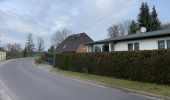
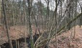
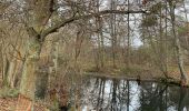
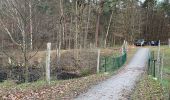
Randonnée A pied de 8,3 km à découvrir à Brandebourg, Oder-Spree, Grünheide (Mark). Cette randonnée est proposée par SityTrail - itinéraires balisés pédestres.
Description
Randonnée créée par Gemeinde Grünheide.
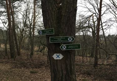
Symbole: Gelber Punkt auf weißen Grund
Localisation
Pays :
Allemagne
Région :
Brandebourg
Département/Province :
Oder-Spree
Commune :
Grünheide (Mark)
Localité :
Grünheide
Départ:(Dec)
Départ:(UTM)
421255 ; 5809600 (33U) N.
Commentaires
Randonnées à proximité
![Randonnée A pied Hoppegarten - Naturlehrpfad - Photo](https://media.geolcdn.com/t/375/260/7a4b1236-d147-4465-87b6-6cdf3e8daa55.jpeg&format=jpg&maxdim=2)
![A pied A pied](https://static1.geolcdn.com/sitytour/trail-icons/100.png)
Naturlehrpfad
A pied
Facile
Hoppegarten,
Brandebourg,
Märkisch-Oderland,
Allemagne
![](/images/other/stat-length.png)
3,7 km | 4 km-effort
54min
![](https://static1.geolcdn.com/siteimages/upload/files/16400158638029165_repeat_loop_refresh_sync_direction_icon.png)
Oui
![Randonnée A pied Mittenwalde - Historischer Landweg Rangsdorf-Königs Wusterhausen - Photo](https://media.geolcdn.com/t/375/260/16c944a7-a918-4bec-9b1b-a46eff50e168.jpeg&format=jpg&maxdim=2)
![A pied A pied](https://static1.geolcdn.com/sitytour/trail-icons/100.png)
Historischer Landweg Rangsdorf-Königs Wusterhausen
A pied
Facile
Mittenwalde,
Brandebourg,
Dahme-Spreewald,
Allemagne
![](/images/other/stat-length.png)
6,2 km | 6,6 km-effort
1h 30min
![](https://static1.geolcdn.com/siteimages/upload/files/16400158638029165_repeat_loop_refresh_sync_direction_icon.png)
Non
![Randonnée A pied Mittenwalde - Wanderweg Sutschketal - Ostseite Krummer See - Photo](https://media.geolcdn.com/t/375/260/20cd188a-f82c-4f4b-94ac-7e5ea1d56520.jpeg&format=jpg&maxdim=2)
![A pied A pied](https://static1.geolcdn.com/sitytour/trail-icons/100.png)
Wanderweg Sutschketal - Ostseite Krummer See
A pied
Facile
Mittenwalde,
Brandebourg,
Dahme-Spreewald,
Allemagne
![](/images/other/stat-length.png)
4,2 km | 4,7 km-effort
1h 3min
![](https://static1.geolcdn.com/siteimages/upload/files/16400158638029165_repeat_loop_refresh_sync_direction_icon.png)
Non
![Randonnée A pied Königs Wusterhausen - Rundweg Krüpelsee - Photo](https://media.geolcdn.com/t/375/260/82b98212-a630-48c6-9b12-eca33a5adcae.jpeg&format=jpg&maxdim=2)
![A pied A pied](https://static1.geolcdn.com/sitytour/trail-icons/100.png)
Rundweg Krüpelsee
A pied
Moyen
Königs Wusterhausen,
Brandebourg,
Dahme-Spreewald,
Allemagne
![](/images/other/stat-length.png)
21 km | 23 km-effort
5h 17min
![](https://static1.geolcdn.com/siteimages/upload/files/16400158638029165_repeat_loop_refresh_sync_direction_icon.png)
Oui
![Randonnée A pied Königs Wusterhausen - Stadtwanderung Königs Wusterhausen - Photo](https://media.geolcdn.com/t/375/260/7e5bd640-f9bc-4aaf-8e62-8b17826105b1.jpeg&format=jpg&maxdim=2)
![A pied A pied](https://static1.geolcdn.com/sitytour/trail-icons/100.png)
Stadtwanderung Königs Wusterhausen
A pied
Facile
Königs Wusterhausen,
Brandebourg,
Dahme-Spreewald,
Allemagne
![](/images/other/stat-length.png)
5,4 km | 5,8 km-effort
1h 18min
![](https://static1.geolcdn.com/siteimages/upload/files/16400158638029165_repeat_loop_refresh_sync_direction_icon.png)
Non
![Randonnée A pied Königs Wusterhausen - Rundweg Niederlehmer Luch - Photo](https://media.geolcdn.com/t/375/260/253a0648-2dfd-479e-af2e-c25f8638896d.jpeg&format=jpg&maxdim=2)
![A pied A pied](https://static1.geolcdn.com/sitytour/trail-icons/100.png)
Rundweg Niederlehmer Luch
A pied
Facile
Königs Wusterhausen,
Brandebourg,
Dahme-Spreewald,
Allemagne
![](/images/other/stat-length.png)
5,6 km | 6,1 km-effort
1h 22min
![](https://static1.geolcdn.com/siteimages/upload/files/16400158638029165_repeat_loop_refresh_sync_direction_icon.png)
Non
![Randonnée A pied Königs Wusterhausen - Rundweg Funkerberg - Photo](https://media.geolcdn.com/t/375/260/253a0648-2dfd-479e-af2e-c25f8638896d.jpeg&format=jpg&maxdim=2)
![A pied A pied](https://static1.geolcdn.com/sitytour/trail-icons/100.png)
Rundweg Funkerberg
A pied
Facile
Königs Wusterhausen,
Brandebourg,
Dahme-Spreewald,
Allemagne
![](/images/other/stat-length.png)
6,9 km | 7,6 km-effort
1h 44min
![](https://static1.geolcdn.com/siteimages/upload/files/16400158638029165_repeat_loop_refresh_sync_direction_icon.png)
Non
![Randonnée A pied Königs Wusterhausen - Wanderlehrpfad um den Wernsdorfer See - Photo](https://media.geolcdn.com/t/375/260/9fa08f14-7900-4afe-b537-f3f67034c0e4.jpeg&format=jpg&maxdim=2)
![A pied A pied](https://static1.geolcdn.com/sitytour/trail-icons/100.png)
Wanderlehrpfad um den Wernsdorfer See
A pied
Facile
Königs Wusterhausen,
Brandebourg,
Dahme-Spreewald,
Allemagne
![](/images/other/stat-length.png)
5,9 km | 6,5 km-effort
1h 29min
![](https://static1.geolcdn.com/siteimages/upload/files/16400158638029165_repeat_loop_refresh_sync_direction_icon.png)
Oui
![Randonnée A pied Königs Wusterhausen - 1. Permanenter Wanderweg Königs Wusterhausen - Photo](https://media.geolcdn.com/t/375/260/c4096d9c-f3cf-4649-93ba-49bdeca17367.jpeg&format=jpg&maxdim=2)
![A pied A pied](https://static1.geolcdn.com/sitytour/trail-icons/100.png)
1. Permanenter Wanderweg Königs Wusterhausen
A pied
Moyen
Königs Wusterhausen,
Brandebourg,
Dahme-Spreewald,
Allemagne
![](/images/other/stat-length.png)
21 km | 23 km-effort
5h 16min
![](https://static1.geolcdn.com/siteimages/upload/files/16400158638029165_repeat_loop_refresh_sync_direction_icon.png)
Non