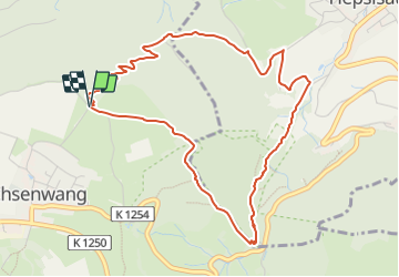
![](/images/other/stat-length.png)
![Randonnée A pied Gomadingen - Weilheim Rundweg 68 - Photo](https://media.geolcdn.com/t/1900/400/6e6022e0-faf3-4782-aa08-f4c31842c6d2.jpeg&format=pjpeg&maxdim=2)
Weilheim Rundweg 68
SityTrail - itinéraires balisés pédestres
Tous les sentiers balisés d’Europe GUIDE+
![Longueur](/images/other/stat-length.png)
![Altitude max](https://static1.geolcdn.com/siteimages/upload/files/1508320355ic_sort_altitude_max_24dp.png)
![Dénivelé positif](https://static1.geolcdn.com/siteimages/upload/files/1508320355ic_sort_den_pos_24dp.png)
![Km-Effort](/images/other/stat-length.png)
![Altitude min](https://static1.geolcdn.com/siteimages/upload/files/1508320355ic_sort_altitude_min_24dp.png)
![Dénivelé négatif](https://static1.geolcdn.com/siteimages/upload/files/1508320355ic_sort_den_neg_24dp.png)
![Boucle](https://static1.geolcdn.com/siteimages/upload/files/16400158638029165_repeat_loop_refresh_sync_direction_icon.png)
![A pied](https://static1.geolcdn.com/sitytour/trail-icons/100.png)
2h02
Difficulté : Facile
![Scannez ce code QR pour ouvrir la randonnée dans l'application SityTrail](https://capi.geolives.com/qq0zvz2zws4bq2lad0pu/sitytour/trails/3091486/qr.png?size=200)
Application GPS de randonnée GRATUITE
À propos
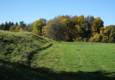
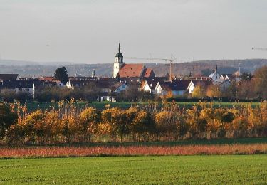
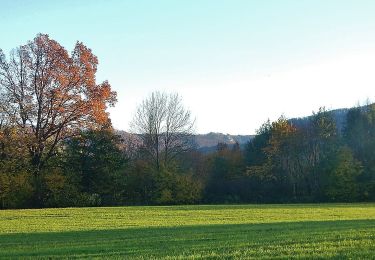
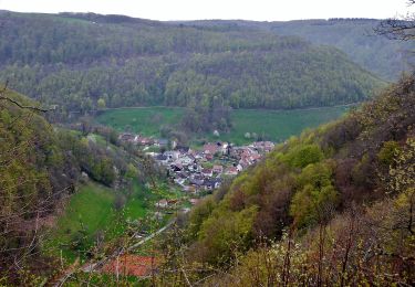
Randonnée A pied de 4,9 km à découvrir à Bade-Wurtemberg, Landkreis Reutlingen, Gomadingen. Cette randonnée est proposée par SityTrail - itinéraires balisés pédestres.
Description
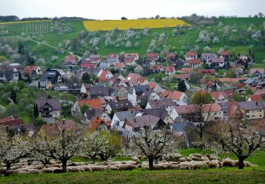
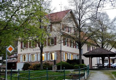
Randonnée créée par Stadt Weilheim an der Teck.
Symbole: quadratische blaue Fläche mit inneren weißen Kreis in dem wiederum die blaue Zahl 68 steht
Localisation
Commentaires
Randonnées à proximité
![Randonnée A pied Gomadingen - Hoch-Geh-Adelt Abkürzung - Photo](https://media.geolcdn.com/t/375/260/c274d950-6d6f-4ae4-94e5-c99588e76650.jpeg&format=jpg&maxdim=2)
![A pied A pied](https://static1.geolcdn.com/sitytour/trail-icons/100.png)
A pied
![](/images/other/stat-length.png)
![](https://static1.geolcdn.com/siteimages/upload/files/16400158638029165_repeat_loop_refresh_sync_direction_icon.png)
![Randonnée A pied Gomadingen - Löwenpfade: Filsursprung-Runde - Photo](https://media.geolcdn.com/t/375/260/3dd351ca-affb-4bc5-8417-719f129ec124.jpeg&format=jpg&maxdim=2)
![A pied A pied](https://static1.geolcdn.com/sitytour/trail-icons/100.png)
A pied
![](/images/other/stat-length.png)
![](https://static1.geolcdn.com/siteimages/upload/files/16400158638029165_repeat_loop_refresh_sync_direction_icon.png)
![Randonnée A pied Lenningen - Rote Gabel Sattelbogen - Erkenbrechtsweiler - Grabenstetten - Photo](https://media.geolcdn.com/t/375/260/2744b40e-5d98-4d86-8cf9-dfff79cb1b48.jpeg&format=jpg&maxdim=2)
![A pied A pied](https://static1.geolcdn.com/sitytour/trail-icons/100.png)
A pied
![](/images/other/stat-length.png)
![](https://static1.geolcdn.com/siteimages/upload/files/16400158638029165_repeat_loop_refresh_sync_direction_icon.png)
![Randonnée A pied Weilheim an der Teck - Weilheim Rundweg 42 - Photo](https://media.geolcdn.com/t/375/260/bd8e75b2-0229-41ef-8093-6e594e3c3309.jpeg&format=jpg&maxdim=2)
![A pied A pied](https://static1.geolcdn.com/sitytour/trail-icons/100.png)
A pied
![](/images/other/stat-length.png)
![](https://static1.geolcdn.com/siteimages/upload/files/16400158638029165_repeat_loop_refresh_sync_direction_icon.png)
![Randonnée A pied Gomadingen - Weilheim Rundweg 66 - Photo](https://media.geolcdn.com/t/375/260/dab04fa3-7ee0-4b94-b99b-5ea34505111c.jpeg&format=jpg&maxdim=2)
![A pied A pied](https://static1.geolcdn.com/sitytour/trail-icons/100.png)
A pied
![](/images/other/stat-length.png)
![](https://static1.geolcdn.com/siteimages/upload/files/16400158638029165_repeat_loop_refresh_sync_direction_icon.png)
![Randonnée A pied Gomadingen - Weilheim Rundweg 63 - Photo](https://media.geolcdn.com/t/375/260/cef0829f-51c6-4885-916b-f912196d9dbe.jpeg&format=jpg&maxdim=2)
![A pied A pied](https://static1.geolcdn.com/sitytour/trail-icons/100.png)
A pied
![](/images/other/stat-length.png)
![](https://static1.geolcdn.com/siteimages/upload/files/16400158638029165_repeat_loop_refresh_sync_direction_icon.png)
![Randonnée A pied Weilheim an der Teck - Weilheim Rundweg 61 - Photo](https://media.geolcdn.com/t/375/260/679afea4-736a-4a67-937c-c90f311162f8.jpeg&format=jpg&maxdim=2)
![A pied A pied](https://static1.geolcdn.com/sitytour/trail-icons/100.png)
A pied
![](/images/other/stat-length.png)
![](https://static1.geolcdn.com/siteimages/upload/files/16400158638029165_repeat_loop_refresh_sync_direction_icon.png)
![Randonnée A pied Weilheim an der Teck - Weilheim Rundweg 51 - Photo](https://media.geolcdn.com/t/375/260/0d3610c9-b7b1-40ee-bea5-9f2144e1799d.jpeg&format=jpg&maxdim=2)
![A pied A pied](https://static1.geolcdn.com/sitytour/trail-icons/100.png)
A pied
![](/images/other/stat-length.png)
![](https://static1.geolcdn.com/siteimages/upload/files/16400158638029165_repeat_loop_refresh_sync_direction_icon.png)
![Randonnée A pied Lenningen - Oberlenningen - Krebsstein - Photo](https://media.geolcdn.com/t/375/260/e6c5eb57-ed98-4693-ad72-9260e581c4ca.jpeg&format=jpg&maxdim=2)
![A pied A pied](https://static1.geolcdn.com/sitytour/trail-icons/100.png)
A pied
![](/images/other/stat-length.png)
![](https://static1.geolcdn.com/siteimages/upload/files/16400158638029165_repeat_loop_refresh_sync_direction_icon.png)