


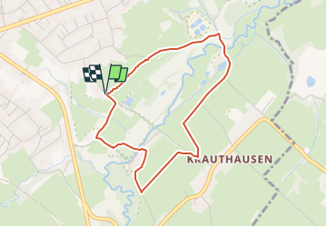

15,5 km | 19,8 km-effort
![Randonnée A pied Aix-la-Chapelle - [B5] Indetal-Rundweg - Photo](https://media.geolcdn.com/t/1900/400/6959ee59-d6d5-4d7a-9031-66fd8a4549f5.jpeg&format=pjpeg&maxdim=2)

Tous les sentiers balisés d’Europe GUIDE+


Application GPS de randonnée GRATUITE
 SityTrail
IGN / Instituts géographiques
SityTrail World
Le monde est à vous
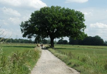
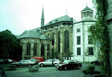
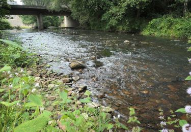
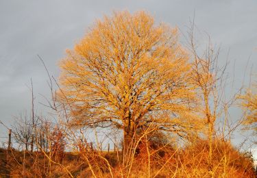
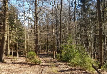
Randonnée A pied de 3,4 km à découvrir à Rhénanie-du-Nord-Westphalie, Région urbaine d'Aix-la-Chapelle, Aix-la-Chapelle. Cette randonnée est proposée par SityTrail - itinéraires balisés pédestres.
![Randonnée A pied Aix-la-Chapelle - [B5] Indetal-Rundweg - Photo 1](https://media.geolcdn.com/t/2048/auto/f3153993-a0d6-4e5c-9b63-01631b0be150.jpeg&format=jpg&maxdim=0 "Randonnée A pied Aix-la-Chapelle - [B5] Indetal-Rundweg - Photo 1")
![Randonnée A pied Aix-la-Chapelle - [B5] Indetal-Rundweg - Photo 2](https://media.geolcdn.com/t/2048/auto/6a7a852d-318d-4054-84c1-245922039b07.jpeg&format=jpg&maxdim=0 "Randonnée A pied Aix-la-Chapelle - [B5] Indetal-Rundweg - Photo 2")
![Randonnée A pied Aix-la-Chapelle - [B5] Indetal-Rundweg - Photo 3](https://media.geolcdn.com/t/2048/auto/8e879da4-4be6-47ff-a1d1-9af51a9b40db.jpeg&format=jpg&maxdim=0 "Randonnée A pied Aix-la-Chapelle - [B5] Indetal-Rundweg - Photo 3")
![Randonnée A pied Aix-la-Chapelle - [B5] Indetal-Rundweg - Photo 4](https://media.geolcdn.com/t/2048/auto/b869cf21-9e19-4c08-8676-eeab0601f8cb.jpeg&format=jpg&maxdim=0 "Randonnée A pied Aix-la-Chapelle - [B5] Indetal-Rundweg - Photo 4")
![Randonnée A pied Aix-la-Chapelle - [B5] Indetal-Rundweg - Photo 5](https://media.geolcdn.com/t/2048/auto/a0d1e290-2ed7-4d11-beb2-9047bccfa4d7.jpeg&format=jpg&maxdim=0 "Randonnée A pied Aix-la-Chapelle - [B5] Indetal-Rundweg - Photo 5")
![Randonnée A pied Aix-la-Chapelle - [B5] Indetal-Rundweg - Photo 6](https://media.geolcdn.com/t/2048/auto/86471882-c81a-48ba-bc4f-83d3addc7c32.jpeg&format=jpg&maxdim=0 "Randonnée A pied Aix-la-Chapelle - [B5] Indetal-Rundweg - Photo 6")
![Randonnée A pied Aix-la-Chapelle - [B5] Indetal-Rundweg - Photo 7](https://media.geolcdn.com/t/2048/auto/7403d14c-636d-4fe2-9285-9b5d6ebe2687.jpeg&format=jpg&maxdim=0 "Randonnée A pied Aix-la-Chapelle - [B5] Indetal-Rundweg - Photo 7")
![Randonnée A pied Aix-la-Chapelle - [B5] Indetal-Rundweg - Photo 8](https://media.geolcdn.com/t/2048/auto/c1084646-15b5-40f8-979d-234585b7d8a0.jpeg&format=jpg&maxdim=0 "Randonnée A pied Aix-la-Chapelle - [B5] Indetal-Rundweg - Photo 8")
![Randonnée A pied Aix-la-Chapelle - [B5] Indetal-Rundweg - Photo 9](https://media.geolcdn.com/t/2048/auto/5b45f3d2-bacb-401d-82e5-6a813ae291fc.jpeg&format=jpg&maxdim=0 "Randonnée A pied Aix-la-Chapelle - [B5] Indetal-Rundweg - Photo 9")
![Randonnée A pied Aix-la-Chapelle - [B5] Indetal-Rundweg - Photo 10](https://media.geolcdn.com/t/2048/auto/6959ee59-d6d5-4d7a-9031-66fd8a4549f5.jpeg&format=jpg&maxdim=0 "Randonnée A pied Aix-la-Chapelle - [B5] Indetal-Rundweg - Photo 10")
Marche

Marche
A pied
A pied
A pied
A pied
A pied
A pied
Marche