![](/images/other/stat-length.png)
![Randonnée A pied Roerdalen - Meinweg - Photo](https://media.geolcdn.com/t/1900/400/9628a06c-b0fa-49d7-a29e-92d1d1b8998a.jpeg&format=pjpeg&maxdim=2)
Meinweg
SityTrail - itinéraires balisés pédestres
Tous les sentiers balisés d’Europe GUIDE+
![Longueur](/images/other/stat-length.png)
Longueur
34 km
![Altitude max](https://static1.geolcdn.com/siteimages/upload/files/1508320355ic_sort_altitude_max_24dp.png)
Altitude max
82 m
![Dénivelé positif](https://static1.geolcdn.com/siteimages/upload/files/1508320355ic_sort_den_pos_24dp.png)
Dénivelé positif
241 m
![Km-Effort](/images/other/stat-length.png)
Km-Effort
38 km
![Altitude min](https://static1.geolcdn.com/siteimages/upload/files/1508320355ic_sort_altitude_min_24dp.png)
Altitude min
20 m
![Dénivelé négatif](https://static1.geolcdn.com/siteimages/upload/files/1508320355ic_sort_den_neg_24dp.png)
Dénivelé négatif
253 m
![Boucle](https://static1.geolcdn.com/siteimages/upload/files/16400158638029165_repeat_loop_refresh_sync_direction_icon.png)
Boucle
Non
Balise
Date de création :
2022-02-11 13:44:37.331
Dernière modification :
2022-02-11 13:44:37.331
![A pied](https://static1.geolcdn.com/sitytour/trail-icons/100.png)
8h31
Difficulté : Difficile
![Scannez ce code QR pour ouvrir la randonnée dans l'application SityTrail](https://capi.geolives.com/qq0zvz2zws4bq2lad0pu/sitytour/trails/3091083/qr.png?size=200)
Application GPS de randonnée GRATUITE
À propos
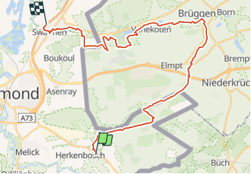
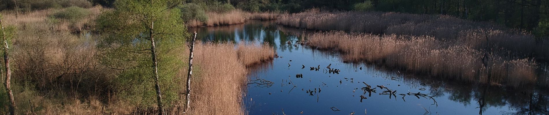
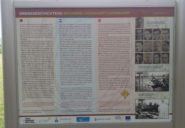
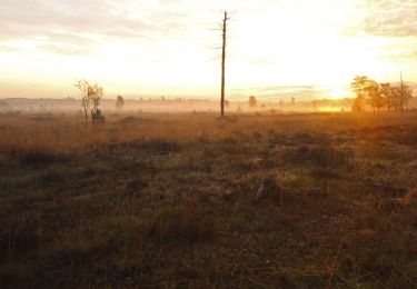
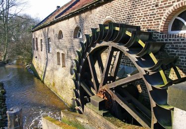
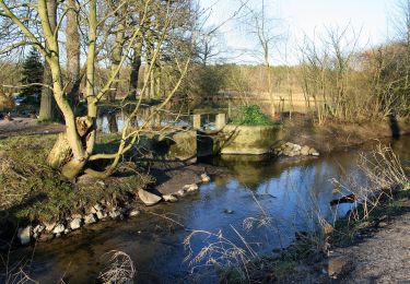
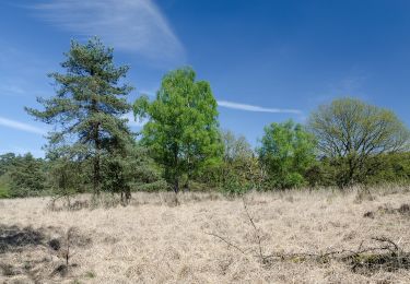
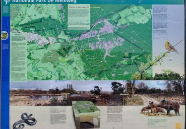
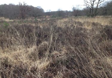
Randonnée A pied de 34 km à découvrir à Limbourg, Inconnu, Roerdalen. Cette randonnée est proposée par SityTrail - itinéraires balisés pédestres.
Description
Wandelen, Stedentrips en Aanbiedingen
Site web: http://www.eropuit.nl
Localisation
Pays :
Pays-Bas
Région :
Limbourg
Département/Province :
Inconnu
Commune :
Roerdalen
Localité :
Unknown
Départ:(Dec)
Départ:(UTM)
295931 ; 5671138 (32U) N.
Commentaires
Randonnées à proximité
![Randonnée A pied Niederkrüchten - Elmpterwald Grenzgeschichten - Photo](https://media.geolcdn.com/t/375/260/8e14d6fd-9613-4986-a202-609e7f4050ef.jpeg&format=jpg&maxdim=2)
![A pied A pied](https://static1.geolcdn.com/sitytour/trail-icons/100.png)
Elmpterwald Grenzgeschichten
A pied
Facile
Niederkrüchten,
Rhénanie-du-Nord-Westphalie,
Kreis Viersen,
Allemagne
![](/images/other/stat-length.png)
4,6 km | 5,4 km-effort
1h 13min
![](https://static1.geolcdn.com/siteimages/upload/files/16400158638029165_repeat_loop_refresh_sync_direction_icon.png)
Non
![Randonnée A pied Niederkrüchten - Rundweg A12 Grenzwald - Photo](https://media.geolcdn.com/t/375/260/d86b75dd-95c2-4b3f-b833-706a4cf4ba8d.jpeg&format=jpg&maxdim=2)
![A pied A pied](https://static1.geolcdn.com/sitytour/trail-icons/100.png)
Rundweg A12 Grenzwald
A pied
Moyen
Niederkrüchten,
Rhénanie-du-Nord-Westphalie,
Kreis Viersen,
Allemagne
![](/images/other/stat-length.png)
25 km | 28 km-effort
6h 23min
![](https://static1.geolcdn.com/siteimages/upload/files/16400158638029165_repeat_loop_refresh_sync_direction_icon.png)
Oui
![Randonnée A pied Wassenberg - Rundweg](https://media.geolcdn.com/t/375/260/b5dc41ff-ee6c-4e28-80ca-7ecb94833885.jpeg&format=jpg&maxdim=2)
![A pied A pied](https://static1.geolcdn.com/sitytour/trail-icons/100.png)
Rundweg "A7 Effelder Wald"
A pied
Facile
Wassenberg,
Rhénanie-du-Nord-Westphalie,
Kreis Heinsberg,
Allemagne
![](/images/other/stat-length.png)
8,6 km | 9,6 km-effort
2h 10min
![](https://static1.geolcdn.com/siteimages/upload/files/16400158638029165_repeat_loop_refresh_sync_direction_icon.png)
Oui
![Randonnée A pied Roerdalen - Rode Beek - Photo](https://media.geolcdn.com/t/375/260/3736a1e8-b7e6-4d6b-beae-fc06f7712295.jpeg&format=jpg&maxdim=2)
![A pied A pied](https://static1.geolcdn.com/sitytour/trail-icons/100.png)
Rode Beek
A pied
Facile
Roerdalen,
Limbourg,
Inconnu,
Pays-Bas
![](/images/other/stat-length.png)
10,5 km | 11,3 km-effort
2h 34min
![](https://static1.geolcdn.com/siteimages/upload/files/16400158638029165_repeat_loop_refresh_sync_direction_icon.png)
Oui
![Randonnée A pied Roerdalen - Meinvennen - Photo](https://media.geolcdn.com/t/375/260/dev_67061552-b6d4-4c65-8168-a2737beb5331.jpeg&format=jpg&maxdim=2)
![A pied A pied](https://static1.geolcdn.com/sitytour/trail-icons/100.png)
Meinvennen
A pied
Facile
Roerdalen,
Limbourg,
Inconnu,
Pays-Bas
![](/images/other/stat-length.png)
17,4 km | 19,8 km-effort
4h 29min
![](https://static1.geolcdn.com/siteimages/upload/files/16400158638029165_repeat_loop_refresh_sync_direction_icon.png)
Oui
![Randonnée A pied Roerdalen - Paardengatroute - Photo](https://media.geolcdn.com/t/375/260/dev_1050fa5d-5770-43ad-9e27-9732b5b8f3c4.jpeg&format=jpg&maxdim=2)
![A pied A pied](https://static1.geolcdn.com/sitytour/trail-icons/100.png)
Paardengatroute
A pied
Facile
Roerdalen,
Limbourg,
Inconnu,
Pays-Bas
![](/images/other/stat-length.png)
5,2 km | 6 km-effort
1h 21min
![](https://static1.geolcdn.com/siteimages/upload/files/16400158638029165_repeat_loop_refresh_sync_direction_icon.png)
Oui
![Randonnée Marche nordique Roerdalen - Herkenbosch Kast. Daelenbroeck - Photo](https://media.geolcdn.com/t/375/260/ext.jpg?maxdim=2&url=https%3A%2F%2Fservices.sitytrail.com%2FGeolivesWS%2FDownloadMedia.ashx%3FTrailID%3D251110%26Media%3D20140220124715.jpg)
![Marche nordique Marche nordique](https://static1.geolcdn.com/sitytour/trail-icons/102.png)
Herkenbosch Kast. Daelenbroeck
Marche nordique
Facile
Roerdalen,
Limbourg,
Inconnu,
Pays-Bas
![](/images/other/stat-length.png)
10,5 km | 11,6 km-effort
2h 25min
![](https://static1.geolcdn.com/siteimages/upload/files/16400158638029165_repeat_loop_refresh_sync_direction_icon.png)
Non
![Randonnée A pied Wassenberg - Rundweg A8 Effeld - Photo](https://media.geolcdn.com/t/375/260/ext.jpg?maxdim=2&url=https%3A%2F%2Fstatic1.geolcdn.com%2Fsiteimages%2Fupload%2Ffiles%2F1545311037marcheuse_200dpi.jpg)
![A pied A pied](https://static1.geolcdn.com/sitytour/trail-icons/100.png)
Rundweg A8 Effeld
A pied
Facile
Wassenberg,
Rhénanie-du-Nord-Westphalie,
Kreis Heinsberg,
Allemagne
![](/images/other/stat-length.png)
3,5 km | 3,7 km-effort
50min
![](https://static1.geolcdn.com/siteimages/upload/files/16400158638029165_repeat_loop_refresh_sync_direction_icon.png)
Oui
![Randonnée Vélo Roerdalen - Limburg - Toeractief Herkenbosch - Photo](https://media.geolcdn.com/t/375/260/ext.jpg?maxdim=2&url=https%3A%2F%2Fstatic1.geolcdn.com%2Fsiteimages%2Fupload%2Ffiles%2F1524743154velo.jpg)
![Vélo Vélo](https://static1.geolcdn.com/sitytour/trail-icons/200.png)
Limburg - Toeractief Herkenbosch
Vélo
Très facile
Roerdalen,
Limbourg,
Inconnu,
Pays-Bas
![](/images/other/stat-length.png)
106 km | 117 km-effort
Inconnu
![](https://static1.geolcdn.com/siteimages/upload/files/16400158638029165_repeat_loop_refresh_sync_direction_icon.png)
Oui