Randonnée A pied Ebermannstadt - Planetenweg Feuerstein - Photo

Tous les sentiers balisés d’Europe GUIDE+

© OpenStreetMap contributors
Longueur
Longueur
9,1 km
Altitude max
Altitude max
514 m
Dénivelé positif
Dénivelé positif
261 m
Km-Effort
Km-Effort  
12,6 km
Altitude min
Altitude min
353 m
Dénivelé négatif
Dénivelé négatif
260 m
Boucle
Boucle
Oui
Balise
Balise
Date de création :
2022-02-11 13:39:24.027
Dernière modification :
2022-02-11 13:39:24.027

(0 Avis)

A pied
A pied
2h51
Difficulté : Facile

Scannez ce code QR pour ouvrir la randonnée dans l'application SityTrail

Application GPS de randonnée GRATUITE

Logo SityTrail SityTrail

IGN / Instituts géographiques

Télécharger SityTrail sur l'App Store Télécharger SityTrail sur Google Play

Logo SityTrail SityTrail World

Le monde est à vous

Télécharger SityTrail sur l'App Store Télécharger SityTrail sur Google Play Télécharger SityTrail sur Huawei AppGallery

À propos

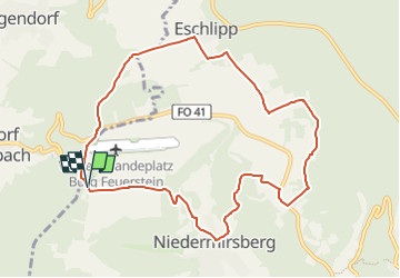
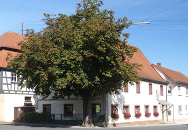
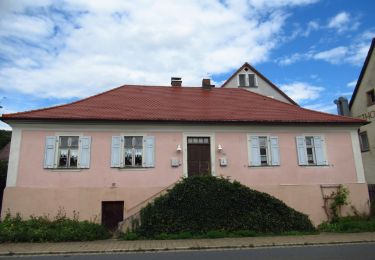
Randonnée A pied de 9,1 km à découvrir à Bavière, Landkreis Forchheim, Ebermannstadt. Cette randonnée est proposée par SityTrail - itinéraires balisés pédestres.

Description

Randonnée créée par SFeu e.V. (Sternwarte Feuerstein e.V.).

Symbole: Gelbe Sonne mit 3 grauen Planeten auf blauem Hintergrund

Profil altimétrique

Photos

Localisation

Pays :
Allemagne
Région :
Bavière
Département/Province :
Landkreis Forchheim
Commune :
Ebermannstadt
Localité :
Unknown
Départ:(UTM)
653085 ; 5517465 (32U) N.

Randonnées à proximité

Randonnée A pied Pretzfeld - Lauferlebnis Fränkische Schweiz W2 - Photo
A pied
GUIDE+

A pied

Facile
Pretzfeld, Bavière, Landkreis Forchheim, Allemagne
10 km | 10,8 km-effort
2h 26min
Oui
Randonnée A pied Pretzfeld - Lauferlebnis Fränkische Schweiz W1 - Photo
A pied
GUIDE+

A pied

Facile
Pretzfeld, Bavière, Landkreis Forchheim, Allemagne
4,7 km | 5 km-effort
1h 8min
Oui
Randonnée A pied Weilersbach - Wanderweg Roter Schrägbalken - Photo
A pied
GUIDE+

A pied

Facile
Weilersbach, Bavière, Landkreis Forchheim, Allemagne
5,1 km | 5,8 km-effort
1h 19min
Non
Randonnée A pied Eggolsheim - Lauferlebnis Fränkische Schweiz E5 - Photo
A pied
GUIDE+

A pied

Moyen
Eggolsheim, Bavière, Landkreis Forchheim, Allemagne
21 km | 26 km-effort
5h 57min
Oui
Randonnée A pied Eggolsheim - Lauferlebnis Fränkische Schweiz E4 - Photo
A pied
GUIDE+

A pied

Facile
Eggolsheim, Bavière, Landkreis Forchheim, Allemagne
10,3 km | 11,6 km-effort
2h 38min
Oui
Randonnée A pied Ebermannstadt - Zielwanderweg Ebermannstadt - Vexierkapelle - Photo
A pied
GUIDE+

A pied

Facile
Ebermannstadt, Bavière, Landkreis Forchheim, Allemagne
7 km | 9,6 km-effort
2h 11min
Non
Randonnée A pied Eggolsheim - Trailsdorf-Ebermannstadt - Photo
A pied
GUIDE+

A pied

Moyen
Eggolsheim, Bavière, Landkreis Forchheim, Allemagne
19,2 km | 24 km-effort
5h 29min
Non
Randonnée A pied Pretzfeld - Lauferlebnis Fränkische Schweiz W3 - Photo
A pied
GUIDE+

A pied

Facile
Pretzfeld, Bavière, Landkreis Forchheim, Allemagne
12,5 km | 14,2 km-effort
3h 13min
Oui
Randonnée A pied Eggolsheim - Lauferlebnis Fränkische Schweiz E3 - Photo
A pied
GUIDE+

A pied

Facile
Eggolsheim, Bavière, Landkreis Forchheim, Allemagne
8,5 km | 9,8 km-effort
2h 13min
Oui


Fermer
Mes abonnements