![](/images/other/stat-length.png)
![Randonnée A pied Lunzenau - Via Porphyria Etappe 7 - Photo](https://media.geolcdn.com/t/1900/400/ext.pjpeg?maxdim=2&url=https%3A%2F%2Fmedia.geolcdn.com%2Ff%2F14e7018c-4675-4342-bc4b-20cfa94c6828.jpeg)
Via Porphyria Etappe 7
SityTrail - itinéraires balisés pédestres
Tous les sentiers balisés d’Europe PRO
![Longueur](/images/other/stat-length.png)
Longueur
15,1 km
![Altitude max](https://static1.geolcdn.com/siteimages/upload/files/1508320355ic_sort_altitude_max_24dp.png)
Altitude max
285 m
![Dénivelé positif](https://static1.geolcdn.com/siteimages/upload/files/1508320355ic_sort_den_pos_24dp.png)
Dénivelé positif
406 m
![Km-Effort](/images/other/stat-length.png)
Km-Effort
20 km
![Altitude min](https://static1.geolcdn.com/siteimages/upload/files/1508320355ic_sort_altitude_min_24dp.png)
Altitude min
177 m
![Dénivelé négatif](https://static1.geolcdn.com/siteimages/upload/files/1508320355ic_sort_den_neg_24dp.png)
Dénivelé négatif
305 m
![Boucle](https://static1.geolcdn.com/siteimages/upload/files/16400158638029165_repeat_loop_refresh_sync_direction_icon.png)
Boucle
Non
Balise
Date de création :
2022-02-11 13:34:28.387
Dernière modification :
2022-02-11 13:34:28.387
![A pied](https://static1.geolcdn.com/sitytour/trail-icons/100.png)
4h35
Difficulté : Moyen
![Scannez ce code QR pour ouvrir la randonnée dans l'application SityTrail](https://capi.geolives.com/qq0zvz2zws4bq2lad0pu/sitytour/trails/3090594/qr.png?size=200)
Application GPS de randonnée GRATUITE
À propos
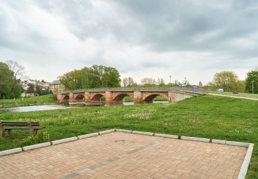
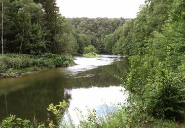
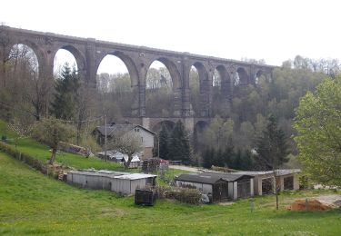
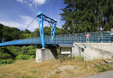
Randonnée A pied de 15,1 km à découvrir à Saxe, Mittelsachsen, Lunzenau. Cette randonnée est proposée par SityTrail - itinéraires balisés pédestres.
Description
Randonnée créée par Kirche im Land des Roten Porphyr e. V..
Symbole: Fensterrose
Localisation
Pays :
Allemagne
Région :
Saxe
Département/Province :
Mittelsachsen
Commune :
Lunzenau
Localité :
Unknown
Départ:(Dec)
Départ:(UTM)
342404 ; 5647972 (33U) N.
Commentaires
Randonnées à proximité
![Randonnée A pied Wechselburg - Wechselburg – Winkeln - Photo](https://media.geolcdn.com/t/375/260/ext.jpg?maxdim=2&url=https%3A%2F%2Fmedia.geolcdn.com%2Ff%2Fb22e177f-5147-4a79-b3ac-16dcbd0f9af5.jpeg)
![A pied A pied](https://static1.geolcdn.com/sitytour/trail-icons/100.png)
Wechselburg – Winkeln
A pied
Facile
Wechselburg,
Saxe,
Mittelsachsen,
Allemagne
![](/images/other/stat-length.png)
5,5 km | 6,7 km-effort
1h 31min
![](https://static1.geolcdn.com/siteimages/upload/files/16400158638029165_repeat_loop_refresh_sync_direction_icon.png)
Non
![Randonnée A pied Lunzenau - Wanderweg Berthelsdorf-Hohenkirchen-Cossen - Photo](https://media.geolcdn.com/t/375/260/ext.jpg?maxdim=2&url=https%3A%2F%2Fmedia.geolcdn.com%2Ff%2Fe29f3f53-e1c4-4f7e-88b8-35490002ee8e.jpeg)
![A pied A pied](https://static1.geolcdn.com/sitytour/trail-icons/100.png)
Wanderweg Berthelsdorf-Hohenkirchen-Cossen
A pied
Facile
Lunzenau,
Saxe,
Mittelsachsen,
Allemagne
![](/images/other/stat-length.png)
3,1 km | 3,7 km-effort
50min
![](https://static1.geolcdn.com/siteimages/upload/files/16400158638029165_repeat_loop_refresh_sync_direction_icon.png)
Non
![Randonnée A pied Wechselburg - Wanderweg Dölitzschtalweg Wechselburg-Dölitzsch - Photo](https://media.geolcdn.com/t/375/260/ext.jpg?maxdim=2&url=https%3A%2F%2Fmedia.geolcdn.com%2Ff%2Ff64740ca-bdc7-4e5b-b59c-c46a1bbaff9e.jpeg)
![A pied A pied](https://static1.geolcdn.com/sitytour/trail-icons/100.png)
Wanderweg Dölitzschtalweg Wechselburg-Dölitzsch
A pied
Facile
Wechselburg,
Saxe,
Mittelsachsen,
Allemagne
![](/images/other/stat-length.png)
4,8 km | 6,3 km-effort
1h 25min
![](https://static1.geolcdn.com/siteimages/upload/files/16400158638029165_repeat_loop_refresh_sync_direction_icon.png)
Non
![Randonnée A pied Wechselburg - Wanderweg Corba - Mutzscheroda - Wechselburg - Photo](https://media.geolcdn.com/t/375/260/ext.jpg?maxdim=2&url=https%3A%2F%2Fmedia.geolcdn.com%2Ff%2Fa419a973-aaf0-4e0c-9d4b-6d83bc73f9ca.jpeg)
![A pied A pied](https://static1.geolcdn.com/sitytour/trail-icons/100.png)
Wanderweg Corba - Mutzscheroda - Wechselburg
A pied
Facile
Wechselburg,
Saxe,
Mittelsachsen,
Allemagne
![](/images/other/stat-length.png)
8,3 km | 10,7 km-effort
2h 25min
![](https://static1.geolcdn.com/siteimages/upload/files/16400158638029165_repeat_loop_refresh_sync_direction_icon.png)
Oui
![Randonnée A pied Burgstädt - Ww Wittgensdorf Oberer Bhf.- Burgstädt - Photo](https://media.geolcdn.com/t/375/260/ext.jpg?maxdim=2&url=https%3A%2F%2Fmedia.geolcdn.com%2Ff%2Ffe72d88e-caca-48d6-a20b-a80bc2131a92.jpeg)
![A pied A pied](https://static1.geolcdn.com/sitytour/trail-icons/100.png)
Ww Wittgensdorf Oberer Bhf.- Burgstädt
A pied
Facile
Burgstädt,
Saxe,
Mittelsachsen,
Allemagne
![](/images/other/stat-length.png)
5,3 km | 6 km-effort
1h 21min
![](https://static1.geolcdn.com/siteimages/upload/files/16400158638029165_repeat_loop_refresh_sync_direction_icon.png)
Non
![Randonnée A pied Lunzenau - Ww Penig-Amerika-Rochsburg-Lunzenau-Göhren-Wechselburg - Photo](https://media.geolcdn.com/t/375/260/ext.jpg?maxdim=2&url=https%3A%2F%2Fmedia.geolcdn.com%2Ff%2Fb2b1dbaa-83b6-4b87-b625-cc413a45425f.jpeg)
![A pied A pied](https://static1.geolcdn.com/sitytour/trail-icons/100.png)
Ww Penig-Amerika-Rochsburg-Lunzenau-Göhren-Wechselburg
A pied
Facile
Lunzenau,
Saxe,
Mittelsachsen,
Allemagne
![](/images/other/stat-length.png)
5,2 km | 6,3 km-effort
1h 26min
![](https://static1.geolcdn.com/siteimages/upload/files/16400158638029165_repeat_loop_refresh_sync_direction_icon.png)
Non
![Randonnée A pied Penig - Ww Zwickauer Mulde-Limbach-Oberfrohna - Photo](https://media.geolcdn.com/t/375/260/ext.jpg?maxdim=2&url=https%3A%2F%2Fmedia.geolcdn.com%2Ff%2F1ff11e62-647a-4ae6-857a-2f331f0acf1b.jpeg)
![A pied A pied](https://static1.geolcdn.com/sitytour/trail-icons/100.png)
Ww Zwickauer Mulde-Limbach-Oberfrohna
A pied
Facile
Penig,
Saxe,
Mittelsachsen,
Allemagne
![](/images/other/stat-length.png)
10,5 km | 13,3 km-effort
3h 1min
![](https://static1.geolcdn.com/siteimages/upload/files/16400158638029165_repeat_loop_refresh_sync_direction_icon.png)
Non
![Randonnée A pied Lunzenau - Ww Verbindung Muldentalweg-Chemnitztalweg - Photo](https://media.geolcdn.com/t/375/260/ext.jpg?maxdim=2&url=https%3A%2F%2Fmedia.geolcdn.com%2Ff%2Fbd2e3f85-d12b-4901-9a29-5b178676d664.jpeg)
![A pied A pied](https://static1.geolcdn.com/sitytour/trail-icons/100.png)
Ww Verbindung Muldentalweg-Chemnitztalweg
A pied
Facile
Lunzenau,
Saxe,
Mittelsachsen,
Allemagne
![](/images/other/stat-length.png)
3,6 km | 4,9 km-effort
1h 7min
![](https://static1.geolcdn.com/siteimages/upload/files/16400158638029165_repeat_loop_refresh_sync_direction_icon.png)
Non
![Randonnée A pied Lunzenau - Einmal Amerika und zurück - Photo](https://media.geolcdn.com/t/375/260/ext.jpg?maxdim=2&url=https%3A%2F%2Fmedia.geolcdn.com%2Ff%2F8d582df9-1e07-4e2f-823a-a774ba87992b.jpeg)
![A pied A pied](https://static1.geolcdn.com/sitytour/trail-icons/100.png)
Einmal Amerika und zurück
A pied
Facile
Lunzenau,
Saxe,
Mittelsachsen,
Allemagne
![](/images/other/stat-length.png)
8,3 km | 10,6 km-effort
2h 24min
![](https://static1.geolcdn.com/siteimages/upload/files/16400158638029165_repeat_loop_refresh_sync_direction_icon.png)
Oui