![](/images/other/stat-length.png)
![Randonnée A pied Freudenberg - Rundwanderweg Freudenberg 5: Freizeitpark-Weg - Photo](https://media.geolcdn.com/t/1900/400/ext.pjpeg?maxdim=2&url=https%3A%2F%2Fmedia.geolcdn.com%2Ff%2F486ce7d8-75fb-4f29-8dae-d80a57a91ee5.jpeg)
Rundwanderweg Freudenberg 5: Freizeitpark-Weg
SityTrail - itinéraires balisés pédestres
Tous les sentiers balisés d’Europe PRO
![Longueur](/images/other/stat-length.png)
Longueur
4,2 km
![Altitude max](https://static1.geolcdn.com/siteimages/upload/files/1508320355ic_sort_altitude_max_24dp.png)
Altitude max
150 m
![Dénivelé positif](https://static1.geolcdn.com/siteimages/upload/files/1508320355ic_sort_den_pos_24dp.png)
Dénivelé positif
36 m
![Km-Effort](/images/other/stat-length.png)
Km-Effort
4,6 km
![Altitude min](https://static1.geolcdn.com/siteimages/upload/files/1508320355ic_sort_altitude_min_24dp.png)
Altitude min
128 m
![Dénivelé négatif](https://static1.geolcdn.com/siteimages/upload/files/1508320355ic_sort_den_neg_24dp.png)
Dénivelé négatif
33 m
![Boucle](https://static1.geolcdn.com/siteimages/upload/files/16400158638029165_repeat_loop_refresh_sync_direction_icon.png)
Boucle
Oui
Balise
Date de création :
2022-02-11 13:33:41.758
Dernière modification :
2022-02-11 13:33:41.758
![A pied](https://static1.geolcdn.com/sitytour/trail-icons/100.png)
1h03
Difficulté : Facile
![Scannez ce code QR pour ouvrir la randonnée dans l'application SityTrail](https://capi.geolives.com/qq0zvz2zws4bq2lad0pu/sitytour/trails/3090553/qr.png?size=200)
Application GPS de randonnée GRATUITE
À propos
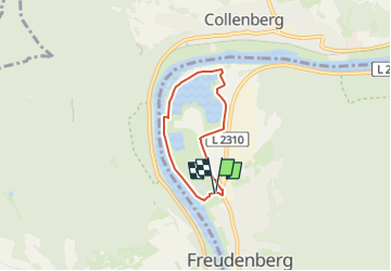
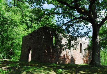
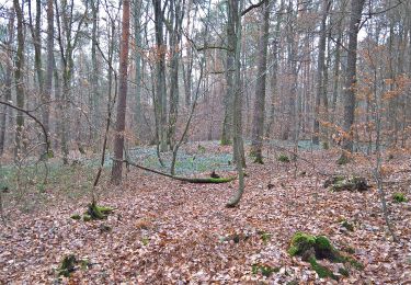
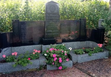
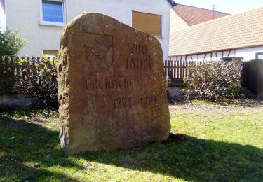
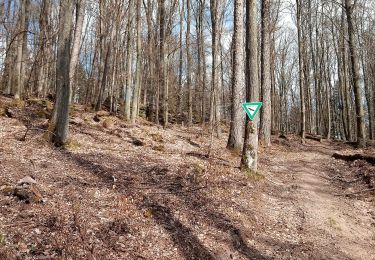
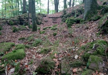
Randonnée A pied de 4,2 km à découvrir à Bade-Wurtemberg, Main-Tauber-Kreis, Freudenberg. Cette randonnée est proposée par SityTrail - itinéraires balisés pédestres.
Description
Randonnée créée par Geo-Naturpark Bergstraße-Odenwald.
Symbole: Weiße "5" im Kreis darüber weißes "F"
Localisation
Pays :
Allemagne
Région :
Bade-Wurtemberg
Département/Province :
Main-Tauber-Kreis
Commune :
Freudenberg
Localité :
Unknown
Départ:(Dec)
Départ:(UTM)
523210 ; 5511488 (32U) N.
Commentaires
Randonnées à proximité
![Randonnée A pied Collenberg - Burgberg-Ausblick - Photo](https://media.geolcdn.com/t/375/260/ext.jpg?maxdim=2&url=https%3A%2F%2Fmedia.geolcdn.com%2Ff%2F47184e0d-c747-4127-bc7d-1a17777a0e98.jpeg)
![A pied A pied](https://static1.geolcdn.com/sitytour/trail-icons/100.png)
Burgberg-Ausblick
A pied
Facile
Collenberg,
Bavière,
Landkreis Miltenberg,
Allemagne
![](/images/other/stat-length.png)
6,4 km | 9,9 km-effort
2h 15min
![](https://static1.geolcdn.com/siteimages/upload/files/16400158638029165_repeat_loop_refresh_sync_direction_icon.png)
Oui
![Randonnée A pied Freudenberg - Liebliches Taubertal 1 - Photo](https://media.geolcdn.com/t/375/260/ext.jpg?maxdim=2&url=https%3A%2F%2Fmedia.geolcdn.com%2Ff%2Fa1a1ddd0-299d-46dc-a79b-92d4fb751b83.jpeg)
![A pied A pied](https://static1.geolcdn.com/sitytour/trail-icons/100.png)
Liebliches Taubertal 1
A pied
Facile
Freudenberg,
Bade-Wurtemberg,
Main-Tauber-Kreis,
Allemagne
![](/images/other/stat-length.png)
3,2 km | 4,1 km-effort
56min
![](https://static1.geolcdn.com/siteimages/upload/files/16400158638029165_repeat_loop_refresh_sync_direction_icon.png)
Non
![Randonnée A pied Bürgstadt - Rundwanderweg Bürgstadt Stutz 3: Ringwall-Weg - Photo](https://media.geolcdn.com/t/375/260/ext.jpg?maxdim=2&url=https%3A%2F%2Fmedia.geolcdn.com%2Ff%2F859545fc-75c4-4048-bc9f-115ae79da6f9.jpeg)
![A pied A pied](https://static1.geolcdn.com/sitytour/trail-icons/100.png)
Rundwanderweg Bürgstadt Stutz 3: Ringwall-Weg
A pied
Facile
Bürgstadt,
Bavière,
Landkreis Miltenberg,
Allemagne
![](/images/other/stat-length.png)
6,5 km | 10 km-effort
2h 16min
![](https://static1.geolcdn.com/siteimages/upload/files/16400158638029165_repeat_loop_refresh_sync_direction_icon.png)
Oui
![Randonnée A pied Mönchberg - Nordic Walking Rot Sparkassen-Trail - Photo](https://media.geolcdn.com/t/375/260/ext.jpg?maxdim=2&url=https%3A%2F%2Fmedia.geolcdn.com%2Ff%2Fc0662f05-e76e-434a-90ea-ced3a7f5af8d.jpeg)
![A pied A pied](https://static1.geolcdn.com/sitytour/trail-icons/100.png)
Nordic Walking Rot Sparkassen-Trail
A pied
Facile
Mönchberg,
Bavière,
Landkreis Miltenberg,
Allemagne
![](/images/other/stat-length.png)
10 km | 12,7 km-effort
2h 53min
![](https://static1.geolcdn.com/siteimages/upload/files/16400158638029165_repeat_loop_refresh_sync_direction_icon.png)
Non
![Randonnée A pied Freudenberg - Rundwanderweg Ebenheid, Eb4, Winnengrund-Weg - Photo](https://media.geolcdn.com/t/375/260/ext.jpg?maxdim=2&url=https%3A%2F%2Fmedia.geolcdn.com%2Ff%2Fd227ce58-2889-487b-8c66-0c05d20cef6d.jpeg)
![A pied A pied](https://static1.geolcdn.com/sitytour/trail-icons/100.png)
Rundwanderweg Ebenheid, Eb4, Winnengrund-Weg
A pied
Facile
Freudenberg,
Bade-Wurtemberg,
Main-Tauber-Kreis,
Allemagne
![](/images/other/stat-length.png)
5 km | 6 km-effort
1h 21min
![](https://static1.geolcdn.com/siteimages/upload/files/16400158638029165_repeat_loop_refresh_sync_direction_icon.png)
Oui
![Randonnée A pied Freudenberg - Rundwanderweg Ebenheid, Eb2, Hohbusch-Weg - Photo](https://media.geolcdn.com/t/375/260/ext.jpg?maxdim=2&url=https%3A%2F%2Fmedia.geolcdn.com%2Ff%2Ff4bd72ff-557f-42b8-bbea-87c658ada1d9.jpeg)
![A pied A pied](https://static1.geolcdn.com/sitytour/trail-icons/100.png)
Rundwanderweg Ebenheid, Eb2, Hohbusch-Weg
A pied
Facile
Freudenberg,
Bade-Wurtemberg,
Main-Tauber-Kreis,
Allemagne
![](/images/other/stat-length.png)
5,1 km | 6,1 km-effort
1h 22min
![](https://static1.geolcdn.com/siteimages/upload/files/16400158638029165_repeat_loop_refresh_sync_direction_icon.png)
Oui
![Randonnée A pied Freudenberg - Hohenstein-Weg - Photo](https://media.geolcdn.com/t/375/260/ext.jpg?maxdim=2&url=https%3A%2F%2Fmedia.geolcdn.com%2Ff%2Fab6acd5a-3f98-480b-af95-2be7a0cd7d70.jpeg)
![A pied A pied](https://static1.geolcdn.com/sitytour/trail-icons/100.png)
Hohenstein-Weg
A pied
Facile
Freudenberg,
Bade-Wurtemberg,
Main-Tauber-Kreis,
Allemagne
![](/images/other/stat-length.png)
7,6 km | 11,6 km-effort
2h 38min
![](https://static1.geolcdn.com/siteimages/upload/files/16400158638029165_repeat_loop_refresh_sync_direction_icon.png)
Oui
![Randonnée A pied Freudenberg - Rundwanderweg Freudenberg Kreuzschleife 1: Schloss-Weg - Photo](https://media.geolcdn.com/t/375/260/ext.jpg?maxdim=2&url=https%3A%2F%2Fmedia.geolcdn.com%2Ff%2F50c50589-5405-4d87-b9da-51f18d12e24b.jpeg)
![A pied A pied](https://static1.geolcdn.com/sitytour/trail-icons/100.png)
Rundwanderweg Freudenberg Kreuzschleife 1: Schloss-Weg
A pied
Facile
Freudenberg,
Bade-Wurtemberg,
Main-Tauber-Kreis,
Allemagne
![](/images/other/stat-length.png)
5,6 km | 8,1 km-effort
1h 50min
![](https://static1.geolcdn.com/siteimages/upload/files/16400158638029165_repeat_loop_refresh_sync_direction_icon.png)
Oui
![Randonnée A pied Freudenberg - Rundwanderweg Freudenberg 4: Lindtal-Weg - Photo](https://media.geolcdn.com/t/375/260/ext.jpg?maxdim=2&url=https%3A%2F%2Fmedia.geolcdn.com%2Ff%2F5b898e90-b167-4cea-bd40-d2e57294ae60.jpeg)
![A pied A pied](https://static1.geolcdn.com/sitytour/trail-icons/100.png)
Rundwanderweg Freudenberg 4: Lindtal-Weg
A pied
Facile
Freudenberg,
Bade-Wurtemberg,
Main-Tauber-Kreis,
Allemagne
![](/images/other/stat-length.png)
8,1 km | 11,4 km-effort
2h 35min
![](https://static1.geolcdn.com/siteimages/upload/files/16400158638029165_repeat_loop_refresh_sync_direction_icon.png)
Oui