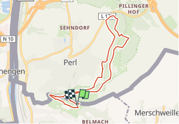
![](/images/other/stat-length.png)
![Randonnée A pied Apach - Saar-Hunsrück Steig Traumschleifen Panoramaweg Perl - Photo](https://media.geolcdn.com/t/1900/400/2f051831-eb4c-430b-86d3-eeef60fb95da.jpeg&format=pjpeg&maxdim=2)
Saar-Hunsrück Steig Traumschleifen Panoramaweg Perl
SityTrail - itinéraires balisés pédestres
Tous les sentiers balisés d’Europe GUIDE+
![Longueur](/images/other/stat-length.png)
![Altitude max](https://static1.geolcdn.com/siteimages/upload/files/1508320355ic_sort_altitude_max_24dp.png)
![Dénivelé positif](https://static1.geolcdn.com/siteimages/upload/files/1508320355ic_sort_den_pos_24dp.png)
![Km-Effort](/images/other/stat-length.png)
![Altitude min](https://static1.geolcdn.com/siteimages/upload/files/1508320355ic_sort_altitude_min_24dp.png)
![Dénivelé négatif](https://static1.geolcdn.com/siteimages/upload/files/1508320355ic_sort_den_neg_24dp.png)
![Boucle](https://static1.geolcdn.com/siteimages/upload/files/16400158638029165_repeat_loop_refresh_sync_direction_icon.png)
![A pied](https://static1.geolcdn.com/sitytour/trail-icons/100.png)
2h35
Difficulté : Facile
![Scannez ce code QR pour ouvrir la randonnée dans l'application SityTrail](https://capi.geolives.com/qq0zvz2zws4bq2lad0pu/sitytour/trails/3090324/qr.png?size=200)
Application GPS de randonnée GRATUITE
À propos
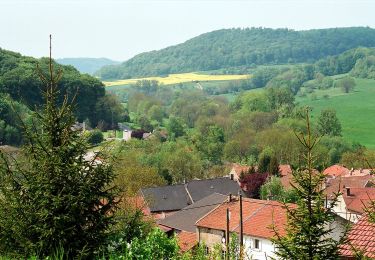
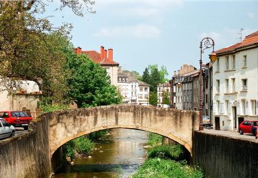
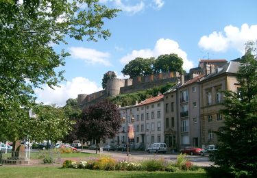
Randonnée A pied de 8,2 km à découvrir à Grand Est, Moselle, Apach. Cette randonnée est proposée par SityTrail - itinéraires balisés pédestres.
Description
Symbole: 2 verschiedene: einmal negativ weißes Symbol "Traumschleifen Saar-Hunsrück" auf einem lila Feld und dann ein rotes "P" auf stilisierten grünen Weintrauben - beide mit Text "Panoramaweg Perl" darunter
Localisation
Commentaires
Randonnées à proximité
![Randonnée A pied Contz-les-Bains - Schengen grenzenlos / sans frontières - Photo](https://media.geolcdn.com/t/375/260/45497cda-a7e7-4df9-a6a1-692f43d5633d.jpeg&format=jpg&maxdim=2)
![A pied A pied](https://static1.geolcdn.com/sitytour/trail-icons/100.png)
A pied
![](/images/other/stat-length.png)
![](https://static1.geolcdn.com/siteimages/upload/files/16400158638029165_repeat_loop_refresh_sync_direction_icon.png)
![Randonnée A pied Merschweiller - Circuit Apach-Waldwisse - Photo](https://media.geolcdn.com/t/375/260/3c410425-0585-4861-9a5d-9ca14274bc18.jpeg&format=jpg&maxdim=2)
![A pied A pied](https://static1.geolcdn.com/sitytour/trail-icons/100.png)
A pied
![](/images/other/stat-length.png)
![](https://static1.geolcdn.com/siteimages/upload/files/16400158638029165_repeat_loop_refresh_sync_direction_icon.png)
![Randonnée A pied Merschweiller - Promenade Circulaire d'Appach - Photo](https://media.geolcdn.com/t/375/260/3c410425-0585-4861-9a5d-9ca14274bc18.jpeg&format=jpg&maxdim=2)
![A pied A pied](https://static1.geolcdn.com/sitytour/trail-icons/100.png)
A pied
![](/images/other/stat-length.png)
![](https://static1.geolcdn.com/siteimages/upload/files/16400158638029165_repeat_loop_refresh_sync_direction_icon.png)
![Randonnée Marche Sierck-les-Bains - Sierck Montenach - Photo](https://media.geolcdn.com/t/375/260/ext.jpg?maxdim=2&url=https%3A%2F%2Fstatic1.geolcdn.com%2Fsiteimages%2Fupload%2Ffiles%2F1553511878bg_sport_marche.png)
![Marche Marche](https://static1.geolcdn.com/sitytour/trail-icons/101.png)
Marche
![](/images/other/stat-length.png)
![](https://static1.geolcdn.com/siteimages/upload/files/16400158638029165_repeat_loop_refresh_sync_direction_icon.png)
![Randonnée A pied Manderen-Ritzing - Promenade Circulaire Manderen-Ritzing - Photo](https://media.geolcdn.com/t/375/260/a57417a1-bfb7-4979-bb99-88cf1c8900c7.jpeg&format=jpg&maxdim=2)
![A pied A pied](https://static1.geolcdn.com/sitytour/trail-icons/100.png)
A pied
![](/images/other/stat-length.png)
![](https://static1.geolcdn.com/siteimages/upload/files/16400158638029165_repeat_loop_refresh_sync_direction_icon.png)
![Randonnée A pied Manderen-Ritzing - Promenade Circulaire Manderen Merschweiler - Photo](https://media.geolcdn.com/t/375/260/3c410425-0585-4861-9a5d-9ca14274bc18.jpeg&format=jpg&maxdim=2)
![A pied A pied](https://static1.geolcdn.com/sitytour/trail-icons/100.png)
A pied
![](/images/other/stat-length.png)
![](https://static1.geolcdn.com/siteimages/upload/files/16400158638029165_repeat_loop_refresh_sync_direction_icon.png)
![Randonnée A pied Sierck-les-Bains - Sentier Sierck-Apach-Montenach - Photo](https://media.geolcdn.com/t/375/260/62837726-a782-4202-8c71-f77c72a6a6b2.jpeg&format=jpg&maxdim=2)
![A pied A pied](https://static1.geolcdn.com/sitytour/trail-icons/100.png)
A pied
![](/images/other/stat-length.png)
![](https://static1.geolcdn.com/siteimages/upload/files/16400158638029165_repeat_loop_refresh_sync_direction_icon.png)
![Randonnée A pied Sierck-les-Bains - CV SentierKoenigsberg - Photo](https://media.geolcdn.com/t/375/260/867e519c-1be9-46c2-afcc-d89ebb2bfb6e.jpeg&format=jpg&maxdim=2)
![A pied A pied](https://static1.geolcdn.com/sitytour/trail-icons/100.png)
A pied
![](/images/other/stat-length.png)
![](https://static1.geolcdn.com/siteimages/upload/files/16400158638029165_repeat_loop_refresh_sync_direction_icon.png)
![Randonnée A pied Schengen - Sentier Grouf - Photo](https://media.geolcdn.com/t/375/260/eeb086f6-5a54-4928-a6cd-8cc9bb48fe81.jpeg&format=jpg&maxdim=2)
![A pied A pied](https://static1.geolcdn.com/sitytour/trail-icons/100.png)
A pied
![](/images/other/stat-length.png)
![](https://static1.geolcdn.com/siteimages/upload/files/16400158638029165_repeat_loop_refresh_sync_direction_icon.png)