Randonnée A pied Troisdorf - Herfeld-Tour - Photo

Tous les sentiers balisés d’Europe PRO

© OpenStreetMap contributors
Longueur
Longueur
6,8 km
Altitude max
Altitude max
120 m
Dénivelé positif
Dénivelé positif
69 m
Km-Effort
Km-Effort  
7,7 km
Altitude min
Altitude min
84 m
Dénivelé négatif
Dénivelé négatif
70 m
Boucle
Boucle
Oui
Balise
Balise
Date de création :
2022-02-11 13:17:43.163
Dernière modification :
2022-02-11 13:17:43.163

(0 Avis)

A pied
A pied
1h45
Difficulté : Facile

Scannez ce code QR pour ouvrir la randonnée dans l'application SityTrail

Application GPS de randonnée GRATUITE

Logo SityTrail SityTrail

IGN / Instituts géographiques

Télécharger SityTrail sur l'App Store Télécharger SityTrail sur Google Play

Logo SityTrail SityTrail World

Le monde est à vous

Télécharger SityTrail sur l'App Store Télécharger SityTrail sur Google Play Télécharger SityTrail sur Huawei AppGallery

À propos

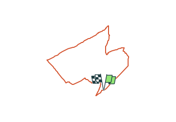
Randonnée A pied de 6,8 km à découvrir à Rhénanie-du-Nord-Westphalie, Rhein-Sieg-Kreis, Troisdorf. Cette randonnée est proposée par SityTrail - itinéraires balisés pédestres.

Description

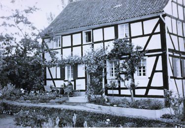
Randonnée créée par Wahner-Heide Stiftung NRW.

Symbole: Moorlilie gelb auf schwarz


Site web: http://www.wahner-heide.com/

Photos

Localisation

Pays :
Allemagne
Région :
Rhénanie-du-Nord-Westphalie
Département/Province :
Rhein-Sieg-Kreis
Commune :
Troisdorf
Localité :
Unknown
Départ:(UTM)
371553 ; 5637068 (32U) N.

Randonnées à proximité

Randonnée A pied Lohmar - 18 Bauernhofweg - Photo
A pied
PRO

A pied

Facile
Lohmar, Rhénanie-du-Nord-Westphalie, Rhein-Sieg-Kreis, Allemagne
12,5 km | 16,3 km-effort
3h 42min
Oui
Randonnée A pied Lohmar - Heideweg (Erlebnisweg Sieg Nr. 1) - Photo
A pied
PRO

A pied

Facile
Lohmar, Rhénanie-du-Nord-Westphalie, Rhein-Sieg-Kreis, Allemagne
8,1 km | 9,4 km-effort
2h 8min
Non
Randonnée A pied Lohmar - Rundweg A3 (Lohmar) - Photo
A pied
PRO

A pied

Facile
Lohmar, Rhénanie-du-Nord-Westphalie, Rhein-Sieg-Kreis, Allemagne
6 km | 7 km-effort
1h 35min
Non
Randonnée A pied Lohmar - Rundweg A1 (Lohmar) - Photo
A pied
PRO

A pied

Facile
Lohmar, Rhénanie-du-Nord-Westphalie, Rhein-Sieg-Kreis, Allemagne
6,8 km | 8,3 km-effort
1h 52min
Oui
Randonnée A pied Rösrath - Rundweg A3 (Honrath) - Photo
A pied
PRO

A pied

Facile
Rösrath, Rhénanie-du-Nord-Westphalie, Rheinisch-Bergischer Kreis, Allemagne
10,9 km | 14,9 km-effort
3h 23min
Oui
Randonnée A pied Troisdorf - Telegraphenberg-Tour - Photo
A pied
PRO

A pied

Facile
Troisdorf, Rhénanie-du-Nord-Westphalie, Rhein-Sieg-Kreis, Allemagne
5,6 km | 6,2 km-effort
1h 24min
Non
Randonnée A pied Rösrath - Geisterbusch-Tour - Photo
A pied
PRO

A pied

Facile
Rösrath, Rhénanie-du-Nord-Westphalie, Rheinisch-Bergischer Kreis, Allemagne
3,6 km | 4 km-effort
55min
Non
Randonnée A pied Inconnu - Eichenblatt-Tour - Photo
A pied
PRO

A pied

Facile
Inconnu, Rhénanie-du-Nord-Westphalie, Cologne, Allemagne
7,1 km | 7,8 km-effort
1h 46min
Oui
Randonnée Marche Rösrath - Rösrath Athénée 5,5 km - Photo
Marche
lucspa

Marche

Moyen
Rösrath, Rhénanie-du-Nord-Westphalie, Rheinisch-Bergischer Kreis, Allemagne
5,5 km | 6,7 km-effort
1h 27min
Oui


Fermer
Mes abonnements