Randonnée A pied Stolberg - Langerwehe Rundwanderweg Nr. 41 - Photo

Tous les sentiers balisés d’Europe PRO

© OpenStreetMap contributors
Longueur
Longueur
12,2 km
Altitude max
Altitude max
273 m
Dénivelé positif
Dénivelé positif
220 m
Km-Effort
Km-Effort  
15,1 km
Altitude min
Altitude min
160 m
Dénivelé négatif
Dénivelé négatif
221 m
Boucle
Boucle
Oui
Balise
Balise
Date de création :
2022-02-11 13:16:44.615
Dernière modification :
2022-02-11 13:16:44.615

(0 Avis)

A pied
A pied
3h26
Difficulté : Facile

Scannez ce code QR pour ouvrir la randonnée dans l'application SityTrail

Application GPS de randonnée GRATUITE

Logo SityTrail SityTrail

IGN / Instituts géographiques

Télécharger SityTrail sur l'App Store Télécharger SityTrail sur Google Play

Logo SityTrail SityTrail World

Le monde est à vous

Télécharger SityTrail sur l'App Store Télécharger SityTrail sur Google Play Télécharger SityTrail sur Huawei AppGallery

À propos

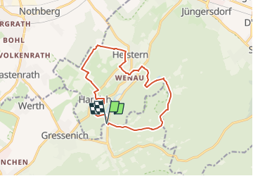
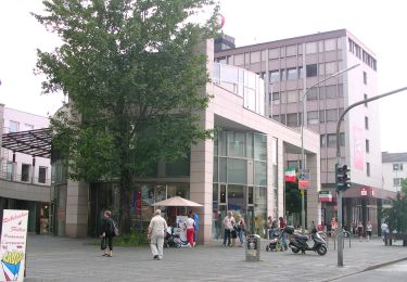
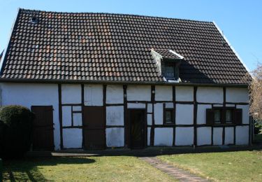
Randonnée A pied de 12,2 km à découvrir à Rhénanie-du-Nord-Westphalie, Région urbaine d'Aix-la-Chapelle, Stolberg. Cette randonnée est proposée par SityTrail - itinéraires balisés pédestres.

Description

Randonnée créée par Eifelverein, Ortsverein Langerwehe.

Symbole: schwarze 41 auf weißem Grund

Photos

Localisation

Pays :
Allemagne
Région :
Rhénanie-du-Nord-Westphalie
Département/Province :
Région urbaine d'Aix-la-Chapelle
Commune :
Stolberg
Localité :
Unknown
Départ:(UTM)
311408 ; 5628328 (32U) N.

Randonnées à proximité

Randonnée A pied Stolberg - Lehmjöres-Weg - Photo
A pied
PRO

A pied

Facile
Stolberg, Rhénanie-du-Nord-Westphalie, Région urbaine d'Aix-la-Chapelle, Allemagne
12,7 km | 16,5 km-effort
3h 44min
Oui
Randonnée A pied Stolberg - Schevenhütte Rundweg 3 - Photo
A pied
PRO

A pied

Facile
Stolberg, Rhénanie-du-Nord-Westphalie, Région urbaine d'Aix-la-Chapelle, Allemagne
6,9 km | 9 km-effort
2h 3min
Non
Randonnée A pied Langerwehe - Schlich Rundweg 71 - Photo
A pied
PRO

A pied

Facile
Langerwehe, Rhénanie-du-Nord-Westphalie, Kreis Düren, Allemagne
9,2 km | 12 km-effort
2h 43min
Oui
Randonnée A pied Langerwehe - Langerwehe Wanderrundweg Nr. 11 - Photo
A pied
PRO

A pied

Facile
Langerwehe, Rhénanie-du-Nord-Westphalie, Kreis Düren, Allemagne
9,1 km | 11,1 km-effort
2h 31min
Oui
Randonnée A pied Langerwehe - Langerwehe Wanderrundweg Nr. 31 - Photo
A pied
PRO

A pied

Facile
Langerwehe, Rhénanie-du-Nord-Westphalie, Kreis Düren, Allemagne
7,2 km | 9,2 km-effort
2h 5min
Oui
Randonnée A pied Langerwehe - Langerwehe Wanderrundweg Nr. 21 - Photo
A pied
PRO

A pied

Facile
Langerwehe, Rhénanie-du-Nord-Westphalie, Kreis Düren, Allemagne
9,6 km | 12,6 km-effort
2h 52min
Non
Randonnée A pied Langerwehe - Schlich Rundweg 51 - Photo
A pied
PRO

A pied

Facile
Langerwehe, Rhénanie-du-Nord-Westphalie, Kreis Düren, Allemagne
7 km | 8,8 km-effort
1h 59min
Oui
Randonnée A pied Eschweiler - Eschweiler Mühlenweg - Photo
A pied
PRO

A pied

Facile
Eschweiler, Rhénanie-du-Nord-Westphalie, Région urbaine d'Aix-la-Chapelle, Allemagne
14,1 km | 16,2 km-effort
3h 41min
Oui
Randonnée A pied Hürtgenwald - Wanderweg Thönbach 34 - Photo
A pied
PRO

A pied

Facile
Hürtgenwald, Rhénanie-du-Nord-Westphalie, Kreis Düren, Allemagne
6,2 km | 7,3 km-effort
1h 39min
Oui


Fermer
Mes abonnements