![](/images/other/stat-length.png)
![Randonnée A pied Gevelsberg - Forsthaus Rundweg A3 - Photo](https://media.geolcdn.com/t/1900/400/21da2367-fb27-4e94-9be3-4f8ac0f58149.jpeg&format=pjpeg&maxdim=2)
Forsthaus Rundweg A3
SityTrail - itinéraires balisés pédestres
Tous les sentiers balisés d’Europe GUIDE+
![Longueur](/images/other/stat-length.png)
Longueur
7,4 km
![Altitude max](https://static1.geolcdn.com/siteimages/upload/files/1508320355ic_sort_altitude_max_24dp.png)
Altitude max
371 m
![Dénivelé positif](https://static1.geolcdn.com/siteimages/upload/files/1508320355ic_sort_den_pos_24dp.png)
Dénivelé positif
224 m
![Km-Effort](/images/other/stat-length.png)
Km-Effort
10,4 km
![Altitude min](https://static1.geolcdn.com/siteimages/upload/files/1508320355ic_sort_altitude_min_24dp.png)
Altitude min
184 m
![Dénivelé négatif](https://static1.geolcdn.com/siteimages/upload/files/1508320355ic_sort_den_neg_24dp.png)
Dénivelé négatif
234 m
![Boucle](https://static1.geolcdn.com/siteimages/upload/files/16400158638029165_repeat_loop_refresh_sync_direction_icon.png)
Boucle
Oui
Balise
Date de création :
2022-02-11 13:07:13.506
Dernière modification :
2022-02-11 13:07:13.506
![A pied](https://static1.geolcdn.com/sitytour/trail-icons/100.png)
2h21
Difficulté : Facile
![Scannez ce code QR pour ouvrir la randonnée dans l'application SityTrail](https://capi.geolives.com/qq0zvz2zws4bq2lad0pu/sitytour/trails/3089219/qr.png?size=200)
Application GPS de randonnée GRATUITE
À propos
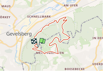
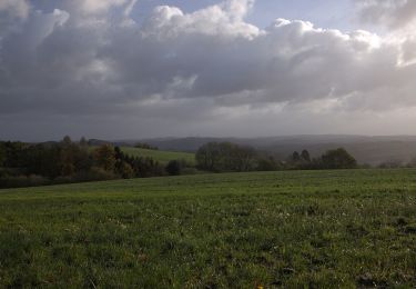
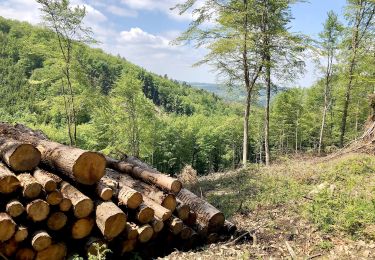
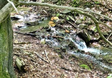
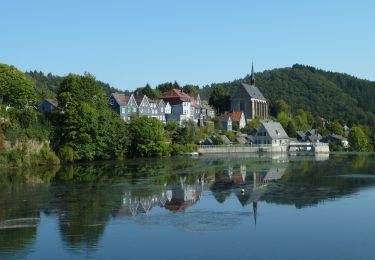
Randonnée A pied de 7,4 km à découvrir à Rhénanie-du-Nord-Westphalie, Ennepe-Ruhr-Kreis, Gevelsberg. Cette randonnée est proposée par SityTrail - itinéraires balisés pédestres.
Description
Randonnée créée par Sauerländischer Gebirgsverein.
Localisation
Pays :
Allemagne
Région :
Rhénanie-du-Nord-Westphalie
Département/Province :
Ennepe-Ruhr-Kreis
Commune :
Gevelsberg
Localité :
Unknown
Départ:(Dec)
Départ:(UTM)
385160 ; 5686208 (32U) N.
Commentaires
Randonnées à proximité
![Randonnée A pied Ennepetal - GEV-Nirgena - EN-Voerde - EN-Ahlhausen - Photo](https://media.geolcdn.com/t/375/260/da141f89-6e3f-4d71-b3a3-70cff173877e.jpeg&format=jpg&maxdim=2)
![A pied A pied](https://static1.geolcdn.com/sitytour/trail-icons/100.png)
GEV-Nirgena - EN-Voerde - EN-Ahlhausen
A pied
Facile
Ennepetal,
Rhénanie-du-Nord-Westphalie,
Ennepe-Ruhr-Kreis,
Allemagne
![](/images/other/stat-length.png)
10,4 km | 14,3 km-effort
3h 15min
![](https://static1.geolcdn.com/siteimages/upload/files/16400158638029165_repeat_loop_refresh_sync_direction_icon.png)
Non
![Randonnée A pied Gevelsberg - Gevelsberg A2 - Photo](https://media.geolcdn.com/t/375/260/21da2367-fb27-4e94-9be3-4f8ac0f58149.jpeg&format=jpg&maxdim=2)
![A pied A pied](https://static1.geolcdn.com/sitytour/trail-icons/100.png)
Gevelsberg A2
A pied
Facile
Gevelsberg,
Rhénanie-du-Nord-Westphalie,
Ennepe-Ruhr-Kreis,
Allemagne
![](/images/other/stat-length.png)
5,4 km | 7,5 km-effort
1h 42min
![](https://static1.geolcdn.com/siteimages/upload/files/16400158638029165_repeat_loop_refresh_sync_direction_icon.png)
Oui
![Randonnée A pied Breckerfeld - Rundweg Breckerfeld über Brenscheid A15 - Photo](https://media.geolcdn.com/t/375/260/91384308-df9e-4ec2-b5bd-6d78a4449bce.jpeg&format=jpg&maxdim=2)
![A pied A pied](https://static1.geolcdn.com/sitytour/trail-icons/100.png)
Rundweg Breckerfeld über Brenscheid A15
A pied
Moyen
Breckerfeld,
Rhénanie-du-Nord-Westphalie,
Ennepe-Ruhr-Kreis,
Allemagne
![](/images/other/stat-length.png)
15,5 km | 20 km-effort
4h 35min
![](https://static1.geolcdn.com/siteimages/upload/files/16400158638029165_repeat_loop_refresh_sync_direction_icon.png)
Oui
![Randonnée A pied Gevelsberg - [A3] historischer Rundwanderweg Silschede - Photo](https://media.geolcdn.com/t/375/260/e8511c04-2680-4359-a7af-e8f515133e2a.jpeg&format=jpg&maxdim=2)
![A pied A pied](https://static1.geolcdn.com/sitytour/trail-icons/100.png)
[A3] historischer Rundwanderweg Silschede
A pied
Facile
Gevelsberg,
Rhénanie-du-Nord-Westphalie,
Ennepe-Ruhr-Kreis,
Allemagne
![](/images/other/stat-length.png)
4 km | 5,3 km-effort
1h 12min
![](https://static1.geolcdn.com/siteimages/upload/files/16400158638029165_repeat_loop_refresh_sync_direction_icon.png)
Oui
![Randonnée A pied Gevelsberg - [A2] Rundwanderweg Silschede - Photo](https://media.geolcdn.com/t/375/260/e8511c04-2680-4359-a7af-e8f515133e2a.jpeg&format=jpg&maxdim=2)
![A pied A pied](https://static1.geolcdn.com/sitytour/trail-icons/100.png)
[A2] Rundwanderweg Silschede
A pied
Facile
Gevelsberg,
Rhénanie-du-Nord-Westphalie,
Ennepe-Ruhr-Kreis,
Allemagne
![](/images/other/stat-length.png)
7,1 km | 9 km-effort
2h 2min
![](https://static1.geolcdn.com/siteimages/upload/files/16400158638029165_repeat_loop_refresh_sync_direction_icon.png)
Oui
![Randonnée A pied Ennepetal - Voerde Rundweg A7 - Photo](https://media.geolcdn.com/t/375/260/06f812dd-828f-4932-abc8-6edb7058f4bf.jpeg&format=jpg&maxdim=2)
![A pied A pied](https://static1.geolcdn.com/sitytour/trail-icons/100.png)
Voerde Rundweg A7
A pied
Facile
Ennepetal,
Rhénanie-du-Nord-Westphalie,
Ennepe-Ruhr-Kreis,
Allemagne
![](/images/other/stat-length.png)
5,2 km | 6,8 km-effort
1h 33min
![](https://static1.geolcdn.com/siteimages/upload/files/16400158638029165_repeat_loop_refresh_sync_direction_icon.png)
Non
![Randonnée A pied Gevelsberg - Wanderweg Gevelsberg-Silschede - Photo](https://media.geolcdn.com/t/375/260/e8511c04-2680-4359-a7af-e8f515133e2a.jpeg&format=jpg&maxdim=2)
![A pied A pied](https://static1.geolcdn.com/sitytour/trail-icons/100.png)
Wanderweg Gevelsberg-Silschede
A pied
Facile
Gevelsberg,
Rhénanie-du-Nord-Westphalie,
Ennepe-Ruhr-Kreis,
Allemagne
![](/images/other/stat-length.png)
11,5 km | 14,7 km-effort
3h 20min
![](https://static1.geolcdn.com/siteimages/upload/files/16400158638029165_repeat_loop_refresh_sync_direction_icon.png)
Non
![Randonnée A pied Gevelsberg - Aske Rundweg A4 - Photo](https://media.geolcdn.com/t/375/260/1594bd41-9524-43ca-85b5-86379e23f07a.jpeg&format=jpg&maxdim=2)
![A pied A pied](https://static1.geolcdn.com/sitytour/trail-icons/100.png)
Aske Rundweg A4
A pied
Facile
Gevelsberg,
Rhénanie-du-Nord-Westphalie,
Ennepe-Ruhr-Kreis,
Allemagne
![](/images/other/stat-length.png)
4,1 km | 5,5 km-effort
1h 14min
![](https://static1.geolcdn.com/siteimages/upload/files/16400158638029165_repeat_loop_refresh_sync_direction_icon.png)
Oui
![Randonnée A pied Schwelm - Rüggeberg-Beyenburg - Photo](https://media.geolcdn.com/t/375/260/02b123f2-cce4-4e86-b142-598c3c9f678e.jpeg&format=jpg&maxdim=2)
![A pied A pied](https://static1.geolcdn.com/sitytour/trail-icons/100.png)
Rüggeberg-Beyenburg
A pied
Facile
Schwelm,
Rhénanie-du-Nord-Westphalie,
Ennepe-Ruhr-Kreis,
Allemagne
![](/images/other/stat-length.png)
4,8 km | 6,6 km-effort
1h 29min
![](https://static1.geolcdn.com/siteimages/upload/files/16400158638029165_repeat_loop_refresh_sync_direction_icon.png)
Non