![](/images/other/stat-length.png)
![Randonnée A pied Losheim am See - Oppig-Grät-Weg - Photo](https://media.geolcdn.com/t/1900/400/8c5067b1-77b3-49a7-9635-b694a9f36ec0.jpeg&format=pjpeg&maxdim=2)
Oppig-Grät-Weg
SityTrail - itinéraires balisés pédestres
Tous les sentiers balisés d’Europe GUIDE+
![Longueur](/images/other/stat-length.png)
Longueur
11,3 km
![Altitude max](https://static1.geolcdn.com/siteimages/upload/files/1508320355ic_sort_altitude_max_24dp.png)
Altitude max
400 m
![Dénivelé positif](https://static1.geolcdn.com/siteimages/upload/files/1508320355ic_sort_den_pos_24dp.png)
Dénivelé positif
374 m
![Km-Effort](/images/other/stat-length.png)
Km-Effort
16,3 km
![Altitude min](https://static1.geolcdn.com/siteimages/upload/files/1508320355ic_sort_altitude_min_24dp.png)
Altitude min
226 m
![Dénivelé négatif](https://static1.geolcdn.com/siteimages/upload/files/1508320355ic_sort_den_neg_24dp.png)
Dénivelé négatif
382 m
![Boucle](https://static1.geolcdn.com/siteimages/upload/files/16400158638029165_repeat_loop_refresh_sync_direction_icon.png)
Boucle
Oui
Balise
Date de création :
2022-02-11 12:54:54.482
Dernière modification :
2022-02-11 12:54:54.482
![A pied](https://static1.geolcdn.com/sitytour/trail-icons/100.png)
3h42
Difficulté : Facile
![Scannez ce code QR pour ouvrir la randonnée dans l'application SityTrail](https://capi.geolives.com/qq0zvz2zws4bq2lad0pu/sitytour/trails/3088516/qr.png?size=200)
Application GPS de randonnée GRATUITE
À propos
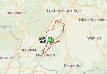
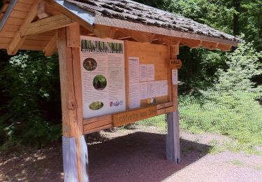
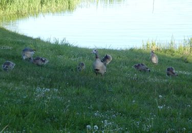
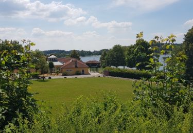
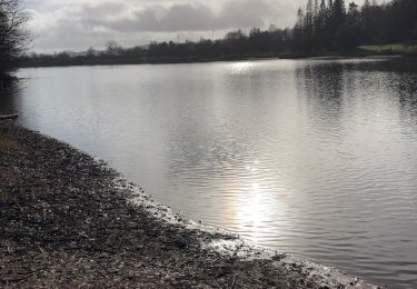
Randonnée A pied de 11,3 km à découvrir à Sarre, Landkreis Merzig-Wadern, Losheim am See. Cette randonnée est proposée par SityTrail - itinéraires balisés pédestres.
Description
Symbole: grünstichiges Foto mit transparentem weißem "OG" und weißem Schriftzug "Oppig-Grät-Weg" auf quadratischem Grund
Localisation
Pays :
Allemagne
Région :
Sarre
Département/Province :
Landkreis Merzig-Wadern
Commune :
Losheim am See
Localité :
Rimlingen
Départ:(Dec)
Départ:(UTM)
335209 ; 5483420 (32U) N.
Commentaires
Randonnées à proximité
![Randonnée A pied Losheim am See - Waldsaumweg - Photo](https://media.geolcdn.com/t/375/260/619ba0cc-99dc-401f-9234-9f002ae39ed3.jpeg&format=jpg&maxdim=2)
![A pied A pied](https://static1.geolcdn.com/sitytour/trail-icons/100.png)
Waldsaumweg
A pied
Facile
Losheim am See,
Sarre,
Landkreis Merzig-Wadern,
Allemagne
![](/images/other/stat-length.png)
10 km | 13,6 km-effort
3h 4min
![](https://static1.geolcdn.com/siteimages/upload/files/16400158638029165_repeat_loop_refresh_sync_direction_icon.png)
Oui
![Randonnée A pied Losheim am See - Tafeltour - Photo](https://media.geolcdn.com/t/375/260/8ef22c85-1d94-40b0-95aa-29761b54f676.jpeg&format=jpg&maxdim=2)
![A pied A pied](https://static1.geolcdn.com/sitytour/trail-icons/100.png)
Tafeltour
A pied
Facile
Losheim am See,
Sarre,
Landkreis Merzig-Wadern,
Allemagne
![](/images/other/stat-length.png)
9,7 km | 12,9 km-effort
2h 55min
![](https://static1.geolcdn.com/siteimages/upload/files/16400158638029165_repeat_loop_refresh_sync_direction_icon.png)
Non
![Randonnée A pied Losheim am See - Steinhauerweg - Photo](https://media.geolcdn.com/t/375/260/c399055f-d88a-4132-9ad1-7de1082fe034.jpeg&format=jpg&maxdim=2)
![A pied A pied](https://static1.geolcdn.com/sitytour/trail-icons/100.png)
Steinhauerweg
A pied
Facile
Losheim am See,
Sarre,
Landkreis Merzig-Wadern,
Allemagne
![](/images/other/stat-length.png)
10,1 km | 13,2 km-effort
3h 0min
![](https://static1.geolcdn.com/siteimages/upload/files/16400158638029165_repeat_loop_refresh_sync_direction_icon.png)
Oui
![Randonnée A pied Losheim am See - Stauseerundweg - Photo](https://media.geolcdn.com/t/375/260/6c88a7bf-e1ab-4c12-bb6b-23ceeb490663.jpeg&format=jpg&maxdim=2)
![A pied A pied](https://static1.geolcdn.com/sitytour/trail-icons/100.png)
Stauseerundweg
A pied
Facile
Losheim am See,
Sarre,
Landkreis Merzig-Wadern,
Allemagne
![](/images/other/stat-length.png)
3,8 km | 4,7 km-effort
1h 4min
![](https://static1.geolcdn.com/siteimages/upload/files/16400158638029165_repeat_loop_refresh_sync_direction_icon.png)
Oui
![Randonnée A pied Losheim am See - Schluchtenpfad - Photo](https://media.geolcdn.com/t/375/260/ext.jpg?maxdim=2&url=https%3A%2F%2Fstatic1.geolcdn.com%2Fsiteimages%2Fupload%2Ffiles%2F1545311037marcheuse_200dpi.jpg)
![A pied A pied](https://static1.geolcdn.com/sitytour/trail-icons/100.png)
Schluchtenpfad
A pied
Facile
Losheim am See,
Sarre,
Landkreis Merzig-Wadern,
Allemagne
![](/images/other/stat-length.png)
3,1 km | 4,7 km-effort
1h 3min
![](https://static1.geolcdn.com/siteimages/upload/files/16400158638029165_repeat_loop_refresh_sync_direction_icon.png)
Non
![Randonnée A pied Losheim am See - Britten tour - Photo](https://media.geolcdn.com/t/375/260/ext.jpg?maxdim=2&url=https%3A%2F%2Fservices.sitytrail.com%2FGeolivesWS%2FDownloadMedia.ashx%3FTrailID%3D1055044%26Media%3Dfix__20181011103359.jpg)
![A pied A pied](https://static1.geolcdn.com/sitytour/trail-icons/100.png)
Britten tour
A pied
Moyen
Losheim am See,
Sarre,
Landkreis Merzig-Wadern,
Allemagne
![](/images/other/stat-length.png)
17,6 km | 23 km-effort
5h 6min
![](https://static1.geolcdn.com/siteimages/upload/files/16400158638029165_repeat_loop_refresh_sync_direction_icon.png)
Oui
![Randonnée Marche Losheim am See - losheim cooll - Photo](https://media.geolcdn.com/t/375/260/ext.jpg?maxdim=2&url=https%3A%2F%2Fservices.sitytrail.com%2FGeolivesWS%2FDownloadMedia.ashx%3FTrailID%3D995313%26Media%3Dfix__20180628143609.jpg)
![Marche Marche](https://static1.geolcdn.com/sitytour/trail-icons/101.png)
losheim cooll
Marche
Très facile
Losheim am See,
Sarre,
Landkreis Merzig-Wadern,
Allemagne
![](/images/other/stat-length.png)
3,7 km | 4,6 km-effort
50min
![](https://static1.geolcdn.com/siteimages/upload/files/16400158638029165_repeat_loop_refresh_sync_direction_icon.png)
Oui
![Randonnée Marche Losheim am See - Losheim 2 - Photo](https://media.geolcdn.com/t/375/260/01a06262-95c9-4cb7-b0c5-9f6cd83b7ccc.jpg&format=jpg&maxdim=2)
![Marche Marche](https://static1.geolcdn.com/sitytour/trail-icons/101.png)
Losheim 2
Marche
Moyen
Losheim am See,
Sarre,
Landkreis Merzig-Wadern,
Allemagne
![](/images/other/stat-length.png)
6,7 km | 8,4 km-effort
1h 54min
![](https://static1.geolcdn.com/siteimages/upload/files/16400158638029165_repeat_loop_refresh_sync_direction_icon.png)
Oui
![Randonnée Marche Losheim am See - Losheim - Photo](https://media.geolcdn.com/t/375/260/ext.jpg?maxdim=2&url=https%3A%2F%2Fstatic1.geolcdn.com%2Fsiteimages%2Fupload%2Ffiles%2F1553511878bg_sport_marche.png)
![Marche Marche](https://static1.geolcdn.com/sitytour/trail-icons/101.png)
Losheim
Marche
Facile
Losheim am See,
Sarre,
Landkreis Merzig-Wadern,
Allemagne
![](/images/other/stat-length.png)
4,2 km | 5,2 km-effort
1h 10min
![](https://static1.geolcdn.com/siteimages/upload/files/16400158638029165_repeat_loop_refresh_sync_direction_icon.png)
Oui