Randonnée A pied Lonnerstadt - Rundweg Lonnerstadt L1 - Photo

Tous les sentiers balisés d’Europe PRO

© OpenStreetMap contributors
Longueur
Longueur
6,8 km
Altitude max
Altitude max
351 m
Dénivelé positif
Dénivelé positif
101 m
Km-Effort
Km-Effort  
8,1 km
Altitude min
Altitude min
272 m
Dénivelé négatif
Dénivelé négatif
101 m
Boucle
Boucle
Oui
Balise
Balise
Date de création :
2022-02-11 12:54:22.464
Dernière modification :
2022-02-11 12:54:22.464

(0 Avis)

A pied
A pied
1h50
Difficulté : Facile

Scannez ce code QR pour ouvrir la randonnée dans l'application SityTrail

Application GPS de randonnée GRATUITE

Logo SityTrail SityTrail

IGN / Instituts géographiques

Télécharger SityTrail sur l'App Store Télécharger SityTrail sur Google Play

Logo SityTrail SityTrail World

Le monde est à vous

Télécharger SityTrail sur l'App Store Télécharger SityTrail sur Google Play Télécharger SityTrail sur Huawei AppGallery

À propos

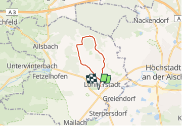
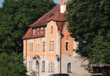
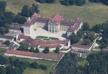
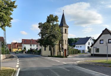
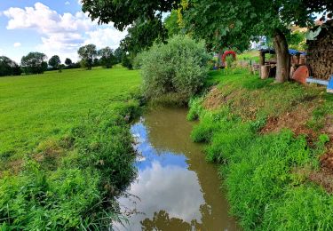
Randonnée A pied de 6,8 km à découvrir à Bavière, Landkreis Erlangen-Höchstadt, Lonnerstadt. Cette randonnée est proposée par SityTrail - itinéraires balisés pédestres.

Description

Randonnée créée par Naturfreunde Lonnerstadt und Obst- und Gartenbauverein Fetzelhofen/Ailsbach.

Symbole: Schwarzes L1 auf gelbem Hintergrund

Photos

Localisation

Pays :
Allemagne
Région :
Bavière
Département/Province :
Landkreis Erlangen-Höchstadt
Commune :
Lonnerstadt
Localité :
Unknown
Départ:(UTM)
627216 ; 5506423 (32U) N.

Randonnées à proximité

Randonnée A pied Uehlfeld - YoungGO Fitness-Parcours - Photo
A pied
PRO

A pied

Facile
Uehlfeld, Bavière, Landkreis Neustadt an der Aisch-Bad Windsheim, Allemagne
3,9 km | 4,4 km-effort
1h 0min
Oui
Randonnée A pied Uehlfeld - Kräuter-Rundweg Uehlfeld - Photo
A pied
PRO

A pied

Moyen
Uehlfeld, Bavière, Landkreis Neustadt an der Aisch-Bad Windsheim, Allemagne
23 km | 27 km-effort
6h 5min
Oui
Randonnée A pied Uehlfeld - Karpfen-Rundweg Uehlfeld - Photo
A pied
PRO

A pied

Difficile
Uehlfeld, Bavière, Landkreis Neustadt an der Aisch-Bad Windsheim, Allemagne
27 km | 31 km-effort
7h 4min
Oui
Randonnée A pied Wachenroth - Weingartsgreuth W7 - Photo
A pied
PRO

A pied

Moyen
Wachenroth, Bavière, Landkreis Erlangen-Höchstadt, Allemagne
17,6 km | 20 km-effort
4h 35min
Oui
Randonnée A pied Wachenroth - Weingartsgreuth W5 - Photo
A pied
PRO

A pied

Facile
Wachenroth, Bavière, Landkreis Erlangen-Höchstadt, Allemagne
12,8 km | 15,6 km-effort
3h 32min
Oui
Randonnée A pied Uehlfeld - Storchen-Lehrpfad Uehlfeld - Photo
A pied
PRO

A pied

Facile
Uehlfeld, Bavière, Landkreis Neustadt an der Aisch-Bad Windsheim, Allemagne
7,6 km | 8,2 km-effort
1h 51min
Oui
Randonnée A pied Lonnerstadt - Rundweg Lonnerstadt L2 - Photo
A pied
PRO

A pied

Facile
Lonnerstadt, Bavière, Landkreis Erlangen-Höchstadt, Allemagne
8,7 km | 11 km-effort
2h 30min
Oui
Randonnée A pied Wachenroth - Weingartsgreuth W6 - Photo
A pied
PRO

A pied

Facile
Wachenroth, Bavière, Landkreis Erlangen-Höchstadt, Allemagne
11,9 km | 14,5 km-effort
3h 17min
Oui
Randonnée A pied Wachenroth - Weingartsgreuth W4 - Photo
A pied
PRO

A pied

Facile
Wachenroth, Bavière, Landkreis Erlangen-Höchstadt, Allemagne
7,2 km | 8,9 km-effort
2h 1min
Oui


Fermer
Mes abonnements