![](/images/other/stat-length.png)
![Randonnée A pied Wipperfürth - Rundweg A3 (Thier) - Photo](https://media.geolcdn.com/t/1900/400/ecf46a98-97e7-400e-8213-76c15c56d211.jpeg&format=pjpeg&maxdim=2)
Rundweg A3 (Thier)
SityTrail - itinéraires balisés pédestres
Tous les sentiers balisés d’Europe GUIDE+
![Longueur](/images/other/stat-length.png)
Longueur
3,1 km
![Altitude max](https://static1.geolcdn.com/siteimages/upload/files/1508320355ic_sort_altitude_max_24dp.png)
Altitude max
317 m
![Dénivelé positif](https://static1.geolcdn.com/siteimages/upload/files/1508320355ic_sort_den_pos_24dp.png)
Dénivelé positif
27 m
![Km-Effort](/images/other/stat-length.png)
Km-Effort
3,7 km
![Altitude min](https://static1.geolcdn.com/siteimages/upload/files/1508320355ic_sort_altitude_min_24dp.png)
Altitude min
219 m
![Dénivelé négatif](https://static1.geolcdn.com/siteimages/upload/files/1508320355ic_sort_den_neg_24dp.png)
Dénivelé négatif
108 m
![Boucle](https://static1.geolcdn.com/siteimages/upload/files/16400158638029165_repeat_loop_refresh_sync_direction_icon.png)
Boucle
Non
Balise
Date de création :
2022-02-11 12:50:22.822
Dernière modification :
2022-02-11 12:50:22.822
![A pied](https://static1.geolcdn.com/sitytour/trail-icons/100.png)
50m
Difficulté : Facile
![Scannez ce code QR pour ouvrir la randonnée dans l'application SityTrail](https://capi.geolives.com/qq0zvz2zws4bq2lad0pu/sitytour/trails/3088096/qr.png?size=200)
Application GPS de randonnée GRATUITE
À propos
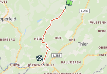
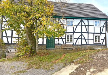
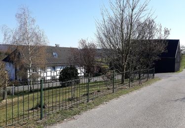
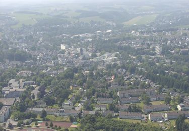
Randonnée A pied de 3,1 km à découvrir à Rhénanie-du-Nord-Westphalie, Oberbergischer Kreis, Wipperfürth. Cette randonnée est proposée par SityTrail - itinéraires balisés pédestres.
Description
Randonnée créée par Sauerländischer Gebirgsverein.
Symbole: de.sgv.a.3
Localisation
Pays :
Allemagne
Région :
Rhénanie-du-Nord-Westphalie
Département/Province :
Oberbergischer Kreis
Commune :
Wipperfürth
Localité :
Unknown
Départ:(Dec)
Départ:(UTM)
385119 ; 5661378 (32U) N.
Commentaires
Randonnées à proximité
![Randonnée A pied Wipperfürth - Heimatweg - Photo](https://media.geolcdn.com/t/375/260/f6c0b015-5c5d-44af-a16e-7121d1677e25.jpeg&format=jpg&maxdim=2)
![A pied A pied](https://static1.geolcdn.com/sitytour/trail-icons/100.png)
Heimatweg
A pied
Facile
Wipperfürth,
Rhénanie-du-Nord-Westphalie,
Oberbergischer Kreis,
Allemagne
![](/images/other/stat-length.png)
10,9 km | 13,5 km-effort
3h 3min
![](https://static1.geolcdn.com/siteimages/upload/files/16400158638029165_repeat_loop_refresh_sync_direction_icon.png)
Oui
![Randonnée A pied Wipperfürth - [=] Ortsweg Wipperfürth—Oberschwarzen - Photo](https://media.geolcdn.com/t/375/260/15a12a35-21ff-4f4d-a60c-1d674dbfb2a2.jpeg&format=jpg&maxdim=2)
![A pied A pied](https://static1.geolcdn.com/sitytour/trail-icons/100.png)
[=] Ortsweg Wipperfürth—Oberschwarzen
A pied
Facile
Wipperfürth,
Rhénanie-du-Nord-Westphalie,
Oberbergischer Kreis,
Allemagne
![](/images/other/stat-length.png)
6,4 km | 8,3 km-effort
1h 53min
![](https://static1.geolcdn.com/siteimages/upload/files/16400158638029165_repeat_loop_refresh_sync_direction_icon.png)
Non
![Randonnée A pied Wipperfürth - Wipperfeld Rundweg A2 - Photo](https://media.geolcdn.com/t/375/260/4ce4eb44-ba42-4569-8f0e-5ead863e28b5.jpeg&format=jpg&maxdim=2)
![A pied A pied](https://static1.geolcdn.com/sitytour/trail-icons/100.png)
Wipperfeld Rundweg A2
A pied
Facile
Wipperfürth,
Rhénanie-du-Nord-Westphalie,
Oberbergischer Kreis,
Allemagne
![](/images/other/stat-length.png)
4,2 km | 6 km-effort
1h 21min
![](https://static1.geolcdn.com/siteimages/upload/files/16400158638029165_repeat_loop_refresh_sync_direction_icon.png)
Oui
![Randonnée A pied Wipperfürth - Rundweg A1 (Wipperfeld) - Photo](https://media.geolcdn.com/t/375/260/39d47986-19f9-4fbd-8a40-ddc944e5ce87.jpeg&format=jpg&maxdim=2)
![A pied A pied](https://static1.geolcdn.com/sitytour/trail-icons/100.png)
Rundweg A1 (Wipperfeld)
A pied
Facile
Wipperfürth,
Rhénanie-du-Nord-Westphalie,
Oberbergischer Kreis,
Allemagne
![](/images/other/stat-length.png)
3,9 km | 5,1 km-effort
1h 10min
![](https://static1.geolcdn.com/siteimages/upload/files/16400158638029165_repeat_loop_refresh_sync_direction_icon.png)
Oui
![Randonnée A pied Wipperfürth - Rundweg A4 (Wipperfeld) - Photo](https://media.geolcdn.com/t/375/260/4ce4eb44-ba42-4569-8f0e-5ead863e28b5.jpeg&format=jpg&maxdim=2)
![A pied A pied](https://static1.geolcdn.com/sitytour/trail-icons/100.png)
Rundweg A4 (Wipperfeld)
A pied
Moyen
Wipperfürth,
Rhénanie-du-Nord-Westphalie,
Oberbergischer Kreis,
Allemagne
![](/images/other/stat-length.png)
21 km | 27 km-effort
6h 7min
![](https://static1.geolcdn.com/siteimages/upload/files/16400158638029165_repeat_loop_refresh_sync_direction_icon.png)
Oui
![Randonnée A pied Wipperfürth - Rundweg A3 (Wipperfeld) - Photo](https://media.geolcdn.com/t/375/260/4ce4eb44-ba42-4569-8f0e-5ead863e28b5.jpeg&format=jpg&maxdim=2)
![A pied A pied](https://static1.geolcdn.com/sitytour/trail-icons/100.png)
Rundweg A3 (Wipperfeld)
A pied
Facile
Wipperfürth,
Rhénanie-du-Nord-Westphalie,
Oberbergischer Kreis,
Allemagne
![](/images/other/stat-length.png)
7,9 km | 10,4 km-effort
2h 22min
![](https://static1.geolcdn.com/siteimages/upload/files/16400158638029165_repeat_loop_refresh_sync_direction_icon.png)
Oui
![Randonnée A pied Wipperfürth - (T) Rund um Thier - Photo](https://media.geolcdn.com/t/375/260/cefcb4db-4163-450d-8300-2a9b01cb29e1.jpeg&format=jpg&maxdim=2)
![A pied A pied](https://static1.geolcdn.com/sitytour/trail-icons/100.png)
(T) Rund um Thier
A pied
Moyen
Wipperfürth,
Rhénanie-du-Nord-Westphalie,
Oberbergischer Kreis,
Allemagne
![](/images/other/stat-length.png)
17,1 km | 22 km-effort
5h 3min
![](https://static1.geolcdn.com/siteimages/upload/files/16400158638029165_repeat_loop_refresh_sync_direction_icon.png)
Oui
![Randonnée A pied Kürten - (K) Rund um Kürten - Photo](https://media.geolcdn.com/t/375/260/3924b498-e722-4aa9-8adb-27c6224fc514.jpeg&format=jpg&maxdim=2)
![A pied A pied](https://static1.geolcdn.com/sitytour/trail-icons/100.png)
(K) Rund um Kürten
A pied
Moyen
Kürten,
Rhénanie-du-Nord-Westphalie,
Rheinisch-Bergischer Kreis,
Allemagne
![](/images/other/stat-length.png)
22 km | 27 km-effort
6h 12min
![](https://static1.geolcdn.com/siteimages/upload/files/16400158638029165_repeat_loop_refresh_sync_direction_icon.png)
Non
![Randonnée A pied Wipperfürth - Milchweg - Photo](https://media.geolcdn.com/t/375/260/e3c9ca57-9d23-4c29-82f9-74cf0258543a.jpeg&format=jpg&maxdim=2)
![A pied A pied](https://static1.geolcdn.com/sitytour/trail-icons/100.png)
Milchweg
A pied
Facile
Wipperfürth,
Rhénanie-du-Nord-Westphalie,
Oberbergischer Kreis,
Allemagne
![](/images/other/stat-length.png)
4,2 km | 5,2 km-effort
1h 10min
![](https://static1.geolcdn.com/siteimages/upload/files/16400158638029165_repeat_loop_refresh_sync_direction_icon.png)
Oui