


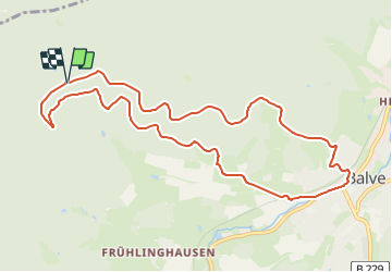

8,6 km | 12,3 km-effort

Tous les sentiers balisés d’Europe GUIDE+


Application GPS de randonnée GRATUITE
 SityTrail
IGN / Instituts géographiques
SityTrail World
Le monde est à vous
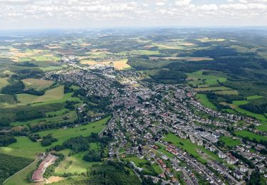
Randonnée A pied de 9,8 km à découvrir à Rhénanie-du-Nord-Westphalie, Märkischer Kreis, Balve. Cette randonnée est proposée par SityTrail - itinéraires balisés pédestres.
Randonnée créée par Sauerländischer Gebirgsverein.
Symbole: Weiße A0 auf schwarzem Grund


A pied
![Randonnée A pied Hemer - [H1] Stadtnahe Sehenswürdigkeiten - Photo](https://media.geolcdn.com/t/375/260/388a4628-6cb4-4a59-aa4f-6d48a6c59b6d.jpeg&format=jpg&maxdim=2)
A pied
![Randonnée A pied Hemer - [A8] Felsenmeer - Photo](https://media.geolcdn.com/t/375/260/54ab6f43-f8f1-42b9-8012-5d5c87338ae6.jpeg&format=jpg&maxdim=2)
A pied
A pied
A pied
A pied

A pied
A pied
A pied