![](/images/other/stat-length.png)
![Randonnée A pied Igersheim - Rundwanderweg Igersheim 51 - Photo](https://media.geolcdn.com/t/1900/400/a6ff97eb-042a-477c-bdbf-39604203cbf6.jpeg&format=pjpeg&maxdim=2)
Rundwanderweg Igersheim 51
SityTrail - itinéraires balisés pédestres
Tous les sentiers balisés d’Europe GUIDE+
![Longueur](/images/other/stat-length.png)
Longueur
10,9 km
![Altitude max](https://static1.geolcdn.com/siteimages/upload/files/1508320355ic_sort_altitude_max_24dp.png)
Altitude max
373 m
![Dénivelé positif](https://static1.geolcdn.com/siteimages/upload/files/1508320355ic_sort_den_pos_24dp.png)
Dénivelé positif
254 m
![Km-Effort](/images/other/stat-length.png)
Km-Effort
14,2 km
![Altitude min](https://static1.geolcdn.com/siteimages/upload/files/1508320355ic_sort_altitude_min_24dp.png)
Altitude min
213 m
![Dénivelé négatif](https://static1.geolcdn.com/siteimages/upload/files/1508320355ic_sort_den_neg_24dp.png)
Dénivelé négatif
249 m
![Boucle](https://static1.geolcdn.com/siteimages/upload/files/16400158638029165_repeat_loop_refresh_sync_direction_icon.png)
Boucle
Oui
Balise
Date de création :
2022-02-11 12:49:05.741
Dernière modification :
2022-02-11 12:49:05.741
![A pied](https://static1.geolcdn.com/sitytour/trail-icons/100.png)
3h14
Difficulté : Facile
![Scannez ce code QR pour ouvrir la randonnée dans l'application SityTrail](https://capi.geolives.com/qq0zvz2zws4bq2lad0pu/sitytour/trails/3088026/qr.png?size=200)
Application GPS de randonnée GRATUITE
À propos
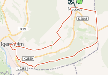
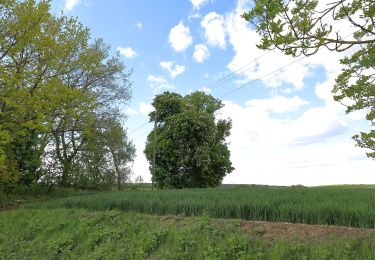
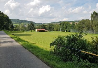
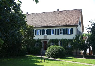
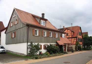
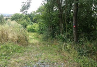
Randonnée A pied de 10,9 km à découvrir à Bade-Wurtemberg, Main-Tauber-Kreis, Igersheim. Cette randonnée est proposée par SityTrail - itinéraires balisés pédestres.
Description
Symbole: Gelbes Schild mit schwarzer 51 (Zusatz Gemeinde Igersheim)
Localisation
Pays :
Allemagne
Région :
Bade-Wurtemberg
Département/Province :
Main-Tauber-Kreis
Commune :
Igersheim
Localité :
Unknown
Départ:(Dec)
Départ:(UTM)
561839 ; 5484165 (32U) N.
Commentaires
Randonnées à proximité
![Randonnée A pied Bad Mergentheim - Schönbühler Weg - Photo](https://media.geolcdn.com/t/375/260/da5b207a-d0e2-49f4-b0c6-3d058584c401.jpeg&format=jpg&maxdim=2)
![A pied A pied](https://static1.geolcdn.com/sitytour/trail-icons/100.png)
Schönbühler Weg
A pied
Moyen
Bad Mergentheim,
Bade-Wurtemberg,
Main-Tauber-Kreis,
Allemagne
![](/images/other/stat-length.png)
16 km | 20 km-effort
4h 37min
![](https://static1.geolcdn.com/siteimages/upload/files/16400158638029165_repeat_loop_refresh_sync_direction_icon.png)
Oui
![Randonnée A pied Bad Mergentheim - Weikersheimer Weg - Photo](https://media.geolcdn.com/t/375/260/882dc426-5f95-4c71-976a-4b59a79eb649.jpeg&format=jpg&maxdim=2)
![A pied A pied](https://static1.geolcdn.com/sitytour/trail-icons/100.png)
Weikersheimer Weg
A pied
Facile
Bad Mergentheim,
Bade-Wurtemberg,
Main-Tauber-Kreis,
Allemagne
![](/images/other/stat-length.png)
3,9 km | 5,1 km-effort
1h 9min
![](https://static1.geolcdn.com/siteimages/upload/files/16400158638029165_repeat_loop_refresh_sync_direction_icon.png)
Non
![Randonnée A pied Bad Mergentheim - Sailbergweg - Photo](https://media.geolcdn.com/t/375/260/ce9a6ca9-6618-4ea0-ae55-4602c7541285.jpeg&format=jpg&maxdim=2)
![A pied A pied](https://static1.geolcdn.com/sitytour/trail-icons/100.png)
Sailbergweg
A pied
Facile
Bad Mergentheim,
Bade-Wurtemberg,
Main-Tauber-Kreis,
Allemagne
![](/images/other/stat-length.png)
5,4 km | 7,4 km-effort
1h 40min
![](https://static1.geolcdn.com/siteimages/upload/files/16400158638029165_repeat_loop_refresh_sync_direction_icon.png)
Oui
![Randonnée A pied Igersheim - Rundwanderweg Igersheim 56 - Photo](https://media.geolcdn.com/t/375/260/b1bffefa-cfc6-4b09-8649-35eb87e06b00.jpeg&format=jpg&maxdim=2)
![A pied A pied](https://static1.geolcdn.com/sitytour/trail-icons/100.png)
Rundwanderweg Igersheim 56
A pied
Facile
Igersheim,
Bade-Wurtemberg,
Main-Tauber-Kreis,
Allemagne
![](/images/other/stat-length.png)
8,2 km | 9,9 km-effort
2h 15min
![](https://static1.geolcdn.com/siteimages/upload/files/16400158638029165_repeat_loop_refresh_sync_direction_icon.png)
Non
![Randonnée A pied Igersheim - Rundwanderweg Igersheim 54 - Photo](https://media.geolcdn.com/t/375/260/b7c8e323-a5fc-46ba-bcb0-9eece59fa630.jpeg&format=jpg&maxdim=2)
![A pied A pied](https://static1.geolcdn.com/sitytour/trail-icons/100.png)
Rundwanderweg Igersheim 54
A pied
Facile
Igersheim,
Bade-Wurtemberg,
Main-Tauber-Kreis,
Allemagne
![](/images/other/stat-length.png)
9,1 km | 11,5 km-effort
2h 36min
![](https://static1.geolcdn.com/siteimages/upload/files/16400158638029165_repeat_loop_refresh_sync_direction_icon.png)
Oui
![Randonnée A pied Igersheim - Rundwanderweg Igersheim 52 - Photo](https://media.geolcdn.com/t/375/260/b7c8e323-a5fc-46ba-bcb0-9eece59fa630.jpeg&format=jpg&maxdim=2)
![A pied A pied](https://static1.geolcdn.com/sitytour/trail-icons/100.png)
Rundwanderweg Igersheim 52
A pied
Facile
Igersheim,
Bade-Wurtemberg,
Main-Tauber-Kreis,
Allemagne
![](/images/other/stat-length.png)
9,2 km | 12,2 km-effort
2h 46min
![](https://static1.geolcdn.com/siteimages/upload/files/16400158638029165_repeat_loop_refresh_sync_direction_icon.png)
Oui
![Randonnée A pied Weikersheim - Nassauer See - Photo](https://media.geolcdn.com/t/375/260/0b4661f4-a576-40fb-9fb1-572b6865d608.jpeg&format=jpg&maxdim=2)
![A pied A pied](https://static1.geolcdn.com/sitytour/trail-icons/100.png)
Nassauer See
A pied
Facile
Weikersheim,
Bade-Wurtemberg,
Main-Tauber-Kreis,
Allemagne
![](/images/other/stat-length.png)
7,1 km | 9,2 km-effort
2h 5min
![](https://static1.geolcdn.com/siteimages/upload/files/16400158638029165_repeat_loop_refresh_sync_direction_icon.png)
Non
![Randonnée A pied Weikersheim - Rundwanderweg Schäftersheim - Photo](https://media.geolcdn.com/t/375/260/7fae043b-ecae-4cb3-9642-d6becbbe31e1.jpeg&format=jpg&maxdim=2)
![A pied A pied](https://static1.geolcdn.com/sitytour/trail-icons/100.png)
Rundwanderweg Schäftersheim
A pied
Facile
Weikersheim,
Bade-Wurtemberg,
Main-Tauber-Kreis,
Allemagne
![](/images/other/stat-length.png)
3 km | 4,1 km-effort
56min
![](https://static1.geolcdn.com/siteimages/upload/files/16400158638029165_repeat_loop_refresh_sync_direction_icon.png)
Non
![Randonnée A pied Weikersheim - Teufelstal bei Elpersheim - Photo](https://media.geolcdn.com/t/375/260/18ada7a3-7146-4cba-842c-92200f24b0ca.jpeg&format=jpg&maxdim=2)
![A pied A pied](https://static1.geolcdn.com/sitytour/trail-icons/100.png)
Teufelstal bei Elpersheim
A pied
Facile
Weikersheim,
Bade-Wurtemberg,
Main-Tauber-Kreis,
Allemagne
![](/images/other/stat-length.png)
4,6 km | 6,6 km-effort
1h 29min
![](https://static1.geolcdn.com/siteimages/upload/files/16400158638029165_repeat_loop_refresh_sync_direction_icon.png)
Non