![](/images/other/stat-length.png)
![Randonnée A pied Hürtgenwald - Ardbinna Wanderweg - Photo](https://media.geolcdn.com/t/1900/400/3b800557-aad4-4aa3-bd05-7d61934bffea.jpeg&format=pjpeg&maxdim=2)
Ardbinna Wanderweg
SityTrail - itinéraires balisés pédestres
Tous les sentiers balisés d’Europe GUIDE+
![Longueur](/images/other/stat-length.png)
![Altitude max](https://static1.geolcdn.com/siteimages/upload/files/1508320355ic_sort_altitude_max_24dp.png)
![Dénivelé positif](https://static1.geolcdn.com/siteimages/upload/files/1508320355ic_sort_den_pos_24dp.png)
![Km-Effort](/images/other/stat-length.png)
![Altitude min](https://static1.geolcdn.com/siteimages/upload/files/1508320355ic_sort_altitude_min_24dp.png)
![Dénivelé négatif](https://static1.geolcdn.com/siteimages/upload/files/1508320355ic_sort_den_neg_24dp.png)
![Boucle](https://static1.geolcdn.com/siteimages/upload/files/16400158638029165_repeat_loop_refresh_sync_direction_icon.png)
![A pied](https://static1.geolcdn.com/sitytour/trail-icons/100.png)
6h05
Difficulté : Moyen
![Scannez ce code QR pour ouvrir la randonnée dans l'application SityTrail](https://capi.geolives.com/qq0zvz2zws4bq2lad0pu/sitytour/trails/3088017/qr.png?size=200)
Application GPS de randonnée GRATUITE
À propos
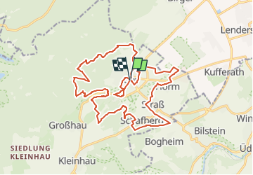
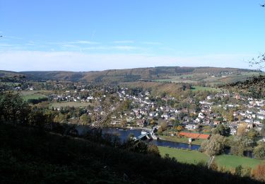
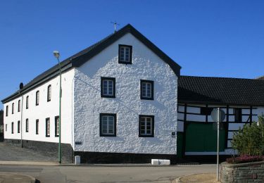
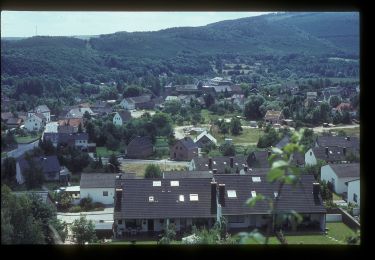
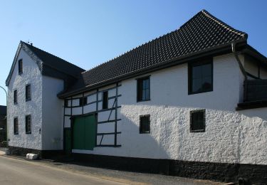
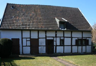
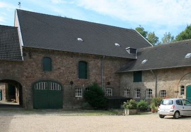
Randonnée A pied de 21 km à découvrir à Rhénanie-du-Nord-Westphalie, Kreis Düren, Hürtgenwald. Cette randonnée est proposée par SityTrail - itinéraires balisés pédestres.
Description
Randonnée créée par Heimat- Wander- und Verkehrsverein Gey-Straß e.V..
HWV Gey-Straß Lodda // bitte in OSM-Wiki Hinweise zum taggen der Wanderwege berücksichtigen mfG tippeltappel
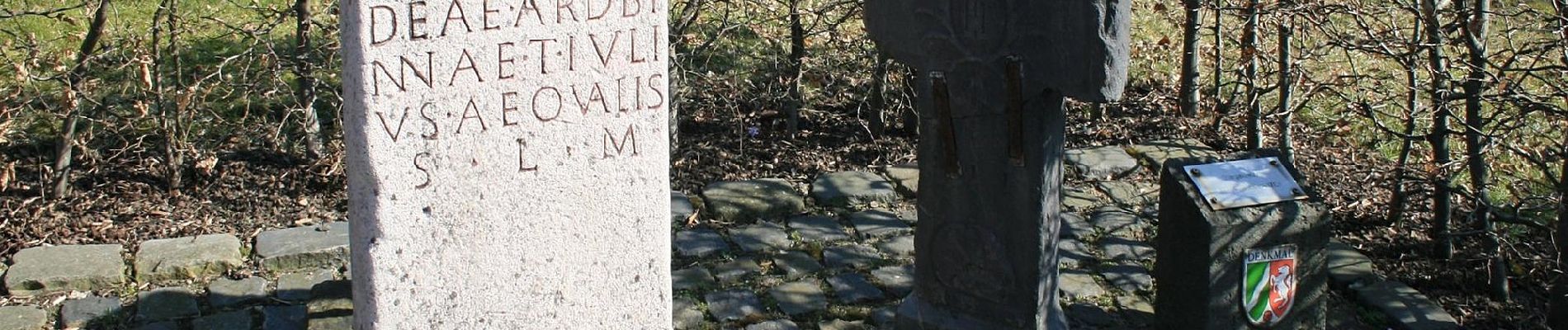
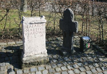
Symbole: schwarze 04 auf weißem Grund
Localisation
Commentaires
Randonnées à proximité
![Randonnée A pied Hürtgenwald - Hochwaldweg - Photo](https://media.geolcdn.com/t/375/260/3b800557-aad4-4aa3-bd05-7d61934bffea.jpeg&format=jpg&maxdim=2)
![A pied A pied](https://static1.geolcdn.com/sitytour/trail-icons/100.png)
A pied
![](/images/other/stat-length.png)
![](https://static1.geolcdn.com/siteimages/upload/files/16400158638029165_repeat_loop_refresh_sync_direction_icon.png)
![Randonnée A pied Hürtgenwald - An der Gieschhardt - Photo](https://media.geolcdn.com/t/375/260/db32e5f9-63c8-4790-8701-1de9e82b7122.jpeg&format=jpg&maxdim=2)
![A pied A pied](https://static1.geolcdn.com/sitytour/trail-icons/100.png)
A pied
![](/images/other/stat-length.png)
![](https://static1.geolcdn.com/siteimages/upload/files/16400158638029165_repeat_loop_refresh_sync_direction_icon.png)
![Randonnée A pied Langerwehe - Schlich Rundweg 71 - Photo](https://media.geolcdn.com/t/375/260/466cb838-894a-4cc5-b608-7394d42b1dd5.jpeg&format=jpg&maxdim=2)
![A pied A pied](https://static1.geolcdn.com/sitytour/trail-icons/100.png)
A pied
![](/images/other/stat-length.png)
![](https://static1.geolcdn.com/siteimages/upload/files/16400158638029165_repeat_loop_refresh_sync_direction_icon.png)
![Randonnée A pied Kreuzau - Wassererlebnispfad Kreuzau - Photo](https://media.geolcdn.com/t/375/260/9bf1ce93-842d-4e9f-9703-efef2e7639e3.jpeg&format=jpg&maxdim=2)
![A pied A pied](https://static1.geolcdn.com/sitytour/trail-icons/100.png)
A pied
![](/images/other/stat-length.png)
![](https://static1.geolcdn.com/siteimages/upload/files/16400158638029165_repeat_loop_refresh_sync_direction_icon.png)
![Randonnée A pied Langerwehe - Schlich Rundweg 61 - Photo](https://media.geolcdn.com/t/375/260/aff25654-5f90-4498-ab70-279cf19c150e.jpeg&format=jpg&maxdim=2)
![A pied A pied](https://static1.geolcdn.com/sitytour/trail-icons/100.png)
A pied
![](/images/other/stat-length.png)
![](https://static1.geolcdn.com/siteimages/upload/files/16400158638029165_repeat_loop_refresh_sync_direction_icon.png)
![Randonnée A pied Kreuzau - Panoramaweg West - Photo](https://media.geolcdn.com/t/375/260/db32e5f9-63c8-4790-8701-1de9e82b7122.jpeg&format=jpg&maxdim=2)
![A pied A pied](https://static1.geolcdn.com/sitytour/trail-icons/100.png)
A pied
![](/images/other/stat-length.png)
![](https://static1.geolcdn.com/siteimages/upload/files/16400158638029165_repeat_loop_refresh_sync_direction_icon.png)
![Randonnée A pied Hürtgenwald - Wanderweg Thönbach 34 - Photo](https://media.geolcdn.com/t/375/260/9bc94237-0fad-47c8-a017-34018f08c3da.jpeg&format=jpg&maxdim=2)
![A pied A pied](https://static1.geolcdn.com/sitytour/trail-icons/100.png)
A pied
![](/images/other/stat-length.png)
![](https://static1.geolcdn.com/siteimages/upload/files/16400158638029165_repeat_loop_refresh_sync_direction_icon.png)
![Randonnée A pied Kreuzau - Rundweg Wv3 - Photo](https://media.geolcdn.com/t/375/260/c9da91dc-7d66-4f8c-a0cb-a1d1c9823f75.jpeg&format=jpg&maxdim=2)
![A pied A pied](https://static1.geolcdn.com/sitytour/trail-icons/100.png)
A pied
![](/images/other/stat-length.png)
![](https://static1.geolcdn.com/siteimages/upload/files/16400158638029165_repeat_loop_refresh_sync_direction_icon.png)
![Randonnée A pied Hürtgenwald - Hemingway-Trail - Photo](https://media.geolcdn.com/t/375/260/9bc94237-0fad-47c8-a017-34018f08c3da.jpeg&format=jpg&maxdim=2)
![A pied A pied](https://static1.geolcdn.com/sitytour/trail-icons/100.png)
A pied
![](/images/other/stat-length.png)
![](https://static1.geolcdn.com/siteimages/upload/files/16400158638029165_repeat_loop_refresh_sync_direction_icon.png)