![](/images/other/stat-length.png)
![Randonnée A pied Leichlingen - [Balken] Naturfreundehaus Leichlingen - SG Schaberg - Photo](https://media.geolcdn.com/t/1900/400/ext.pjpeg?maxdim=2&url=https%3A%2F%2Fstatic1.geolcdn.com%2Fsiteimages%2Fupload%2Ffiles%2F1545311037marcheuse_200dpi.jpg)
[Balken] Naturfreundehaus Leichlingen - SG Schaberg
SityTrail - itinéraires balisés pédestres
Tous les sentiers balisés d’Europe GUIDE+
![Longueur](/images/other/stat-length.png)
Longueur
16,9 km
![Altitude max](https://static1.geolcdn.com/siteimages/upload/files/1508320355ic_sort_altitude_max_24dp.png)
Altitude max
258 m
![Dénivelé positif](https://static1.geolcdn.com/siteimages/upload/files/1508320355ic_sort_den_pos_24dp.png)
Dénivelé positif
439 m
![Km-Effort](/images/other/stat-length.png)
Km-Effort
22 km
![Altitude min](https://static1.geolcdn.com/siteimages/upload/files/1508320355ic_sort_altitude_min_24dp.png)
Altitude min
66 m
![Dénivelé négatif](https://static1.geolcdn.com/siteimages/upload/files/1508320355ic_sort_den_neg_24dp.png)
Dénivelé négatif
310 m
![Boucle](https://static1.geolcdn.com/siteimages/upload/files/16400158638029165_repeat_loop_refresh_sync_direction_icon.png)
Boucle
Non
Balise
Date de création :
2022-02-11 12:45:52.857
Dernière modification :
2022-02-11 12:45:52.857
![A pied](https://static1.geolcdn.com/sitytour/trail-icons/100.png)
5h03
Difficulté : Moyen
![Scannez ce code QR pour ouvrir la randonnée dans l'application SityTrail](https://capi.geolives.com/qq0zvz2zws4bq2lad0pu/sitytour/trails/3087779/qr.png?size=200)
Application GPS de randonnée GRATUITE
À propos
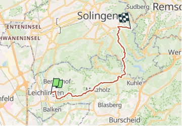
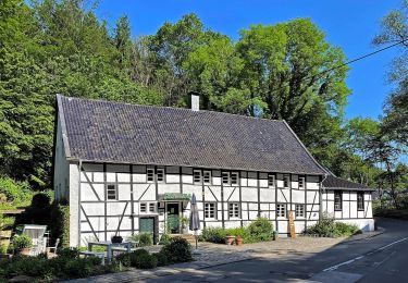
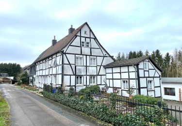
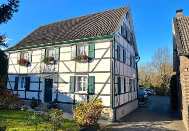
Randonnée A pied de 16,9 km à découvrir à Rhénanie-du-Nord-Westphalie, Rheinisch-Bergischer Kreis, Leichlingen. Cette randonnée est proposée par SityTrail - itinéraires balisés pédestres.
Description
Randonnée créée par Sauerländischer Gebirgsverein.
Symbole: Balken
Localisation
Pays :
Allemagne
Région :
Rhénanie-du-Nord-Westphalie
Département/Province :
Rheinisch-Bergischer Kreis
Commune :
Leichlingen
Localité :
Unknown
Départ:(Dec)
Départ:(UTM)
361471 ; 5663292 (32U) N.
Commentaires
Randonnées à proximité
![Randonnée A pied - Obstweg Solingen - Photo](https://media.geolcdn.com/t/375/260/c552bb09-1f68-45fa-8083-6c84c99407c7.jpeg&format=jpg&maxdim=2)
![A pied A pied](https://static1.geolcdn.com/sitytour/trail-icons/100.png)
Obstweg Solingen
A pied
Facile
,
Rhénanie-du-Nord-Westphalie,
Solingen,
Allemagne
![](/images/other/stat-length.png)
4,8 km | 6,7 km-effort
1h 31min
![](https://static1.geolcdn.com/siteimages/upload/files/16400158638029165_repeat_loop_refresh_sync_direction_icon.png)
Oui
![Randonnée A pied - Erlebnisweg Wupper - Photo](https://media.geolcdn.com/t/375/260/c552bb09-1f68-45fa-8083-6c84c99407c7.jpeg&format=jpg&maxdim=2)
![A pied A pied](https://static1.geolcdn.com/sitytour/trail-icons/100.png)
Erlebnisweg Wupper
A pied
Facile
,
Rhénanie-du-Nord-Westphalie,
Solingen,
Allemagne
![](/images/other/stat-length.png)
5,9 km | 7,1 km-effort
1h 36min
![](https://static1.geolcdn.com/siteimages/upload/files/16400158638029165_repeat_loop_refresh_sync_direction_icon.png)
Non
![Randonnée A pied - Odenthaler Weg Rundweg A2 - Photo](https://media.geolcdn.com/t/375/260/92ae7591-38bc-441d-bb93-8e0fbf6e4b4f.jpeg&format=jpg&maxdim=2)
![A pied A pied](https://static1.geolcdn.com/sitytour/trail-icons/100.png)
Odenthaler Weg Rundweg A2
A pied
Facile
,
Rhénanie-du-Nord-Westphalie,
Solingen,
Allemagne
![](/images/other/stat-length.png)
6,5 km | 9,2 km-effort
2h 5min
![](https://static1.geolcdn.com/siteimages/upload/files/16400158638029165_repeat_loop_refresh_sync_direction_icon.png)
Oui
![Randonnée A pied Leichlingen - Obstweg Leichlingen - Photo](https://media.geolcdn.com/t/375/260/c552bb09-1f68-45fa-8083-6c84c99407c7.jpeg&format=jpg&maxdim=2)
![A pied A pied](https://static1.geolcdn.com/sitytour/trail-icons/100.png)
Obstweg Leichlingen
A pied
Facile
Leichlingen,
Rhénanie-du-Nord-Westphalie,
Rheinisch-Bergischer Kreis,
Allemagne
![](/images/other/stat-length.png)
8,6 km | 11,3 km-effort
2h 34min
![](https://static1.geolcdn.com/siteimages/upload/files/16400158638029165_repeat_loop_refresh_sync_direction_icon.png)
Non
![Randonnée A pied - Friedrichsaue Rundweg A2 - Photo](https://media.geolcdn.com/t/375/260/c552bb09-1f68-45fa-8083-6c84c99407c7.jpeg&format=jpg&maxdim=2)
![A pied A pied](https://static1.geolcdn.com/sitytour/trail-icons/100.png)
Friedrichsaue Rundweg A2
A pied
Facile
,
Rhénanie-du-Nord-Westphalie,
Solingen,
Allemagne
![](/images/other/stat-length.png)
6,9 km | 9,3 km-effort
2h 6min
![](https://static1.geolcdn.com/siteimages/upload/files/16400158638029165_repeat_loop_refresh_sync_direction_icon.png)
Oui
![Randonnée A pied - Aufderhöhe Rundweg A2 - Photo](https://media.geolcdn.com/t/375/260/cc2f3b22-f615-47d4-b883-1cd0d96c59ab.jpeg&format=jpg&maxdim=2)
![A pied A pied](https://static1.geolcdn.com/sitytour/trail-icons/100.png)
Aufderhöhe Rundweg A2
A pied
Facile
,
Rhénanie-du-Nord-Westphalie,
Solingen,
Allemagne
![](/images/other/stat-length.png)
8 km | 10,1 km-effort
2h 17min
![](https://static1.geolcdn.com/siteimages/upload/files/16400158638029165_repeat_loop_refresh_sync_direction_icon.png)
Oui
![Randonnée A pied - Aufderhöhe Rundweg A1 - Photo](https://media.geolcdn.com/t/375/260/7f0e7e7a-6fb2-4a38-8cef-5ab2cad84ec7.jpeg&format=jpg&maxdim=2)
![A pied A pied](https://static1.geolcdn.com/sitytour/trail-icons/100.png)
Aufderhöhe Rundweg A1
A pied
Facile
,
Rhénanie-du-Nord-Westphalie,
Solingen,
Allemagne
![](/images/other/stat-length.png)
5,9 km | 6,9 km-effort
1h 34min
![](https://static1.geolcdn.com/siteimages/upload/files/16400158638029165_repeat_loop_refresh_sync_direction_icon.png)
Oui
![Randonnée A pied Leichlingen - Weltersbachtal Rundweg A2 - Photo](https://media.geolcdn.com/t/375/260/062cb71c-bb6f-4b1d-b073-db90087cbcd1.jpeg&format=jpg&maxdim=2)
![A pied A pied](https://static1.geolcdn.com/sitytour/trail-icons/100.png)
Weltersbachtal Rundweg A2
A pied
Facile
Leichlingen,
Rhénanie-du-Nord-Westphalie,
Rheinisch-Bergischer Kreis,
Allemagne
![](/images/other/stat-length.png)
5,8 km | 7 km-effort
1h 35min
![](https://static1.geolcdn.com/siteimages/upload/files/16400158638029165_repeat_loop_refresh_sync_direction_icon.png)
Oui
![Randonnée A pied Inconnu - Bergisch-Neukirchen Rundweg A8 - Photo](https://media.geolcdn.com/t/375/260/1c9f756c-9f0a-4258-a5eb-501dc87f2896.jpeg&format=jpg&maxdim=2)
![A pied A pied](https://static1.geolcdn.com/sitytour/trail-icons/100.png)
Bergisch-Neukirchen Rundweg A8
A pied
Facile
Inconnu,
Rhénanie-du-Nord-Westphalie,
Leverkusen,
Allemagne
![](/images/other/stat-length.png)
3,9 km | 4,7 km-effort
1h 3min
![](https://static1.geolcdn.com/siteimages/upload/files/16400158638029165_repeat_loop_refresh_sync_direction_icon.png)
Non