


12,4 km | 15,7 km-effort
![Randonnée A pied Inconnu - [Dreieck] Benrath-Eller - Photo](https://media.geolcdn.com/t/1900/400/266731a8-fd1a-456f-89bb-c5c7ffea0328.jpeg&format=pjpeg&maxdim=2)

Tous les sentiers balisés d’Europe GUIDE+


Application GPS de randonnée GRATUITE
 SityTrail
IGN / Instituts géographiques
SityTrail World
Le monde est à vous
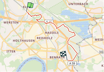
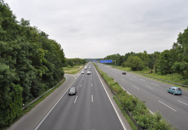
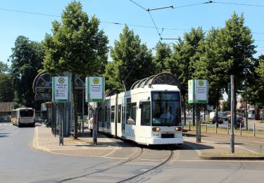
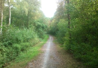
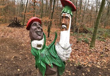
Randonnée A pied de 10,3 km à découvrir à Rhénanie-du-Nord-Westphalie, Düsseldorf, Inconnu. Cette randonnée est proposée par SityTrail - itinéraires balisés pédestres.
Randonnée créée par Sauerländischer Gebirgsverein.
Symbole: weißes Dreieck (ungefüllt) auf schwarzem Grund (Delta)
Site web: https://sgv-duesseldorf.de/
![Randonnée A pied Inconnu - [Dreieck] Benrath-Eller - Photo 1](https://media.geolcdn.com/t/2048/auto/ba02b21a-a5dc-4cca-a100-e149ec22280e.jpeg&format=jpg&maxdim=0 "Randonnée A pied Inconnu - [Dreieck] Benrath-Eller - Photo 1")
![Randonnée A pied Inconnu - [Dreieck] Benrath-Eller - Photo 2](https://media.geolcdn.com/t/2048/auto/88850d8d-abe6-4da8-8c94-33a60c848a64.jpeg&format=jpg&maxdim=0 "Randonnée A pied Inconnu - [Dreieck] Benrath-Eller - Photo 2")
![Randonnée A pied Inconnu - [Dreieck] Benrath-Eller - Photo 3](https://media.geolcdn.com/t/2048/auto/10e16d0e-8ce8-4e1d-8043-3b04e65e5f7d.jpeg&format=jpg&maxdim=0 "Randonnée A pied Inconnu - [Dreieck] Benrath-Eller - Photo 3")
![Randonnée A pied Inconnu - [Dreieck] Benrath-Eller - Photo 4](https://media.geolcdn.com/t/2048/auto/1aa9b511-1000-4820-b6ee-9bd33c2b68e4.jpeg&format=jpg&maxdim=0 "Randonnée A pied Inconnu - [Dreieck] Benrath-Eller - Photo 4")
![Randonnée A pied Inconnu - [Dreieck] Benrath-Eller - Photo 5](https://media.geolcdn.com/t/2048/auto/ce53915b-386d-4e2e-b1ef-4d912d5b07ad.jpeg&format=jpg&maxdim=0 "Randonnée A pied Inconnu - [Dreieck] Benrath-Eller - Photo 5")
![Randonnée A pied Inconnu - [Dreieck] Benrath-Eller - Photo 6](https://media.geolcdn.com/t/2048/auto/65ae5825-9d55-48e8-ab37-dd055bc107db.jpeg&format=jpg&maxdim=0 "Randonnée A pied Inconnu - [Dreieck] Benrath-Eller - Photo 6")
![Randonnée A pied Inconnu - [Dreieck] Benrath-Eller - Photo 7](https://media.geolcdn.com/t/2048/auto/02398625-9783-4a6b-913e-ce79bc76d8b1.jpeg&format=jpg&maxdim=0 "Randonnée A pied Inconnu - [Dreieck] Benrath-Eller - Photo 7")
![Randonnée A pied Inconnu - [Dreieck] Benrath-Eller - Photo 8](https://media.geolcdn.com/t/2048/auto/2ebd260a-f98a-4e59-aa2c-0a36d3111d8f.jpeg&format=jpg&maxdim=0 "Randonnée A pied Inconnu - [Dreieck] Benrath-Eller - Photo 8")
![Randonnée A pied Inconnu - [Dreieck] Benrath-Eller - Photo 9](https://media.geolcdn.com/t/2048/auto/8a72960d-3a14-4e60-95e0-99357e2467ee.jpeg&format=jpg&maxdim=0 "Randonnée A pied Inconnu - [Dreieck] Benrath-Eller - Photo 9")
![Randonnée A pied Inconnu - [Dreieck] Benrath-Eller - Photo 10](https://media.geolcdn.com/t/2048/auto/266731a8-fd1a-456f-89bb-c5c7ffea0328.jpeg&format=jpg&maxdim=0 "Randonnée A pied Inconnu - [Dreieck] Benrath-Eller - Photo 10")
A pied
A pied
A pied
A pied
A pied
A pied
![Randonnée A pied Inconnu - [Volldreieck] Eller - Volksgarten - Photo](https://media.geolcdn.com/t/375/260/8a72960d-3a14-4e60-95e0-99357e2467ee.jpeg&format=jpg&maxdim=2)
A pied
A pied

Marche