![](/images/other/stat-length.png)
![Randonnée A pied Courtrai - Twee bekenwandelroute - Photo](https://media.geolcdn.com/t/1900/400/5c28fb18-5c25-4c5d-9d3f-100b9d27b980.jpeg&format=pjpeg&maxdim=2)
Twee bekenwandelroute
SityTrail - itinéraires balisés pédestres
Tous les sentiers balisés d’Europe GUIDE+
![Longueur](/images/other/stat-length.png)
Longueur
12,2 km
![Altitude max](https://static1.geolcdn.com/siteimages/upload/files/1508320355ic_sort_altitude_max_24dp.png)
Altitude max
33 m
![Dénivelé positif](https://static1.geolcdn.com/siteimages/upload/files/1508320355ic_sort_den_pos_24dp.png)
Dénivelé positif
83 m
![Km-Effort](/images/other/stat-length.png)
Km-Effort
13,3 km
![Altitude min](https://static1.geolcdn.com/siteimages/upload/files/1508320355ic_sort_altitude_min_24dp.png)
Altitude min
3 m
![Dénivelé négatif](https://static1.geolcdn.com/siteimages/upload/files/1508320355ic_sort_den_neg_24dp.png)
Dénivelé négatif
83 m
![Boucle](https://static1.geolcdn.com/siteimages/upload/files/16400158638029165_repeat_loop_refresh_sync_direction_icon.png)
Boucle
Oui
Balise
Date de création :
2022-02-09 19:00:30.676
Dernière modification :
2022-02-09 19:00:30.676
![A pied](https://static1.geolcdn.com/sitytour/trail-icons/100.png)
3h01
Difficulté : Facile
![Scannez ce code QR pour ouvrir la randonnée dans l'application SityTrail](https://capi.geolives.com/qq0zvz2zws4bq2lad0pu/sitytour/trails/3085051/qr.png?size=200)
Application GPS de randonnée GRATUITE
À propos
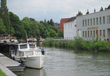
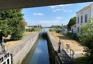
Randonnée A pied de 12,2 km à découvrir à Flandre, Flandre-Occidentale, Courtrai. Cette randonnée est proposée par SityTrail - itinéraires balisés pédestres.
Description
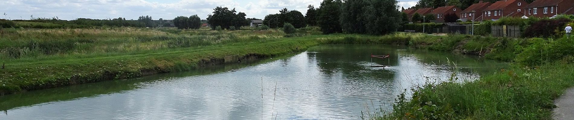
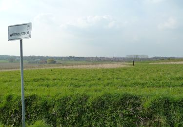
De Twee bekenwandelroute gaat door Marke en Bissegem. Je wandelt doorheen de valleien van de Markebeek en de Neerbeek.
Localisation
Pays :
Belgique
Région :
Flandre
Département/Province :
Flandre-Occidentale
Commune :
Courtrai
Localité :
Bissegem
Départ:(Dec)
Départ:(UTM)
515830 ; 5630407 (31U) N.
Commentaires
Randonnées à proximité
![Randonnée A pied Courtrai - Markebeekpad - Photo](https://media.geolcdn.com/t/375/260/e7c7bf34-88a3-4b33-97ab-5fbbd87b7c1d.jpeg&format=jpg&maxdim=2)
![A pied A pied](https://static1.geolcdn.com/sitytour/trail-icons/100.png)
Markebeekpad
A pied
Facile
Courtrai,
Flandre,
Flandre-Occidentale,
Belgique
![](/images/other/stat-length.png)
4,3 km | 5 km-effort
1h 8min
![](https://static1.geolcdn.com/siteimages/upload/files/16400158638029165_repeat_loop_refresh_sync_direction_icon.png)
Oui
![Randonnée A pied Courtrai - Stadswandelroute Kortrijk - Photo](https://media.geolcdn.com/t/375/260/4fdb58de-2377-4d35-839b-35b6b751a901.jpeg&format=jpg&maxdim=2)
![A pied A pied](https://static1.geolcdn.com/sitytour/trail-icons/100.png)
Stadswandelroute Kortrijk
A pied
Facile
Courtrai,
Flandre,
Flandre-Occidentale,
Belgique
![](/images/other/stat-length.png)
4,5 km | 4,8 km-effort
1h 5min
![](https://static1.geolcdn.com/siteimages/upload/files/16400158638029165_repeat_loop_refresh_sync_direction_icon.png)
Oui
![Randonnée Marche Courtrai - Kortrijk 13 km - Photo](https://media.geolcdn.com/t/375/260/0bd07b70-623d-4f39-bbe3-260ce89dd4b4.jpg&format=jpg&maxdim=2)
![Marche Marche](https://static1.geolcdn.com/sitytour/trail-icons/101.png)
Kortrijk 13 km
Marche
Facile
Courtrai,
Flandre,
Flandre-Occidentale,
Belgique
![](/images/other/stat-length.png)
13,2 km | 14,2 km-effort
4h 10min
![](https://static1.geolcdn.com/siteimages/upload/files/16400158638029165_repeat_loop_refresh_sync_direction_icon.png)
Oui
![Randonnée A pied Menin - Preshoekpad - Photo](https://media.geolcdn.com/t/375/260/853ea2e0-d894-4cfc-bc99-fc78368c5def.jpeg&format=jpg&maxdim=2)
![A pied A pied](https://static1.geolcdn.com/sitytour/trail-icons/100.png)
Preshoekpad
A pied
Facile
Menin,
Flandre,
Flandre-Occidentale,
Belgique
![](/images/other/stat-length.png)
4,5 km | 5 km-effort
1h 8min
![](https://static1.geolcdn.com/siteimages/upload/files/16400158638029165_repeat_loop_refresh_sync_direction_icon.png)
Oui
![Randonnée A pied Menin - Kortewagenpad Lauwe - Photo](https://media.geolcdn.com/t/375/260/f545b169-9dc5-48d6-bcd5-5fdbffb4f316.jpeg&format=jpg&maxdim=2)
![A pied A pied](https://static1.geolcdn.com/sitytour/trail-icons/100.png)
Kortewagenpad Lauwe
A pied
Facile
Menin,
Flandre,
Flandre-Occidentale,
Belgique
![](/images/other/stat-length.png)
13 km | 14,4 km-effort
3h 16min
![](https://static1.geolcdn.com/siteimages/upload/files/16400158638029165_repeat_loop_refresh_sync_direction_icon.png)
Oui
![Randonnée Marche Menin - DKP2013 - Photo](https://media.geolcdn.com/t/375/260/ext.jpg?maxdim=2&url=https%3A%2F%2Fstatic1.geolcdn.com%2Fsiteimages%2Fupload%2Ffiles%2F1553511878bg_sport_marche.png)
![Marche Marche](https://static1.geolcdn.com/sitytour/trail-icons/101.png)
DKP2013
Marche
Très facile
(3)
Menin,
Flandre,
Flandre-Occidentale,
Belgique
![](/images/other/stat-length.png)
7,7 km | 8,4 km-effort
1h 38min
![](https://static1.geolcdn.com/siteimages/upload/files/16400158638029165_repeat_loop_refresh_sync_direction_icon.png)
Non
![Randonnée Marche Menin - Milpattes - 19112012 - Photo](https://media.geolcdn.com/t/375/260/ext.jpg?maxdim=2&url=https%3A%2F%2Fservices.sitytrail.com%2FGeolivesWS%2FDownloadMedia.ashx%3FTrailID%3D163481%26Media%3Dbc875ad0-3971-4ad9-ab3d-580b96ef771d.jpg)
![Marche Marche](https://static1.geolcdn.com/sitytour/trail-icons/101.png)
Milpattes - 19112012
Marche
Très facile
Menin,
Flandre,
Flandre-Occidentale,
Belgique
![](/images/other/stat-length.png)
7,7 km | 8,3 km-effort
1h 49min
![](https://static1.geolcdn.com/siteimages/upload/files/16400158638029165_repeat_loop_refresh_sync_direction_icon.png)
Oui
![Randonnée Vélo de route Courtrai - Kortrijk -la pann - Photo](https://media.geolcdn.com/t/375/260/30cce3e9-9541-4851-b150-3f0e4c6178e7.jpg&format=jpg&maxdim=2)
![Vélo de route Vélo de route](https://static1.geolcdn.com/sitytour/trail-icons/201.png)
Kortrijk -la pann
Vélo de route
Courtrai,
Flandre,
Flandre-Occidentale,
Belgique
![](/images/other/stat-length.png)
75 km | 80 km-effort
4h 48min
![](https://static1.geolcdn.com/siteimages/upload/files/16400158638029165_repeat_loop_refresh_sync_direction_icon.png)
Non
![Randonnée Cheval Courtrai - wandeling zwijntje 16 - Photo](https://media.geolcdn.com/t/375/260/ext.jpg?maxdim=2&url=https%3A%2F%2Fstatic1.geolcdn.com%2Fsiteimages%2Fupload%2Ffiles%2F1524743154cheval.jpg)
![Cheval Cheval](https://static1.geolcdn.com/sitytour/trail-icons/300.png)
wandeling zwijntje 16
Cheval
Très facile
Courtrai,
Flandre,
Flandre-Occidentale,
Belgique
![](/images/other/stat-length.png)
17,1 km | 19,3 km-effort
5h 29min
![](https://static1.geolcdn.com/siteimages/upload/files/16400158638029165_repeat_loop_refresh_sync_direction_icon.png)
Oui