![](/images/other/stat-length.png)
![Randonnée A pied Anhée - Adèle et Christophe - Photo](https://media.geolcdn.com/t/1900/400/e54f6dca-c5f1-4be9-8101-55349f133265.jpeg&format=pjpeg&maxdim=2)
Adèle et Christophe
SityTrail - itinéraires balisés pédestres
Tous les sentiers balisés d’Europe GUIDE+
![Longueur](/images/other/stat-length.png)
Longueur
8,6 km
![Altitude max](https://static1.geolcdn.com/siteimages/upload/files/1508320355ic_sort_altitude_max_24dp.png)
Altitude max
200 m
![Dénivelé positif](https://static1.geolcdn.com/siteimages/upload/files/1508320355ic_sort_den_pos_24dp.png)
Dénivelé positif
136 m
![Km-Effort](/images/other/stat-length.png)
Km-Effort
10,7 km
![Altitude min](https://static1.geolcdn.com/siteimages/upload/files/1508320355ic_sort_altitude_min_24dp.png)
Altitude min
80 m
![Dénivelé négatif](https://static1.geolcdn.com/siteimages/upload/files/1508320355ic_sort_den_neg_24dp.png)
Dénivelé négatif
233 m
![Boucle](https://static1.geolcdn.com/siteimages/upload/files/16400158638029165_repeat_loop_refresh_sync_direction_icon.png)
Boucle
Non
Balise
Date de création :
2022-02-09 18:57:07.246
Dernière modification :
2022-03-10 10:18:09.54
![A pied](https://static1.geolcdn.com/sitytour/trail-icons/100.png)
2h26
Difficulté : Facile
![Scannez ce code QR pour ouvrir la randonnée dans l'application SityTrail](https://capi.geolives.com/qq0zvz2zws4bq2lad0pu/sitytour/trails/3084967/qr.png?size=200)
Application GPS de randonnée GRATUITE
À propos
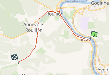
Randonnée A pied de 8,6 km à découvrir à Wallonie, Namur, Anhée. Cette randonnée est proposée par SityTrail - itinéraires balisés pédestres.
Description
Randonnée créée par SI Anhée.
Mise à jour - Juillet 2018 - Mercator 1958
Localisation
Pays :
Belgique
Région :
Wallonie
Département/Province :
Namur
Commune :
Anhée
Localité :
Unknown
Départ:(Dec)
Départ:(UTM)
632199 ; 5576543 (31U) N.
Commentaires
Randonnées à proximité
![Randonnée Marche Profondeville - RL-GG-19_Lustin_Namur - Photo](https://media.geolcdn.com/t/375/260/b0b5ef2e-bf0c-4965-a3a2-62d0da2d07c7.jpg&format=jpg&maxdim=2)
![Marche Marche](https://static1.geolcdn.com/sitytour/trail-icons/101.png)
RL-GG-19_Lustin_Namur
Marche
Très difficile
(13)
Profondeville,
Wallonie,
Namur,
Belgique
![](/images/other/stat-length.png)
22 km | 28 km-effort
6h 7min
![](https://static1.geolcdn.com/siteimages/upload/files/16400158638029165_repeat_loop_refresh_sync_direction_icon.png)
Non
![Randonnée Marche Anhée - RB-Na-22_Bioul_via-racc - Photo](https://media.geolcdn.com/t/375/260/9e39c4d6-ac1b-4acf-9686-7baae428f1a0.jpg&format=jpg&maxdim=2)
![Marche Marche](https://static1.geolcdn.com/sitytour/trail-icons/101.png)
RB-Na-22_Bioul_via-racc
Marche
Très difficile
(6)
Anhée,
Wallonie,
Namur,
Belgique
![](/images/other/stat-length.png)
16,7 km | 21 km-effort
4h 52min
![](https://static1.geolcdn.com/siteimages/upload/files/16400158638029165_repeat_loop_refresh_sync_direction_icon.png)
Oui
![Randonnée Marche Anhée - RB-Na-22_Bioul - Photo](https://media.geolcdn.com/t/375/260/8622883f-03f3-4eff-8458-0cb9f1aba19e.jpg&format=jpg&maxdim=2)
![Marche Marche](https://static1.geolcdn.com/sitytour/trail-icons/101.png)
RB-Na-22_Bioul
Marche
Très difficile
(11)
Anhée,
Wallonie,
Namur,
Belgique
![](/images/other/stat-length.png)
19,5 km | 25 km-effort
5h 46min
![](https://static1.geolcdn.com/siteimages/upload/files/16400158638029165_repeat_loop_refresh_sync_direction_icon.png)
Oui
![Marche Marche](https://static1.geolcdn.com/sitytour/trail-icons/101.png)
RB-Na-21_Mont
Marche
Très difficile
(6)
Yvoir,
Wallonie,
Namur,
Belgique
![](/images/other/stat-length.png)
22 km | 30 km-effort
6h 51min
![](https://static1.geolcdn.com/siteimages/upload/files/16400158638029165_repeat_loop_refresh_sync_direction_icon.png)
Oui
![Randonnée Marche Yvoir - RB-Na-03_Houx - Photo](https://media.geolcdn.com/t/375/260/ext.jpg?maxdim=2&url=https%3A%2F%2Fservices.sitytrail.com%2FGeolivesWS%2FDownloadMedia.ashx%3FTrailID%3D179628%26Media%3D8266bb1a-850d-41b8-8bad-8e0bd7c82bf9.jpg)
![Marche Marche](https://static1.geolcdn.com/sitytour/trail-icons/101.png)
RB-Na-03_Houx
Marche
Difficile
(11)
Yvoir,
Wallonie,
Namur,
Belgique
![](/images/other/stat-length.png)
22 km | 30 km-effort
7h 1min
![](https://static1.geolcdn.com/siteimages/upload/files/16400158638029165_repeat_loop_refresh_sync_direction_icon.png)
Oui
![Randonnée Marche Yvoir - RL-GG-38_Godinne_Dinant - Photo](https://media.geolcdn.com/t/375/260/4b7f8162-b405-4557-afe1-7567462c4aff.jpg&format=jpg&maxdim=2)
![Marche Marche](https://static1.geolcdn.com/sitytour/trail-icons/101.png)
RL-GG-38_Godinne_Dinant
Marche
Très difficile
(6)
Yvoir,
Wallonie,
Namur,
Belgique
![](/images/other/stat-length.png)
19,5 km | 27 km-effort
6h 13min
![](https://static1.geolcdn.com/siteimages/upload/files/16400158638029165_repeat_loop_refresh_sync_direction_icon.png)
Non
![Randonnée Marche Anhée - RF-Na-05 Annevoie, côté Jardins_Grande-boucle - Photo](https://media.geolcdn.com/t/375/260/ext.jpg?maxdim=2&url=https%3A%2F%2Fservices.sitytrail.com%2FGeolivesWS%2FDownloadMedia.ashx%3FTrailID%3D545753%26Media%3D5d973c83-4a6c-40fc-a026-25de6c754887.JPG)
![Marche Marche](https://static1.geolcdn.com/sitytour/trail-icons/101.png)
RF-Na-05 Annevoie, côté Jardins_Grande-boucle
Marche
Moyen
(11)
Anhée,
Wallonie,
Namur,
Belgique
![](/images/other/stat-length.png)
11,3 km | 14,5 km-effort
3h 6min
![](https://static1.geolcdn.com/siteimages/upload/files/16400158638029165_repeat_loop_refresh_sync_direction_icon.png)
Oui
![Randonnée Marche Anhée - RF-Na-05 Annevoie, côté Jardins_Petite-boucle - Photo](https://media.geolcdn.com/t/375/260/ext.jpg?maxdim=2&url=https%3A%2F%2Fservices.sitytrail.com%2FGeolivesWS%2FDownloadMedia.ashx%3FTrailID%3D545751%26Media%3D5d973c83-4a6c-40fc-a026-25de6c754887.JPG)
![Marche Marche](https://static1.geolcdn.com/sitytour/trail-icons/101.png)
RF-Na-05 Annevoie, côté Jardins_Petite-boucle
Marche
Facile
(7)
Anhée,
Wallonie,
Namur,
Belgique
![](/images/other/stat-length.png)
7,4 km | 10 km-effort
2h 7min
![](https://static1.geolcdn.com/siteimages/upload/files/16400158638029165_repeat_loop_refresh_sync_direction_icon.png)
Oui
![Marche Marche](https://static1.geolcdn.com/sitytour/trail-icons/101.png)
RB-Na-21_Mont_via-racc
Marche
Très difficile
(4)
Yvoir,
Wallonie,
Namur,
Belgique
![](/images/other/stat-length.png)
18,6 km | 25 km-effort
5h 43min
![](https://static1.geolcdn.com/siteimages/upload/files/16400158638029165_repeat_loop_refresh_sync_direction_icon.png)
Oui