![](/images/other/stat-length.png)
![Randonnée A pied Nassogne - 6. Promenade Les Espèches - Photo](https://media.geolcdn.com/t/1900/400/ext.pjpeg?maxdim=2&url=https%3A%2F%2Fstatic1.geolcdn.com%2Fsiteimages%2Fupload%2Ffiles%2F1545311037marcheuse_200dpi.jpg)
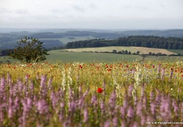
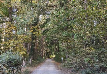
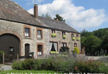
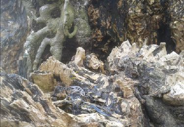
6. Promenade Les Espèches
SityTrail - itinéraires balisés pédestres
Tous les sentiers balisés d’Europe GUIDE+
![Longueur](/images/other/stat-length.png)
Longueur
7,9 km
![Altitude max](https://static1.geolcdn.com/siteimages/upload/files/1508320355ic_sort_altitude_max_24dp.png)
Altitude max
326 m
![Dénivelé positif](https://static1.geolcdn.com/siteimages/upload/files/1508320355ic_sort_den_pos_24dp.png)
Dénivelé positif
180 m
![Km-Effort](/images/other/stat-length.png)
Km-Effort
10,3 km
![Altitude min](https://static1.geolcdn.com/siteimages/upload/files/1508320355ic_sort_altitude_min_24dp.png)
Altitude min
241 m
![Dénivelé négatif](https://static1.geolcdn.com/siteimages/upload/files/1508320355ic_sort_den_neg_24dp.png)
Dénivelé négatif
174 m
![Boucle](https://static1.geolcdn.com/siteimages/upload/files/16400158638029165_repeat_loop_refresh_sync_direction_icon.png)
Boucle
Oui
Balise
Date de création :
2022-02-09 18:53:14.527
Dernière modification :
2022-02-09 18:53:14.527
![A pied](https://static1.geolcdn.com/sitytour/trail-icons/100.png)
2h20
Difficulté : Facile
![Scannez ce code QR pour ouvrir la randonnée dans l'application SityTrail](https://capi.geolives.com/qq0zvz2zws4bq2lad0pu/sitytour/trails/3084823/qr.png?size=200)
Application GPS de randonnée GRATUITE
À propos
Randonnée A pied de 7,9 km à découvrir à Wallonie, Luxembourg, Nassogne. Cette randonnée est proposée par SityTrail - itinéraires balisés pédestres.
Description
Randonnée créée par Office Communal du Tourisme de l'Entité de Nassogne.
Localisation
Pays :
Belgique
Région :
Wallonie
Département/Province :
Luxembourg
Commune :
Nassogne
Localité :
Unknown
Départ:(Dec)
Départ:(UTM)
669667 ; 5561628 (31U) N.
Commentaires
Randonnées à proximité
![Marche Marche](https://static1.geolcdn.com/sitytour/trail-icons/101.png)
RB-Lu-31_Marche-en-Famenne
Marche
Très difficile
(3)
Marche-en-Famenne,
Wallonie,
Luxembourg,
Belgique
![](/images/other/stat-length.png)
26 km | 31 km-effort
7h 6min
![](https://static1.geolcdn.com/siteimages/upload/files/16400158638029165_repeat_loop_refresh_sync_direction_icon.png)
Oui
![Randonnée Marche Nassogne - Grune - Promenade du Chevenys (NG 11) - Photo](https://media.geolcdn.com/t/375/260/ext.jpg?maxdim=2&url=https%3A%2F%2Fservices.sitytrail.com%2FGeolivesWS%2FDownloadMedia.ashx%3FTrailID%3D334481%26Media%3Dba9aa845-ef30-419f-8abc-4937a3dcd165.jpg)
![Marche Marche](https://static1.geolcdn.com/sitytour/trail-icons/101.png)
Grune - Promenade du Chevenys (NG 11)
Marche
Moyen
(3)
Nassogne,
Wallonie,
Luxembourg,
Belgique
![](/images/other/stat-length.png)
8,4 km | 11,6 km-effort
2h 27min
![](https://static1.geolcdn.com/siteimages/upload/files/16400158638029165_repeat_loop_refresh_sync_direction_icon.png)
Oui
![Randonnée Marche Nassogne - Grune - Promenade des Prés (NG 10) - Photo](https://media.geolcdn.com/t/375/260/ext.jpg?maxdim=2&url=https%3A%2F%2Fservices.sitytrail.com%2FGeolivesWS%2FDownloadMedia.ashx%3FTrailID%3D334480%26Media%3D401003b0-e8fc-4e5d-bd6d-081ce49adfea.jpg)
![Marche Marche](https://static1.geolcdn.com/sitytour/trail-icons/101.png)
Grune - Promenade des Prés (NG 10)
Marche
Facile
(1)
Nassogne,
Wallonie,
Luxembourg,
Belgique
![](/images/other/stat-length.png)
4,4 km | 5,3 km-effort
1h 10min
![](https://static1.geolcdn.com/siteimages/upload/files/16400158638029165_repeat_loop_refresh_sync_direction_icon.png)
Oui
![Randonnée Marche Nassogne - Ambly - Promenade de Javingue (NG 02) - Photo](https://media.geolcdn.com/t/375/260/ext.jpg?maxdim=2&url=https%3A%2F%2Fservices.sitytrail.com%2FGeolivesWS%2FDownloadMedia.ashx%3FTrailID%3D334471%26Media%3Ddbed45a4-783f-4743-9c84-6e8d4ec05336.jpg)
![Marche Marche](https://static1.geolcdn.com/sitytour/trail-icons/101.png)
Ambly - Promenade de Javingue (NG 02)
Marche
Moyen
(7)
Nassogne,
Wallonie,
Luxembourg,
Belgique
![](/images/other/stat-length.png)
9 km | 11,6 km-effort
2h 28min
![](https://static1.geolcdn.com/siteimages/upload/files/16400158638029165_repeat_loop_refresh_sync_direction_icon.png)
Oui
![Randonnée Marche Marche-en-Famenne - Balade pédestre de la Hédrée - Photo](https://media.geolcdn.com/t/375/260/ab1d5669-7ecf-451e-a04e-4f6f7bcd2b0a.jpg&format=jpg&maxdim=2)
![Marche Marche](https://static1.geolcdn.com/sitytour/trail-icons/101.png)
Balade pédestre de la Hédrée
Marche
Moyen
(2)
Marche-en-Famenne,
Wallonie,
Luxembourg,
Belgique
![](/images/other/stat-length.png)
5,7 km | 8,2 km-effort
1h 51min
![](https://static1.geolcdn.com/siteimages/upload/files/16400158638029165_repeat_loop_refresh_sync_direction_icon.png)
Oui
![Randonnée Marche Marche-en-Famenne - Champlon - Boucle qui alterne sous-bois et vues dégagées à 360°. Larges sentiers caillouteux et un peu de macadam. - Photo](https://media.geolcdn.com/t/375/260/f9518a34-3708-4717-a5a9-ec6d14ee87bd.jpg&format=jpg&maxdim=2)
![Marche Marche](https://static1.geolcdn.com/sitytour/trail-icons/101.png)
Champlon - Boucle qui alterne sous-bois et vues dégagées à 360°. Larges senti...
Marche
Facile
(1)
Marche-en-Famenne,
Wallonie,
Luxembourg,
Belgique
![](/images/other/stat-length.png)
9,6 km | 12,8 km-effort
2h 23min
![](https://static1.geolcdn.com/siteimages/upload/files/16400158638029165_repeat_loop_refresh_sync_direction_icon.png)
Oui
![Randonnée Marche Nassogne - Ambly - Promenade Derrière le bois (NG 01) - Photo](https://media.geolcdn.com/t/375/260/ext.jpg?maxdim=2&url=https%3A%2F%2Fservices.sitytrail.com%2FGeolivesWS%2FDownloadMedia.ashx%3FTrailID%3D334470%26Media%3Ddc6689e0-745d-4639-902b-366926b3982f.JPG)
![Marche Marche](https://static1.geolcdn.com/sitytour/trail-icons/101.png)
Ambly - Promenade Derrière le bois (NG 01)
Marche
Moyen
(4)
Nassogne,
Wallonie,
Luxembourg,
Belgique
![](/images/other/stat-length.png)
4,7 km | 6,4 km-effort
1h 22min
![](https://static1.geolcdn.com/siteimages/upload/files/16400158638029165_repeat_loop_refresh_sync_direction_icon.png)
Oui
![Randonnée Marche Marche-en-Famenne - Grimbiémont-Lignières- boucle - Photo](https://media.geolcdn.com/t/375/260/ext.jpg?maxdim=2&url=https%3A%2F%2Fservices.sitytrail.com%2FGeolivesWS%2FDownloadMedia.ashx%3FTrailID%3D116546%26Media%3D492a6278-1252-4756-987d-ad86fac6f5d1.jpg)
![Marche Marche](https://static1.geolcdn.com/sitytour/trail-icons/101.png)
Grimbiémont-Lignières- boucle
Marche
Facile
(3)
Marche-en-Famenne,
Wallonie,
Luxembourg,
Belgique
![](/images/other/stat-length.png)
8,6 km | 11,6 km-effort
1h 59min
![](https://static1.geolcdn.com/siteimages/upload/files/16400158638029165_repeat_loop_refresh_sync_direction_icon.png)
Oui
![Randonnée Marche Nassogne - Bande - Promenade de la Pisserotte (NG 05) - Photo](https://media.geolcdn.com/t/375/260/ext.jpg?maxdim=2&url=https%3A%2F%2Fservices.sitytrail.com%2FGeolivesWS%2FDownloadMedia.ashx%3FTrailID%3D334474%26Media%3Da2eaaaef-4832-4b6e-a845-589a4bdf618e.jpg)
![Marche Marche](https://static1.geolcdn.com/sitytour/trail-icons/101.png)
Bande - Promenade de la Pisserotte (NG 05)
Marche
Difficile
(4)
Nassogne,
Wallonie,
Luxembourg,
Belgique
![](/images/other/stat-length.png)
10,4 km | 13,7 km-effort
2h 56min
![](https://static1.geolcdn.com/siteimages/upload/files/16400158638029165_repeat_loop_refresh_sync_direction_icon.png)
Oui