![](/images/other/stat-length.png)
![Randonnée A pied Staden - Arteveldewandelroute - Photo](https://media.geolcdn.com/t/1900/400/321193f2-85f0-4c8a-8cea-a92745f7fe19.jpeg&format=pjpeg&maxdim=2)
Arteveldewandelroute
SityTrail - itinéraires balisés pédestres
Tous les sentiers balisés d’Europe GUIDE+
![Longueur](/images/other/stat-length.png)
Longueur
5,3 km
![Altitude max](https://static1.geolcdn.com/siteimages/upload/files/1508320355ic_sort_altitude_max_24dp.png)
Altitude max
49 m
![Dénivelé positif](https://static1.geolcdn.com/siteimages/upload/files/1508320355ic_sort_den_pos_24dp.png)
Dénivelé positif
49 m
![Km-Effort](/images/other/stat-length.png)
Km-Effort
6 km
![Altitude min](https://static1.geolcdn.com/siteimages/upload/files/1508320355ic_sort_altitude_min_24dp.png)
Altitude min
26 m
![Dénivelé négatif](https://static1.geolcdn.com/siteimages/upload/files/1508320355ic_sort_den_neg_24dp.png)
Dénivelé négatif
49 m
![Boucle](https://static1.geolcdn.com/siteimages/upload/files/16400158638029165_repeat_loop_refresh_sync_direction_icon.png)
Boucle
Oui
Balise
Date de création :
2022-02-09 18:33:35.15
Dernière modification :
2022-02-09 18:33:35.15
![A pied](https://static1.geolcdn.com/sitytour/trail-icons/100.png)
1h21
Difficulté : Facile
![Scannez ce code QR pour ouvrir la randonnée dans l'application SityTrail](https://capi.geolives.com/qq0zvz2zws4bq2lad0pu/sitytour/trails/3084451/qr.png?size=200)
Application GPS de randonnée GRATUITE
À propos
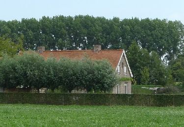
Randonnée A pied de 5,3 km à découvrir à Flandre, Flandre-Occidentale, Staden. Cette randonnée est proposée par SityTrail - itinéraires balisés pédestres.
Description
Randonnée créée par Gemeente Staden.
Site web: http://www.staden.be/product/243/wandelen
Localisation
Pays :
Belgique
Région :
Flandre
Département/Province :
Flandre-Occidentale
Commune :
Staden
Localité :
Westrozebeke
Départ:(Dec)
Départ:(UTM)
500850 ; 5642222 (31U) N.
Commentaires
Randonnées à proximité
![Randonnée A pied Moorslede - Koekuit wandelroute - Photo](https://media.geolcdn.com/t/375/260/3b74c5a0-ead2-4047-acbe-d55bc548d71e.jpeg&format=jpg&maxdim=2)
![A pied A pied](https://static1.geolcdn.com/sitytour/trail-icons/100.png)
Koekuit wandelroute
A pied
Facile
Moorslede,
Flandre,
Flandre-Occidentale,
Belgique
![](/images/other/stat-length.png)
8,3 km | 9,1 km-effort
2h 4min
![](https://static1.geolcdn.com/siteimages/upload/files/16400158638029165_repeat_loop_refresh_sync_direction_icon.png)
Oui
![Randonnée A pied Zonnebeke - Canadian Road to Passchendaele - Photo](https://media.geolcdn.com/t/375/260/c26199c1-6ebc-4bf5-b76f-bd7d05d0c29e.jpeg&format=jpg&maxdim=2)
![A pied A pied](https://static1.geolcdn.com/sitytour/trail-icons/100.png)
Canadian Road to Passchendaele
A pied
Facile
Zonnebeke,
Flandre,
Flandre-Occidentale,
Belgique
![](/images/other/stat-length.png)
6,7 km | 7,4 km-effort
1h 41min
![](https://static1.geolcdn.com/siteimages/upload/files/16400158638029165_repeat_loop_refresh_sync_direction_icon.png)
Oui
![Randonnée Marche Zonnebeke - Passendale_Tynecot_Oorlogroute - Photo](https://media.geolcdn.com/t/375/260/ext.jpg?maxdim=2&url=https%3A%2F%2Fstatic1.geolcdn.com%2Fsiteimages%2Fupload%2Ffiles%2F1553511878bg_sport_marche.png)
![Marche Marche](https://static1.geolcdn.com/sitytour/trail-icons/101.png)
Passendale_Tynecot_Oorlogroute
Marche
Très facile
Zonnebeke,
Flandre,
Flandre-Occidentale,
Belgique
![](/images/other/stat-length.png)
14,5 km | 15,9 km-effort
Inconnu
![](https://static1.geolcdn.com/siteimages/upload/files/16400158638029165_repeat_loop_refresh_sync_direction_icon.png)
Oui
![Randonnée Marche Zonnebeke - 68.569 Passendale - Tyne Côté - Photo](https://media.geolcdn.com/t/375/260/ext.jpg?maxdim=2&url=https%3A%2F%2Fstatic1.geolcdn.com%2Fsiteimages%2Fupload%2Ffiles%2F1553511878bg_sport_marche.png)
![Marche Marche](https://static1.geolcdn.com/sitytour/trail-icons/101.png)
68.569 Passendale - Tyne Côté
Marche
Facile
Zonnebeke,
Flandre,
Flandre-Occidentale,
Belgique
![](/images/other/stat-length.png)
14,5 km | 15,9 km-effort
3h 37min
![](https://static1.geolcdn.com/siteimages/upload/files/16400158638029165_repeat_loop_refresh_sync_direction_icon.png)
Oui
![Randonnée Marche Zonnebeke - roulers - Photo](https://media.geolcdn.com/t/375/260/ext.jpg?maxdim=2&url=https%3A%2F%2Fstatic1.geolcdn.com%2Fsiteimages%2Fupload%2Ffiles%2F1553511878bg_sport_marche.png)
![Marche Marche](https://static1.geolcdn.com/sitytour/trail-icons/101.png)
roulers
Marche
Facile
Zonnebeke,
Flandre,
Flandre-Occidentale,
Belgique
![](/images/other/stat-length.png)
5,6 km | 6,1 km-effort
1h 21min
![](https://static1.geolcdn.com/siteimages/upload/files/16400158638029165_repeat_loop_refresh_sync_direction_icon.png)
Oui
![Randonnée Autre activité Hooglede - roodhuis - Photo](https://media.geolcdn.com/t/375/260/ext.jpg?maxdim=2&url=https%3A%2F%2Fstatic1.geolcdn.com%2Fsiteimages%2Fupload%2Ffiles%2F1545311037marcheuse_200dpi.jpg)
![Autre activité Autre activité](https://static1.geolcdn.com/sitytour/trail-icons/900.png)
roodhuis
Autre activité
Très facile
Hooglede,
Flandre,
Flandre-Occidentale,
Belgique
![](/images/other/stat-length.png)
35 km | 38 km-effort
27min
![](https://static1.geolcdn.com/siteimages/upload/files/16400158638029165_repeat_loop_refresh_sync_direction_icon.png)
Non