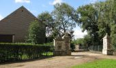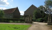

De Spicht
SityTrail - itinéraires balisés pédestres
Tous les sentiers balisés d’Europe GUIDE+

Longueur
9,9 km

Altitude max
89 m

Dénivelé positif
105 m

Km-Effort
11,3 km

Altitude min
38 m

Dénivelé négatif
105 m
Boucle
Oui
Balise
Date de création :
2022-02-09 16:03:21.64
Dernière modification :
2022-02-09 18:25:08.984
2h33
Difficulté : Facile

Application GPS de randonnée GRATUITE
À propos
Randonnée A pied de 9,9 km à découvrir à Flandre, Brabant flamand, Lubbeek. Cette randonnée est proposée par SityTrail - itinéraires balisés pédestres.
Description
Randonnée créée par Regionaal Landschap Noord-Hageland.
Symbole: red triangle
Localisation
Pays :
Belgique
Région :
Flandre
Département/Province :
Brabant flamand
Commune :
Lubbeek
Localité :
Lubbeek
Départ:(Dec)
Départ:(UTM)
629385 ; 5638423 (31U) N.
Commentaires
Randonnées à proximité
Korttijk Dutsel


Marche
Facile
(1)
Holsbeek,
Flandre,
Brabant flamand,
Belgique

7,7 km | 8,8 km-effort
1h 45min
Oui
Werveldtwandelpad


A pied
Facile
Lubbeek,
Flandre,
Brabant flamand,
Belgique

9,4 km | 10,7 km-effort
2h 25min
Oui
Klein Zwitserlandwandelpad


A pied
Facile
Boutersem,
Flandre,
Brabant flamand,
Belgique

10 km | 11,4 km-effort
2h 35min
Oui
Koebos Rode driehoek


A pied
Facile
Lubbeek,
Flandre,
Brabant flamand,
Belgique

10,5 km | 12,5 km-effort
2h 50min
Oui
Koebos Oranje bol


A pied
Facile
Bierbeek,
Flandre,
Brabant flamand,
Belgique

5,9 km | 6,9 km-effort
1h 34min
Oui

De Spicht Oranje bol


A pied
Facile
Lubbeek,
Flandre,
Brabant flamand,
Belgique

4,5 km | 5,6 km-effort
1h 16min
Oui
Kalvariewandelpad


A pied
Facile
Lubbeek,
Flandre,
Brabant flamand,
Belgique

7,3 km | 8,7 km-effort
1h 58min
Oui
Sint-Ermelindiswandelpad


A pied
Facile
Bierbeek,
Flandre,
Brabant flamand,
Belgique

7,6 km | 8,5 km-effort
1h 55min
Oui
S-GR Hageland: Kortrijk-Dutsel - Leuven


Marche
Moyen
Holsbeek,
Flandre,
Brabant flamand,
Belgique

24 km | 28 km-effort
6h 21min
Non


 SityTrail


