![](/images/other/stat-length.png)
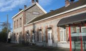
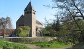
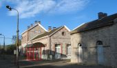
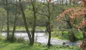
![Randonnée A pied Nassogne - 8. Promenade Saint-Martin - Photo](https://media.geolcdn.com/t/1900/400/95a1b3b8-bcf2-492e-920c-ceefc05f2c10.jpeg&format=pjpeg&maxdim=2)
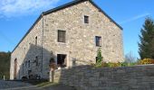
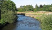
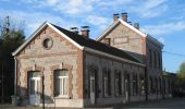
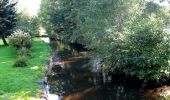
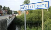
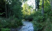
8. Promenade Saint-Martin
SityTrail - itinéraires balisés pédestres
Tous les sentiers balisés d’Europe GUIDE+
![Longueur](/images/other/stat-length.png)
Longueur
7,5 km
![Altitude max](https://static1.geolcdn.com/siteimages/upload/files/1508320355ic_sort_altitude_max_24dp.png)
Altitude max
291 m
![Dénivelé positif](https://static1.geolcdn.com/siteimages/upload/files/1508320355ic_sort_den_pos_24dp.png)
Dénivelé positif
133 m
![Km-Effort](/images/other/stat-length.png)
Km-Effort
9,2 km
![Altitude min](https://static1.geolcdn.com/siteimages/upload/files/1508320355ic_sort_altitude_min_24dp.png)
Altitude min
200 m
![Dénivelé négatif](https://static1.geolcdn.com/siteimages/upload/files/1508320355ic_sort_den_neg_24dp.png)
Dénivelé négatif
133 m
![Boucle](https://static1.geolcdn.com/siteimages/upload/files/16400158638029165_repeat_loop_refresh_sync_direction_icon.png)
Boucle
Oui
Balise
Date de création :
2022-02-09 16:02:54.972
Dernière modification :
2022-02-09 18:24:47.099
![A pied](https://static1.geolcdn.com/sitytour/trail-icons/100.png)
2h05
Difficulté : Facile
![Scannez ce code QR pour ouvrir la randonnée dans l'application SityTrail](https://capi.geolives.com/qq0zvz2zws4bq2lad0pu/sitytour/trails/3084049/qr.png?size=200)
Application GPS de randonnée GRATUITE
À propos
Randonnée A pied de 7,5 km à découvrir à Wallonie, Luxembourg, Nassogne. Cette randonnée est proposée par SityTrail - itinéraires balisés pédestres.
Description
Randonnée créée par Office Communal du Tourisme de l'Entité de Nassogne.
Localisation
Pays :
Belgique
Région :
Wallonie
Département/Province :
Luxembourg
Commune :
Nassogne
Localité :
Unknown
Départ:(Dec)
Départ:(UTM)
662900 ; 5555959 (31U) N.
Commentaires
Randonnées à proximité
![Randonnée Moteur Rochefort - Auto : Patrimoine : abbayes, églises et chapelles - Rochefort - Photo](https://media.geolcdn.com/t/375/260/ext.jpg?maxdim=2&url=https%3A%2F%2Fservices.sitytrail.com%2FGeolivesWS%2FDownloadMedia.ashx%3FTrailID%3D153103%26Media%3D05603f1b-9f7c-481f-bc84-6cc819555dbb.jpg)
![Moteur Moteur](https://static1.geolcdn.com/sitytour/trail-icons/400.png)
Auto : Patrimoine : abbayes, églises et chapelles - Rochefort
Moteur
Facile
(5)
Rochefort,
Wallonie,
Namur,
Belgique
![](/images/other/stat-length.png)
65 km | 78 km-effort
2h 40min
![](https://static1.geolcdn.com/siteimages/upload/files/16400158638029165_repeat_loop_refresh_sync_direction_icon.png)
Oui
![Marche Marche](https://static1.geolcdn.com/sitytour/trail-icons/101.png)
RL-GG-34_Jemelle_Marche-en-Famenne
Marche
Moyen
(1)
Rochefort,
Wallonie,
Namur,
Belgique
![](/images/other/stat-length.png)
19,2 km | 24 km-effort
5h 32min
![](https://static1.geolcdn.com/siteimages/upload/files/16400158638029165_repeat_loop_refresh_sync_direction_icon.png)
Non
![Randonnée Marche Tellin - RL-GG-13_Grupont_Poix-Saint-Hubert - Photo](https://media.geolcdn.com/t/375/260/5959367f-35e5-42da-bbcc-7bf6a947c3d1.jpg&format=jpg&maxdim=2)
![Marche Marche](https://static1.geolcdn.com/sitytour/trail-icons/101.png)
RL-GG-13_Grupont_Poix-Saint-Hubert
Marche
Très difficile
(3)
Tellin,
Wallonie,
Luxembourg,
Belgique
![](/images/other/stat-length.png)
26 km | 34 km-effort
7h 23min
![](https://static1.geolcdn.com/siteimages/upload/files/16400158638029165_repeat_loop_refresh_sync_direction_icon.png)
Non
![Randonnée Marche Tellin - Balade à Grupont - Photo](https://media.geolcdn.com/t/375/260/ext.jpg?maxdim=2&url=https%3A%2F%2Fservices.sitytrail.com%2FGeolivesWS%2FDownloadMedia.ashx%3FTrailID%3D963883%26Media%3D35fabe2c-0877-4435-b4f9-1ab0863175f9.jpg)
![Marche Marche](https://static1.geolcdn.com/sitytour/trail-icons/101.png)
Balade à Grupont
Marche
Facile
(1)
Tellin,
Wallonie,
Luxembourg,
Belgique
![](/images/other/stat-length.png)
8,4 km | 11,9 km-effort
2h 33min
![](https://static1.geolcdn.com/siteimages/upload/files/16400158638029165_repeat_loop_refresh_sync_direction_icon.png)
Oui
![Randonnée Marche Tellin - Bure - Promenade des chapelles - Photo](https://media.geolcdn.com/t/375/260/ext.jpg?maxdim=2&url=https%3A%2F%2Fservices.sitytrail.com%2FGeolivesWS%2FDownloadMedia.ashx%3FTrailID%3D551016%26Media%3D367a68c9-5f59-4fbe-aa6c-c01d282ce6b9.jpg)
![Marche Marche](https://static1.geolcdn.com/sitytour/trail-icons/101.png)
Bure - Promenade des chapelles
Marche
Facile
(1)
Tellin,
Wallonie,
Luxembourg,
Belgique
![](/images/other/stat-length.png)
4,5 km | 5,9 km-effort
1h 15min
![](https://static1.geolcdn.com/siteimages/upload/files/16400158638029165_repeat_loop_refresh_sync_direction_icon.png)
Oui
![Randonnée Moteur Rochefort - Roadbook auto/moto - Circuit terroir saveurs - Photo](https://media.geolcdn.com/t/375/260/ext.jpg?maxdim=2&url=https%3A%2F%2Fservices.sitytrail.com%2FGeolivesWS%2FDownloadMedia.ashx%3FTrailID%3D428715%26Media%3Dff47641a-75c9-4285-926b-b7008d6e40b8.png)
![Moteur Moteur](https://static1.geolcdn.com/sitytour/trail-icons/400.png)
Roadbook auto/moto - Circuit terroir saveurs
Moteur
Très facile
(3)
Rochefort,
Wallonie,
Namur,
Belgique
![](/images/other/stat-length.png)
140 km | 169 km-effort
2h 0min
![](https://static1.geolcdn.com/siteimages/upload/files/16400158638029165_repeat_loop_refresh_sync_direction_icon.png)
Oui
![Randonnée Marche Tellin - Grupont - Promenade du bois de Machi - Photo](https://media.geolcdn.com/t/375/260/ext.jpg?maxdim=2&url=https%3A%2F%2Fservices.sitytrail.com%2FGeolivesWS%2FDownloadMedia.ashx%3FTrailID%3D334604%26Media%3Dcf0f2910-0190-4469-9f88-d94c6a2716b3.jpg)
![Marche Marche](https://static1.geolcdn.com/sitytour/trail-icons/101.png)
Grupont - Promenade du bois de Machi
Marche
Moyen
(1)
Tellin,
Wallonie,
Luxembourg,
Belgique
![](/images/other/stat-length.png)
8,6 km | 12,6 km-effort
2h 37min
![](https://static1.geolcdn.com/siteimages/upload/files/16400158638029165_repeat_loop_refresh_sync_direction_icon.png)
Oui
![Randonnée Marche Tellin - Bure - Promenade du Pont des Cloyes - Photo](https://media.geolcdn.com/t/375/260/ext.jpg?maxdim=2&url=https%3A%2F%2Fservices.sitytrail.com%2FGeolivesWS%2FDownloadMedia.ashx%3FTrailID%3D334602%26Media%3D8e0d2c95-f7df-4bf3-a998-440fe6cfb5b4.jpg)
![Marche Marche](https://static1.geolcdn.com/sitytour/trail-icons/101.png)
Bure - Promenade du Pont des Cloyes
Marche
Moyen
(2)
Tellin,
Wallonie,
Luxembourg,
Belgique
![](/images/other/stat-length.png)
6,9 km | 9 km-effort
1h 59min
![](https://static1.geolcdn.com/siteimages/upload/files/16400158638029165_repeat_loop_refresh_sync_direction_icon.png)
Oui
![Randonnée V.T.T. Nassogne - Nassogne - Circuit VTT rouge 4 - Photo](https://media.geolcdn.com/t/375/260/ext.jpg?maxdim=2&url=https%3A%2F%2Fservices.sitytrail.com%2FGeolivesWS%2FDownloadMedia.ashx%3FTrailID%3D334498%26Media%3D7e3b25c4-69c3-43b8-9aff-2ac9aa518f72.jpg)
![V.T.T. V.T.T.](https://static1.geolcdn.com/sitytour/trail-icons/202.png)
Nassogne - Circuit VTT rouge 4
V.T.T.
Difficile
(1)
Nassogne,
Wallonie,
Luxembourg,
Belgique
![](/images/other/stat-length.png)
26 km | 36 km-effort
2h 16min
![](https://static1.geolcdn.com/siteimages/upload/files/16400158638029165_repeat_loop_refresh_sync_direction_icon.png)
Oui