![](/images/other/stat-length.png)
![Randonnée A pied Ostende - Erfgoedwandelroute Oostende - Photo](https://media.geolcdn.com/t/1900/400/047b4ab6-977b-43f8-8094-d85cf0d16c1b.jpeg&format=pjpeg&maxdim=2)
Erfgoedwandelroute Oostende
SityTrail - itinéraires balisés pédestres
Tous les sentiers balisés d’Europe GUIDE+
![Longueur](/images/other/stat-length.png)
Longueur
4,5 km
![Altitude max](https://static1.geolcdn.com/siteimages/upload/files/1508320355ic_sort_altitude_max_24dp.png)
Altitude max
25 m
![Dénivelé positif](https://static1.geolcdn.com/siteimages/upload/files/1508320355ic_sort_den_pos_24dp.png)
Dénivelé positif
38 m
![Km-Effort](/images/other/stat-length.png)
Km-Effort
5 km
![Altitude min](https://static1.geolcdn.com/siteimages/upload/files/1508320355ic_sort_altitude_min_24dp.png)
Altitude min
4 m
![Dénivelé négatif](https://static1.geolcdn.com/siteimages/upload/files/1508320355ic_sort_den_neg_24dp.png)
Dénivelé négatif
34 m
![Boucle](https://static1.geolcdn.com/siteimages/upload/files/16400158638029165_repeat_loop_refresh_sync_direction_icon.png)
Boucle
Oui
Balise
Date de création :
2022-02-09 15:32:07.673
Dernière modification :
2022-02-09 18:08:32.692
![A pied](https://static1.geolcdn.com/sitytour/trail-icons/100.png)
1h07
Difficulté : Facile
![Scannez ce code QR pour ouvrir la randonnée dans l'application SityTrail](https://capi.geolives.com/qq0zvz2zws4bq2lad0pu/sitytour/trails/3083739/qr.png?size=200)
Application GPS de randonnée GRATUITE
À propos
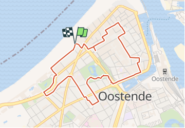
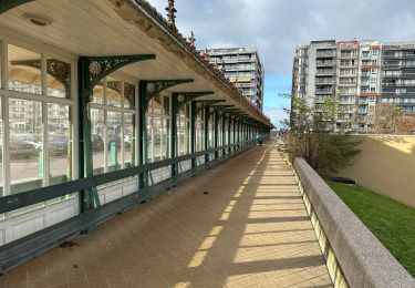
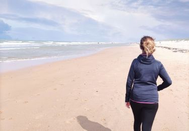
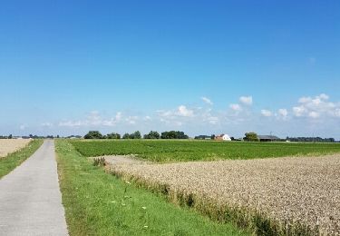
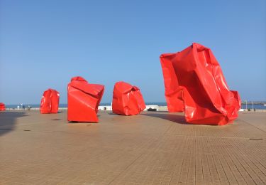
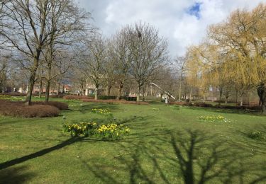
Randonnée A pied de 4,5 km à découvrir à Flandre, Flandre-Occidentale, Ostende. Cette randonnée est proposée par SityTrail - itinéraires balisés pédestres.
Description
Een boeiende wandeling door een mondaine Stad aan Zee met rijk historisch verleden.
Localisation
Pays :
Belgique
Région :
Flandre
Département/Province :
Flandre-Occidentale
Commune :
Ostende
Localité :
Ostende
Départ:(Dec)
Départ:(UTM)
493802 ; 5675553 (31U) N.
Commentaires
Randonnées à proximité
![Randonnée Marche Ostende - sgr kust (gr régional côte) day 3/4 - Photo](https://media.geolcdn.com/t/375/260/a9fa8825-a870-45dd-9963-e9584afaff4b.jpg&format=jpg&maxdim=2)
![Marche Marche](https://static1.geolcdn.com/sitytour/trail-icons/101.png)
sgr kust (gr régional côte) day 3/4
Marche
Très difficile
Ostende,
Flandre,
Flandre-Occidentale,
Belgique
![](/images/other/stat-length.png)
24 km | 26 km-effort
6h 3min
![](https://static1.geolcdn.com/siteimages/upload/files/16400158638029165_repeat_loop_refresh_sync_direction_icon.png)
Non
![Randonnée Marche Ostende - Ostende - Bredene - Photo](https://media.geolcdn.com/t/375/260/a4e72293-e1df-4125-8578-ff77ccdb4b9d.jpg&format=jpg&maxdim=2)
![Marche Marche](https://static1.geolcdn.com/sitytour/trail-icons/101.png)
Ostende - Bredene
Marche
Facile
Ostende,
Flandre,
Flandre-Occidentale,
Belgique
![](/images/other/stat-length.png)
9,4 km | 10,3 km-effort
1h 41min
![](https://static1.geolcdn.com/siteimages/upload/files/16400158638029165_repeat_loop_refresh_sync_direction_icon.png)
Non
![Randonnée A pied Bredene - Erfgoedwandelroute Bredene - Photo](https://media.geolcdn.com/t/375/260/5c0af986-d225-41c1-8640-fd065a19c709.jpeg&format=jpg&maxdim=2)
![A pied A pied](https://static1.geolcdn.com/sitytour/trail-icons/100.png)
Erfgoedwandelroute Bredene
A pied
Facile
Bredene,
Flandre,
Flandre-Occidentale,
Belgique
![](/images/other/stat-length.png)
4,4 km | 4,7 km-effort
1h 3min
![](https://static1.geolcdn.com/siteimages/upload/files/16400158638029165_repeat_loop_refresh_sync_direction_icon.png)
Non
![Randonnée Marche Ostende - Ostende Blankenberge 24 km - Photo](https://media.geolcdn.com/t/375/260/c23f2984-82f8-4fe7-9527-13e6c3285f67.jpg&format=jpg&maxdim=2)
![Marche Marche](https://static1.geolcdn.com/sitytour/trail-icons/101.png)
Ostende Blankenberge 24 km
Marche
Très difficile
Ostende,
Flandre,
Flandre-Occidentale,
Belgique
![](/images/other/stat-length.png)
25 km | 27 km-effort
6h 10min
![](https://static1.geolcdn.com/siteimages/upload/files/16400158638029165_repeat_loop_refresh_sync_direction_icon.png)
Non
![Randonnée Marche Bredene - Promenade à Bredene - Photo](https://media.geolcdn.com/t/375/260/ddb05975-8748-4f0b-a94b-51decd8b878a.jpg&format=jpg&maxdim=2)
![Marche Marche](https://static1.geolcdn.com/sitytour/trail-icons/101.png)
Promenade à Bredene
Marche
Très facile
(2)
Bredene,
Flandre,
Flandre-Occidentale,
Belgique
![](/images/other/stat-length.png)
5,2 km | 5,7 km-effort
Inconnu
![](https://static1.geolcdn.com/siteimages/upload/files/16400158638029165_repeat_loop_refresh_sync_direction_icon.png)
Oui
![Randonnée Marche Ostende - Rond Stene - Photo](https://media.geolcdn.com/t/375/260/ext.jpg?maxdim=2&url=https%3A%2F%2Fservices.sitytrail.com%2FGeolivesWS%2FDownloadMedia.ashx%3FTrailID%3D609905%26Media%3Dfix__20160806152218.jpg)
![Marche Marche](https://static1.geolcdn.com/sitytour/trail-icons/101.png)
Rond Stene
Marche
Facile
Ostende,
Flandre,
Flandre-Occidentale,
Belgique
![](/images/other/stat-length.png)
11,7 km | 12,3 km-effort
2h 4min
![](https://static1.geolcdn.com/siteimages/upload/files/16400158638029165_repeat_loop_refresh_sync_direction_icon.png)
Oui
![Randonnée Marche Ostende - ostende - Photo](https://media.geolcdn.com/t/375/260/fed54713-9626-43c6-8bf7-c772d44711a7.jpg&format=jpg&maxdim=2)
![Marche Marche](https://static1.geolcdn.com/sitytour/trail-icons/101.png)
ostende
Marche
Très facile
Ostende,
Flandre,
Flandre-Occidentale,
Belgique
![](/images/other/stat-length.png)
3,4 km | 3,9 km-effort
1h 4min
![](https://static1.geolcdn.com/siteimages/upload/files/16400158638029165_repeat_loop_refresh_sync_direction_icon.png)
Non
![Randonnée Marche Ostende - 67.381 Oostende - Raversijde : Circuit Ensor - Photo](https://media.geolcdn.com/t/375/260/baecc0d5-4288-465a-80c5-6abdd06485ec.jpg&format=jpg&maxdim=2)
![Marche Marche](https://static1.geolcdn.com/sitytour/trail-icons/101.png)
67.381 Oostende - Raversijde : Circuit Ensor
Marche
Très facile
(1)
Ostende,
Flandre,
Flandre-Occidentale,
Belgique
![](/images/other/stat-length.png)
17,4 km | 19,5 km-effort
4h 55min
![](https://static1.geolcdn.com/siteimages/upload/files/16400158638029165_repeat_loop_refresh_sync_direction_icon.png)
Oui
![Randonnée Marche Ostende - aan t'zeetje - Photo](https://media.geolcdn.com/t/375/260/ext.jpg?maxdim=2&url=https%3A%2F%2Fstatic1.geolcdn.com%2Fsiteimages%2Fupload%2Ffiles%2F1553511878bg_sport_marche.png)
![Marche Marche](https://static1.geolcdn.com/sitytour/trail-icons/101.png)
aan t'zeetje
Marche
Facile
Ostende,
Flandre,
Flandre-Occidentale,
Belgique
![](/images/other/stat-length.png)
4,6 km | 5,1 km-effort
35min
![](https://static1.geolcdn.com/siteimages/upload/files/16400158638029165_repeat_loop_refresh_sync_direction_icon.png)
Oui