![](/images/other/stat-length.png)
![Randonnée A pied Bruges - Ter Doest wandelroute - Photo](https://media.geolcdn.com/t/1900/400/7c264992-b54a-400b-9ef1-c9a11c4d9d34.jpeg&format=pjpeg&maxdim=2)
Ter Doest wandelroute
SityTrail - itinéraires balisés pédestres
Tous les sentiers balisés d’Europe GUIDE+
![Longueur](/images/other/stat-length.png)
Longueur
4,2 km
![Altitude max](https://static1.geolcdn.com/siteimages/upload/files/1508320355ic_sort_altitude_max_24dp.png)
Altitude max
14 m
![Dénivelé positif](https://static1.geolcdn.com/siteimages/upload/files/1508320355ic_sort_den_pos_24dp.png)
Dénivelé positif
22 m
![Km-Effort](/images/other/stat-length.png)
Km-Effort
4,5 km
![Altitude min](https://static1.geolcdn.com/siteimages/upload/files/1508320355ic_sort_altitude_min_24dp.png)
Altitude min
-1 m
![Dénivelé négatif](https://static1.geolcdn.com/siteimages/upload/files/1508320355ic_sort_den_neg_24dp.png)
Dénivelé négatif
23 m
![Boucle](https://static1.geolcdn.com/siteimages/upload/files/16400158638029165_repeat_loop_refresh_sync_direction_icon.png)
Boucle
Oui
Balise
Date de création :
2022-02-09 15:07:37.942
Dernière modification :
2022-02-09 17:53:59.847
![A pied](https://static1.geolcdn.com/sitytour/trail-icons/100.png)
1h01
Difficulté : Facile
![Scannez ce code QR pour ouvrir la randonnée dans l'application SityTrail](https://capi.geolives.com/qq0zvz2zws4bq2lad0pu/sitytour/trails/3083351/qr.png?size=200)
Application GPS de randonnée GRATUITE
À propos
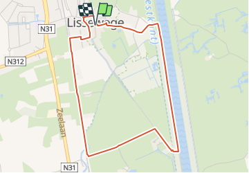
Randonnée A pied de 4,2 km à découvrir à Flandre, Flandre-Occidentale, Bruges. Cette randonnée est proposée par SityTrail - itinéraires balisés pédestres.
Description
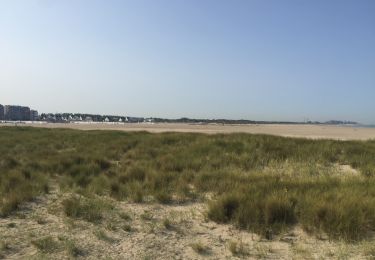
Deze route verkent het vlakke polderlandschap van Lissewege. Je wordt getrakteerd op landelijke wegen, fraaie vergezichten en uitgestrekte polderweiden.
Localisation
Pays :
Belgique
Région :
Flandre
Département/Province :
Flandre-Occidentale
Commune :
Bruges
Localité :
Lissewege
Départ:(Dec)
Départ:(UTM)
513832 ; 5682522 (31U) N.
Commentaires
Randonnées à proximité
![Randonnée A pied Blankenberghe - Erfgoedwandelroute Blankenberge - Photo](https://media.geolcdn.com/t/375/260/89899cee-80b3-4c52-972f-0300408f72cc.jpeg&format=jpg&maxdim=2)
![A pied A pied](https://static1.geolcdn.com/sitytour/trail-icons/100.png)
Erfgoedwandelroute Blankenberge
A pied
Facile
Blankenberghe,
Flandre,
Flandre-Occidentale,
Belgique
![](/images/other/stat-length.png)
3,7 km | 4,3 km-effort
58min
![](https://static1.geolcdn.com/siteimages/upload/files/16400158638029165_repeat_loop_refresh_sync_direction_icon.png)
Oui
![Randonnée Marche Blankenberghe - BLANKENBERGE _ Marche international le Tweedaagse _ Blankenberge VZW - 1/05/2022 - Photo](https://media.geolcdn.com/t/375/260/f0b619f8-3743-47b7-bc81-acd9ac4c9caf.jpg&format=jpg&maxdim=2)
![Marche Marche](https://static1.geolcdn.com/sitytour/trail-icons/101.png)
BLANKENBERGE _ Marche international le Tweedaagse _ Blankenberge VZW - 1/05/2022
Marche
Très difficile
(1)
Blankenberghe,
Flandre,
Flandre-Occidentale,
Belgique
![](/images/other/stat-length.png)
18,3 km | 19,1 km-effort
5h 48min
![](https://static1.geolcdn.com/siteimages/upload/files/16400158638029165_repeat_loop_refresh_sync_direction_icon.png)
Oui
![Randonnée Marche Blankenberghe - Promenade dans les Polders - Photo](https://media.geolcdn.com/t/375/260/f03ed4f1-113c-4cac-8d3c-46dc6eb4a2ad.jpg&format=jpg&maxdim=2)
![Marche Marche](https://static1.geolcdn.com/sitytour/trail-icons/101.png)
Promenade dans les Polders
Marche
Moyen
Blankenberghe,
Flandre,
Flandre-Occidentale,
Belgique
![](/images/other/stat-length.png)
7,7 km | 8 km-effort
1h 48min
![](https://static1.geolcdn.com/siteimages/upload/files/16400158638029165_repeat_loop_refresh_sync_direction_icon.png)
Oui
![Randonnée Marche Blankenberghe - Blankenberge _ Circuit 2 _ Tweedaagse van Vlanderen - Photo](https://media.geolcdn.com/t/375/260/6accc6cd-3e83-43ed-9593-7ba7873a1a5c.jpg&format=jpg&maxdim=2)
![Marche Marche](https://static1.geolcdn.com/sitytour/trail-icons/101.png)
Blankenberge _ Circuit 2 _ Tweedaagse van Vlanderen
Marche
Facile
Blankenberghe,
Flandre,
Flandre-Occidentale,
Belgique
![](/images/other/stat-length.png)
25 km | 26 km-effort
6h 52min
![](https://static1.geolcdn.com/siteimages/upload/files/16400158638029165_repeat_loop_refresh_sync_direction_icon.png)
Oui
![Randonnée Marche Blankenberghe - 30.323 Blankenberge - Lissewege - Photo](https://media.geolcdn.com/t/375/260/e8af1102-34bd-4cf8-94bc-3594e75c7e13.jpg&format=jpg&maxdim=2)
![Marche Marche](https://static1.geolcdn.com/sitytour/trail-icons/101.png)
30.323 Blankenberge - Lissewege
Marche
Très facile
(1)
Blankenberghe,
Flandre,
Flandre-Occidentale,
Belgique
![](/images/other/stat-length.png)
8,1 km | 8,5 km-effort
1h 50min
![](https://static1.geolcdn.com/siteimages/upload/files/16400158638029165_repeat_loop_refresh_sync_direction_icon.png)
Non
![Randonnée Marche Blankenberghe - 85.515 Blankenberge - Zeebrugge via Zeebos - Photo](https://media.geolcdn.com/t/375/260/bf484984-7a7e-437d-b19d-f0b44c1de045.jpg&format=jpg&maxdim=2)
![Marche Marche](https://static1.geolcdn.com/sitytour/trail-icons/101.png)
85.515 Blankenberge - Zeebrugge via Zeebos
Marche
Facile
Blankenberghe,
Flandre,
Flandre-Occidentale,
Belgique
![](/images/other/stat-length.png)
8,6 km | 9,3 km-effort
2h 27min
![](https://static1.geolcdn.com/siteimages/upload/files/16400158638029165_repeat_loop_refresh_sync_direction_icon.png)
Non
![Randonnée Marche Blankenberghe - 30.003 Blankenberge - Erfgoedwandeling - Photo](https://media.geolcdn.com/t/375/260/0f7b1271-d795-4eee-847e-ba66dce6a520.jpg&format=jpg&maxdim=2)
![Marche Marche](https://static1.geolcdn.com/sitytour/trail-icons/101.png)
30.003 Blankenberge - Erfgoedwandeling
Marche
Très facile
Blankenberghe,
Flandre,
Flandre-Occidentale,
Belgique
![](/images/other/stat-length.png)
3,9 km | 4,5 km-effort
1h 1min
![](https://static1.geolcdn.com/siteimages/upload/files/16400158638029165_repeat_loop_refresh_sync_direction_icon.png)
Oui
![Randonnée Vélo Blankenberghe - Beaufortfietsroute Nieuwpoort - Middelkerke - Photo](https://media.geolcdn.com/t/375/260/ext.jpg?maxdim=2&url=https%3A%2F%2Fstatic1.geolcdn.com%2Fsiteimages%2Fupload%2Ffiles%2F1524743154velo.jpg)
![Vélo Vélo](https://static1.geolcdn.com/sitytour/trail-icons/200.png)
Beaufortfietsroute Nieuwpoort - Middelkerke
Vélo
Très facile
Blankenberghe,
Flandre,
Flandre-Occidentale,
Belgique
![](/images/other/stat-length.png)
18,3 km | 20 km-effort
Inconnu
![](https://static1.geolcdn.com/siteimages/upload/files/16400158638029165_repeat_loop_refresh_sync_direction_icon.png)
Oui
![Randonnée Vélo Blankenberghe - Beaufortfietsroute Blankenberge - Zeebrugge - Photo](https://media.geolcdn.com/t/375/260/ext.jpg?maxdim=2&url=https%3A%2F%2Fstatic1.geolcdn.com%2Fsiteimages%2Fupload%2Ffiles%2F1524743154velo.jpg)
![Vélo Vélo](https://static1.geolcdn.com/sitytour/trail-icons/200.png)
Beaufortfietsroute Blankenberge - Zeebrugge
Vélo
Très facile
Blankenberghe,
Flandre,
Flandre-Occidentale,
Belgique
![](/images/other/stat-length.png)
18,3 km | 20 km-effort
Inconnu
![](https://static1.geolcdn.com/siteimages/upload/files/16400158638029165_repeat_loop_refresh_sync_direction_icon.png)
Oui
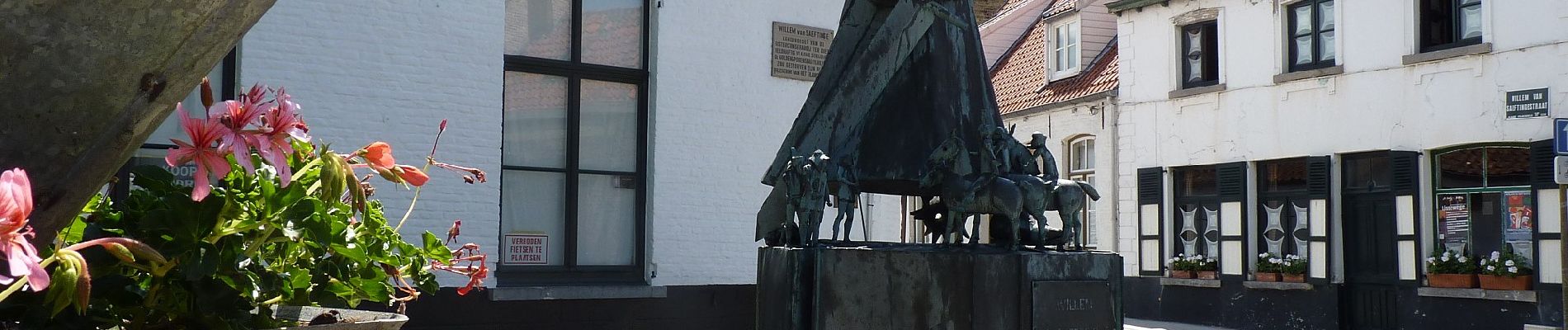
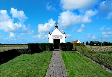
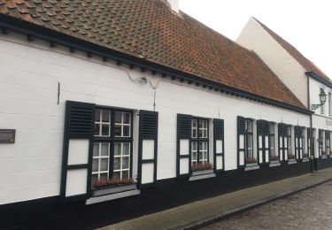
Lissewege vaut une plus longue visite ainsi que le détour par Ter Doest. Liaison ter Doest Lissewege sans intérêt