![](/images/other/stat-length.png)
![Randonnée Marche Villeneuve - 1Les Cannebières, costebelle, bois d'Asson. - Photo](https://media.geolcdn.com/t/1900/400/8f615e55-02ed-485d-9ec5-a2af60548658.jpg&format=pjpeg&maxdim=2)
1Les Cannebières, costebelle, bois d'Asson.
liocol
Utilisateur
![Longueur](/images/other/stat-length.png)
Longueur
7,9 km
![Altitude max](https://static1.geolcdn.com/siteimages/upload/files/1508320355ic_sort_altitude_max_24dp.png)
Altitude max
540 m
![Dénivelé positif](https://static1.geolcdn.com/siteimages/upload/files/1508320355ic_sort_den_pos_24dp.png)
Dénivelé positif
223 m
![Km-Effort](/images/other/stat-length.png)
Km-Effort
10,9 km
![Altitude min](https://static1.geolcdn.com/siteimages/upload/files/1508320355ic_sort_altitude_min_24dp.png)
Altitude min
359 m
![Dénivelé négatif](https://static1.geolcdn.com/siteimages/upload/files/1508320355ic_sort_den_neg_24dp.png)
Dénivelé négatif
225 m
![Boucle](https://static1.geolcdn.com/siteimages/upload/files/16400158638029165_repeat_loop_refresh_sync_direction_icon.png)
Boucle
Oui
Date de création :
2022-02-09 08:20:49.052
Dernière modification :
2022-02-09 13:56:29.68
![Marche](https://static1.geolcdn.com/sitytour/trail-icons/101.png)
2h26
Difficulté : Moyen
![Scannez ce code QR pour ouvrir la randonnée dans l'application SityTrail](https://capi.geolives.com/qq0zvz2zws4bq2lad0pu/sitytour/trails/3082729/qr.png?size=200)
Application GPS de randonnée GRATUITE
À propos
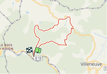
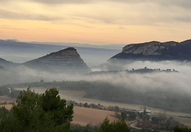
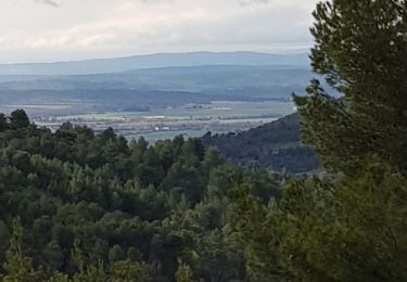
Randonnée Marche de 7,9 km à découvrir à Provence-Alpes-Côte d'Azur, Alpes-de-Haute-Provence, Villeneuve. Cette randonnée est proposée par liocol.
Description
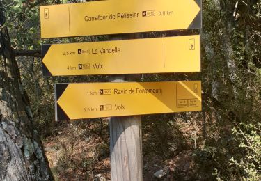
Garez vous, avant le bois d'Asson, en face du Radar. départ de la rando, barrière verte et balisage jaune.
Localisation
Pays :
France
Région :
Provence-Alpes-Côte d'Azur
Département/Province :
Alpes-de-Haute-Provence
Commune :
Villeneuve
Localité :
Unknown
Départ:(Dec)
Départ:(UTM)
727266 ; 4864347 (31T) N.
Commentaires
Randonnées à proximité
![Randonnée Marche Dauphin - DAUPHIN La forêt de Pelissier o - Photo](https://media.geolcdn.com/t/375/260/38031732-1577-4607-ab9b-103e2562d975.jpg&format=jpg&maxdim=2)
![Marche Marche](https://static1.geolcdn.com/sitytour/trail-icons/101.png)
DAUPHIN La forêt de Pelissier o
Marche
Moyen
(1)
Dauphin,
Provence-Alpes-Côte d'Azur,
Alpes-de-Haute-Provence,
France
![](/images/other/stat-length.png)
15,2 km | 22 km-effort
4h 6min
![](https://static1.geolcdn.com/siteimages/upload/files/16400158638029165_repeat_loop_refresh_sync_direction_icon.png)
Oui
![Randonnée Marche Villeneuve - VILLENEUVE La Roche amere , Chapelle notre-dame de la Roche moy n - Photo](https://media.geolcdn.com/t/375/260/78d42f2f-150b-404c-9269-37a1d30b783e.jpg&format=jpg&maxdim=2)
![Marche Marche](https://static1.geolcdn.com/sitytour/trail-icons/101.png)
VILLENEUVE La Roche amere , Chapelle notre-dame de la Roche moy n
Marche
Moyen
Villeneuve,
Provence-Alpes-Côte d'Azur,
Alpes-de-Haute-Provence,
France
![](/images/other/stat-length.png)
13,1 km | 18,2 km-effort
4h 38min
![](https://static1.geolcdn.com/siteimages/upload/files/16400158638029165_repeat_loop_refresh_sync_direction_icon.png)
Oui
![Randonnée A pied Saint-Maime - SAINT MAIME . Brives , le Pin Blanc o - Photo](https://media.geolcdn.com/t/375/260/11607803-5104-4dd0-9a83-c2f0b288f355.jpg&format=jpg&maxdim=2)
![A pied A pied](https://static1.geolcdn.com/sitytour/trail-icons/100.png)
SAINT MAIME . Brives , le Pin Blanc o
A pied
Facile
(1)
Saint-Maime,
Provence-Alpes-Côte d'Azur,
Alpes-de-Haute-Provence,
France
![](/images/other/stat-length.png)
13,9 km | 18,6 km-effort
Inconnu
![](https://static1.geolcdn.com/siteimages/upload/files/16400158638029165_repeat_loop_refresh_sync_direction_icon.png)
Oui
![Randonnée V.T.T. Volx - Volx/Montaigu/Bellevue/La Garde - Photo](https://media.geolcdn.com/t/375/260/ext.jpg?maxdim=2&url=https%3A%2F%2Fstatic1.geolcdn.com%2Fsiteimages%2Fupload%2Ffiles%2F1524743154velo.jpg)
![V.T.T. V.T.T.](https://static1.geolcdn.com/sitytour/trail-icons/202.png)
Volx/Montaigu/Bellevue/La Garde
V.T.T.
Moyen
(1)
Volx,
Provence-Alpes-Côte d'Azur,
Alpes-de-Haute-Provence,
France
![](/images/other/stat-length.png)
16,2 km | 24 km-effort
1h 33min
![](https://static1.geolcdn.com/siteimages/upload/files/16400158638029165_repeat_loop_refresh_sync_direction_icon.png)
Oui
![Randonnée Marche Villeneuve - VILLENEUVE. NOTRE-DAME DE LA ROCHE O L S - Photo](https://media.geolcdn.com/t/375/260/e12c610c-f05d-407f-8a61-1557f236cc62.jpg&format=jpg&maxdim=2)
![Marche Marche](https://static1.geolcdn.com/sitytour/trail-icons/101.png)
VILLENEUVE. NOTRE-DAME DE LA ROCHE O L S
Marche
Moyen
Villeneuve,
Provence-Alpes-Côte d'Azur,
Alpes-de-Haute-Provence,
France
![](/images/other/stat-length.png)
16,1 km | 23 km-effort
4h 25min
![](https://static1.geolcdn.com/siteimages/upload/files/16400158638029165_repeat_loop_refresh_sync_direction_icon.png)
Oui
![Randonnée Marche Volx - VOLX . TOUR DE LA ROCHE AMÈRE 0 L M - Photo](https://media.geolcdn.com/t/375/260/6872c8a4-7e66-489f-a2b2-1aad1480f59e.jpg&format=jpg&maxdim=2)
![Marche Marche](https://static1.geolcdn.com/sitytour/trail-icons/101.png)
VOLX . TOUR DE LA ROCHE AMÈRE 0 L M
Marche
Facile
Volx,
Provence-Alpes-Côte d'Azur,
Alpes-de-Haute-Provence,
France
![](/images/other/stat-length.png)
12,7 km | 17,3 km-effort
3h 34min
![](https://static1.geolcdn.com/siteimages/upload/files/16400158638029165_repeat_loop_refresh_sync_direction_icon.png)
Oui
![Randonnée Marche Volx - VOLX . CRETES DE VOLX O L M - Photo](https://media.geolcdn.com/t/375/260/33e323f9-3969-4d23-a293-27950b255122.jpg&format=jpg&maxdim=2)
![Marche Marche](https://static1.geolcdn.com/sitytour/trail-icons/101.png)
VOLX . CRETES DE VOLX O L M
Marche
Difficile
Volx,
Provence-Alpes-Côte d'Azur,
Alpes-de-Haute-Provence,
France
![](/images/other/stat-length.png)
15,2 km | 24 km-effort
5h 38min
![](https://static1.geolcdn.com/siteimages/upload/files/16400158638029165_repeat_loop_refresh_sync_direction_icon.png)
Oui
![Randonnée Trail Volx - volx - Photo](https://media.geolcdn.com/t/375/260/074b6f13-4b46-4d5f-9210-d6f66b960796.jpg&format=jpg&maxdim=2)
![Trail Trail](https://static1.geolcdn.com/sitytour/trail-icons/104.png)
volx
Trail
Difficile
Volx,
Provence-Alpes-Côte d'Azur,
Alpes-de-Haute-Provence,
France
![](/images/other/stat-length.png)
9,2 km | 14,7 km-effort
1h 43min
![](https://static1.geolcdn.com/siteimages/upload/files/16400158638029165_repeat_loop_refresh_sync_direction_icon.png)
Oui
![Randonnée Marche Manosque - 1Gaude, boucle de Montaigu. - Photo](https://media.geolcdn.com/t/375/260/13d3f8ee-c326-48e6-acf5-3d3f5fa0e4c9.jpg&format=jpg&maxdim=2)
![Marche Marche](https://static1.geolcdn.com/sitytour/trail-icons/101.png)
1Gaude, boucle de Montaigu.
Marche
Moyen
Manosque,
Provence-Alpes-Côte d'Azur,
Alpes-de-Haute-Provence,
France
![](/images/other/stat-length.png)
6,6 km | 10,2 km-effort
2h 7min
![](https://static1.geolcdn.com/siteimages/upload/files/16400158638029165_repeat_loop_refresh_sync_direction_icon.png)
Oui