![](/images/other/stat-length.png)
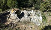
![Randonnée Marche Garéoult - l'amarron et son dolmen au départ de Garréoult la Gabelle - Photo](https://media.geolcdn.com/t/1900/400/87a9b798-8a41-4999-9b8e-e89295cb67d3.jpg&format=pjpeg&maxdim=2)
l'amarron et son dolmen au départ de Garréoult la Gabelle
chrifor
Utilisateur
![Longueur](/images/other/stat-length.png)
![Altitude max](https://static1.geolcdn.com/siteimages/upload/files/1508320355ic_sort_altitude_max_24dp.png)
![Dénivelé positif](https://static1.geolcdn.com/siteimages/upload/files/1508320355ic_sort_den_pos_24dp.png)
![Km-Effort](/images/other/stat-length.png)
![Altitude min](https://static1.geolcdn.com/siteimages/upload/files/1508320355ic_sort_altitude_min_24dp.png)
![Dénivelé négatif](https://static1.geolcdn.com/siteimages/upload/files/1508320355ic_sort_den_neg_24dp.png)
![Boucle](https://static1.geolcdn.com/siteimages/upload/files/16400158638029165_repeat_loop_refresh_sync_direction_icon.png)
![Marche](https://static1.geolcdn.com/sitytour/trail-icons/101.png)
6h08
Difficulté : Moyen
![Scannez ce code QR pour ouvrir la randonnée dans l'application SityTrail](https://capi.geolives.com/qq0zvz2zws4bq2lad0pu/sitytour/trails/3081839/qr.png?size=200)
Application GPS de randonnée GRATUITE
À propos
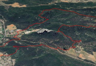
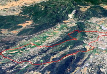
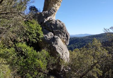
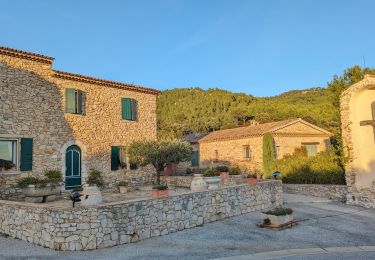
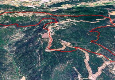
Randonnée Marche de 11,5 km à découvrir à Provence-Alpes-Côte d'Azur, Var, Garéoult. Cette randonnée est proposée par chrifor.
Description
Le chemin du Vallon de Cavaillon n'a rien d'agréable (très creusé, caillouteux, tristounet...). Mieux vaut utiliser le tracé sud en A/R et rejoindre la montée à la cote 652.
Le dolmen, effondré, est situé de suite à gauche en arrivant sur le plateau (cairns).
Rando parcourue le 08/02/2022
Localisation
Commentaires
Randonnées à proximité
![Randonnée Marche Rocbaron - Castellas de Forcalqueiret - Plateau de Themes - GR9 - Photo](https://media.geolcdn.com/t/375/260/65b9c34e-6588-477e-8f02-e7295c203708.jpg&format=jpg&maxdim=2)
![Marche Marche](https://static1.geolcdn.com/sitytour/trail-icons/101.png)
Marche
![](/images/other/stat-length.png)
![](https://static1.geolcdn.com/siteimages/upload/files/16400158638029165_repeat_loop_refresh_sync_direction_icon.png)
![Randonnée Marche La Celle - Les hautes Bastides - Lac - Candelon - Dolmen - Amarron - Photo](https://media.geolcdn.com/t/375/260/367c307f-f133-49ff-990b-24c0026569ab.jpg&format=jpg&maxdim=2)
![Marche Marche](https://static1.geolcdn.com/sitytour/trail-icons/101.png)
Marche
![](/images/other/stat-length.png)
![](https://static1.geolcdn.com/siteimages/upload/files/16400158638029165_repeat_loop_refresh_sync_direction_icon.png)
![Randonnée Marche Brignoles - Vallon de Pouraque - Circuit de l'eau - Rocher de Gueit - St Sébastien - Camps - Photo](https://media.geolcdn.com/t/375/260/31d7ffa9-7745-46d9-9b40-e3c546757624.jpg&format=jpg&maxdim=2)
![Marche Marche](https://static1.geolcdn.com/sitytour/trail-icons/101.png)
Marche
![](/images/other/stat-length.png)
![](https://static1.geolcdn.com/siteimages/upload/files/16400158638029165_repeat_loop_refresh_sync_direction_icon.png)
![Randonnée Marche Néoules - Neoules crête 19,5 km - Photo](https://media.geolcdn.com/t/375/260/80c386c8-cc89-4ce0-b16a-56ff29c0cd34.jpg&format=jpg&maxdim=2)
![Marche Marche](https://static1.geolcdn.com/sitytour/trail-icons/101.png)
Marche
![](/images/other/stat-length.png)
![](https://static1.geolcdn.com/siteimages/upload/files/16400158638029165_repeat_loop_refresh_sync_direction_icon.png)
![Randonnée Marche La Celle - L'Escarelle 1 - Photo](https://media.geolcdn.com/t/375/260/ext.jpg?maxdim=2&url=https%3A%2F%2Fstatic1.geolcdn.com%2Fsiteimages%2Fupload%2Ffiles%2F1553511878bg_sport_marche.png)
![Marche Marche](https://static1.geolcdn.com/sitytour/trail-icons/101.png)
Marche
![](/images/other/stat-length.png)
![](https://static1.geolcdn.com/siteimages/upload/files/16400158638029165_repeat_loop_refresh_sync_direction_icon.png)
![Randonnée Marche Camps-la-Source - Rocher du Gueit- Camps la Source-06-11-2024 - Photo](https://media.geolcdn.com/t/375/260/e92a19e7-d25b-4cc7-a41e-f3e4999745e6.jpg&format=jpg&maxdim=2)
![Marche Marche](https://static1.geolcdn.com/sitytour/trail-icons/101.png)
Marche
![](/images/other/stat-length.png)
![](https://static1.geolcdn.com/siteimages/upload/files/16400158638029165_repeat_loop_refresh_sync_direction_icon.png)
![Randonnée Marche La Celle - Roc de Candelon - Photo](https://media.geolcdn.com/t/375/260/a9cfb2ad-a53d-4040-a9b9-a70f08f9f434.jpg&format=jpg&maxdim=2)
![Marche Marche](https://static1.geolcdn.com/sitytour/trail-icons/101.png)
Marche
![](/images/other/stat-length.png)
![](https://static1.geolcdn.com/siteimages/upload/files/16400158638029165_repeat_loop_refresh_sync_direction_icon.png)
![Randonnée Marche La Roquebrussanne - chapelle St André et grotte des irris - Photo](https://media.geolcdn.com/t/375/260/c17b726b-2dcc-44be-a87c-f260edf4e94a.jpg&format=jpg&maxdim=2)
![Marche Marche](https://static1.geolcdn.com/sitytour/trail-icons/101.png)
Marche
![](/images/other/stat-length.png)
![](https://static1.geolcdn.com/siteimages/upload/files/16400158638029165_repeat_loop_refresh_sync_direction_icon.png)
![Randonnée Marche Garéoult - L'Amarron depuis Garéoult - Photo](https://media.geolcdn.com/t/375/260/47c5c3b8-59ea-460f-b034-de18890572e7.jpg&format=jpg&maxdim=2)
![Marche Marche](https://static1.geolcdn.com/sitytour/trail-icons/101.png)
Marche
![](/images/other/stat-length.png)
![](https://static1.geolcdn.com/siteimages/upload/files/16400158638029165_repeat_loop_refresh_sync_direction_icon.png)